Showing posts with label ProbSevere. Show all posts

Thursday, May 22, 2025

Comparing LightningCast v1 and v2 in benign thunderstorms

Lightning is deadly even in "benign" thunderstorms. Some morning convection in Arkansas demonstrates the everyday value of having MRMS Reflectivity at -10C in LightningCast v2 (LCv2), compared to satellite-only LightningCast v1 (LCv1). 

The GOES ABI data is invaluable in the probabilistic LightningCast model, especially prior to convective initiation. But radar data sometimes (not always) provides a signal of convective weakening or decay prior to satellite data.

In this example, thunderstorms ongoing in southern Missouri and northern Arkansas weaken as the sun is coming up. In the animation below, LCv2 is on the left and LCv1 is on the right.


Towards the end of the period, when only one cell is present, we see that LCv2 reduces probabilities of lightning about 10-15 minutes prior to LCv1. This cell did not produce any additional lightning.

Figure 2: LCv2 (left) and LCv1 (right) contours, along with GOES-19 day-cloud-phase-distinction RGB and GLM flash-extent density (large blue pixels).

Other features that stand out are "stronger" false alarms in LCv1, compared to LCv2. The images below show these false alarm regions to the south (Figure 3) and south and east of the thunderstorms (Figure 4).

Figure 3: LCv2 (left) and LCv1 (right) contours, along with GOES-19 day-cloud-phase-distinction RGB and GLM flash-extent density (large blue pixels). Note the stronger false alarm in LCv1 south of the ongoing thunderstorms.


Figure 4: LCv2 (left) and LCv1 (right) contours, along with GOES-19 day-cloud-phase-distinction RGB and GLM flash-extent density (large blue pixels). Note the stronger false alarms in LCv1 south and east of the ongoing thunderstorms.

Overall, the radar predictor in LCv2 helps to reduce false alarms that occurred in LCv1.


Tuesday, April 1, 2025

LightningCast v1 vs v2

ProbSevere LightningCast v2 adds a new predictor---MRMS Reflectivity -10C. This predictor has been well documented to correspond to electrification in storms, as it observes water particles in the mixed-phase region, where charge separation begins. We use it in LightningCast v2 at approximately 1-km resolution, along with the GOES-R ABI 0.64 µm reflectance (C02, 0.5 km), 1.6 µm reflectance (C05, 1 km), 10.3 µm brightness temperature (C13, 2 km), and 12.3 µm brightness temperature (C15, 2 km).

In the example below, LCv2 is on the bottom left, LCv1 is on the bottom right, and the MRMS Ref. -10C is on top. You can see that there is lightning (as detected from GLM) in a mid-level cloud deck, but obscured by some high-level ice. LCv1 drops probabilities < 10% at numerous times in the animation, due to the uncertain signal from the relatively smooth but not overly cold cloud tops. On the other hand, LCv2 picks up on the re-developing convective cores, as shown in the Ref. -10C pockets of ≥ 35 dBZ (yellow-orange), and correctly maintains a higher probability of lightning throughout the animation.

This is one way in which LCv2 is an improvement over LCv1---in convection that is obscured by moderate-to-thick ice. We've also seen improvement for lightning cessation situations and more "marginal" situations such as for lightning in low-topped convection.


Thursday, June 6, 2024

LightningCast in Texas

One team of forecasters was working in the San Antonio office yesterday. Convection began forming on a moisture boundary, captured by the GOES-18 mesoscale scan.


Under clear skies, LightningCast quickly picked up on the areas of glaciating cumulus clouds. Probabilities gradually increased along the moisture boundaries, emanating from the main storm, which went on to produce golfball-sized hail. LightningCast provided generally 35-40 minutes of lead time to initial flashes (from the 30% threshold).

Discussions with forecasters this week have included topics such as extending the lead time past 60 minutes, which is what LightningCast was trained for. Decisions by forecasters and event managers often have to be made 1-2 hours ahead of time, and the overall median lead time is about 20 minutes for LightningCast. LightningCast generally produces elevated probabilities once clouds begin to glaciate, as seen in the animation above. But what if we can make skillful predictions before the first signs glaciation, perhaps when an only-liquid-water cumulus field is present? That is one future research goal. Some ideas to accomplish this include exploring environmental fields (i.e., short-term NWP fields), as well as using time sequences of satellite data to better handle storm motion. We believe there is more information and value we can extract from the rich GOES-R observations, complemented with ancillary datasets.

Tuesday, May 21, 2024

Getting ramped up

Our forecasters are working in Kansas City and Des Moines today. Storms are already rolling in eastern Nebraska, with ProbSevere LightningCast is picking up on the southward development of storms to the Kansas border.


Forecasters are evaluating the utility of lightning dashboards, available at static locations (airports, stadiums) and on-demand locations, for decision-support services. The on-demand capability is automated via a google form.

Below shows an example panel of the lightning dashboard for an airport in St. Joseph, Missouri. The lines are time series of LightningCast probabilities for the CONUS (5-min) and mesoscale (1-min) sectors, and the blue points are GLM flash centroid observations.


Monday, May 20, 2024

IntenseStormNet in Kansas and Oklahoma

ProbSevere IntenseStormNet is not being evaluated at HWT this week, but it is a unique application of satellite data for severe weather. On the eve of the 2nd week of the 2024 HWT, severe storms were ravaging the Plains.

IntenseStormNet is an AI model that uses patterns in ABI and GLM image data to predict a probability of "intense" convection. The strongest probabilities are often correlated with strong overshooting tops, bubbly texture in the visible band, storm-top divergence, and lightning cores.


In the movie above, you can see several MCSs traversing the state, producing severe hail, wind, and tornado reports. One the convection becomes cold-pool driven, the probabilities often diminish, sometimes significantly (see eastern Kansas at the end of the period).


Meanwhile in Oklahoma, a monster supercell progressed steadily through the western half of the state, dropping tornadoes, hail, and producing severe wind gusts. One interesting aspect about the product was the drop in probabilities from about 01:40 - 02:10 UTC. This drop corresponded to a short gap in severe weather reports produced by the supercell. Visually, the main overshooting top appeared to diminish.

IntenseStormNet is used in ProbSevere v3, feeding in satellite information at the mature stage to the severe-weather models.

Wednesday, May 15, 2024

LightningCast in the Rockies and Appalachians

Forecasters are working in the Amarillo, TX and Columbia, SC county warning areas today. One tool they are evaluating is ProbSevere LightningCast, which helps forecasters by providing objective guidance on lightning potential in the next 60 minutes. 

Afternoon thunderstorms on high terrain are a common occurrence in warm weather. Upslope flow can provide lift for convective initiation. It's difficult to monitor all of the convection developing across a region at once, but LightningCast can help forecasters quickly see which clouds are glaciating and quantify the near-term lightning potential. 


Lead time to the first GLM flash varies widely, but we've found that on average you can expect about 20 minutes of lead time to lightning initiation, measured from the 25% threshold. We are still trying to skillfully extend the average lead time to initiation.

Out east, a short wave trough is forcing convection today in and around the Appalachian Mountains. One new product that forecasters are looking at is the probability of ≥ 10 flashes in the 60 minutes after a GOES ABI scan. This product is meant to give forecasters a heads up on intensifying convection, specifically the initial intensification from benign thunderstorm to one that could develop into a severe threat. The ≥10-flash probability is also an indicator for an increased chance of a cloud-to-ground strike.


In the animation below, two cells achieved flash rates > 10 flashes. On the eastern cell, LightningCast had 35 min (10 min) of lead time to the first 10-flash obs, measured from the 10% (25%) contour. On the western one, there was about 10 min (5 min) of lead time from the 10% (25%) thresholds. Users should note that we have found the P(≥ 10 flashes) generally produces better lead time in "clearer" or "cleaner" scenes, with little convective debris near the developing cells.  


- John Cintineo


Wednesday, May 1, 2024

Cold front on the Plains

A potent cold front swept through the Great Plains in late April, spawning severe storms, including supercells, producing large hail, severe wind gusts, and tornadoes. 

Figure 1: Storm Prediction Center local storm reports from 12Z on 30 April to 12Z on 1 May 2024.


ProbSevere LightningCast was able to pick out developing convection along and ahead of the cold front, shown by regions of enhanced probabilities---first in eastern Nebraska, and then later in Kansas and Oklahoma. Toggle back and forth in time in the animation below to investigate model lead time to the first GLM flashes in different cells.


LightningCast is being evaluated at the HWT this spring, with some new features including:

  • better probability calibration (as a result of more training data)
  • static and on-demand lightning dashboards
  • GOES-West version trained on only GOES-18 data
  • an additional output product, the probability of ≥ 10 flashes in the next 60 minutes
The lightning dashboards are available from the LightningCast webpage for static locations such as airports and football stadiums, as well as dynamically changing locations like active wild-land fires.


The panel above shows some time series of LightningCast probabilities for the 5-min CONUS sector (red) and 1-min mesoscale sector (yellow) for Wichita Mid-Continent Airport, as storms developed and traveled over the airport. Blue dots are GLM centroid observations within 5 miles (large dots) and 10 miles (small dots) of the airport. 

A new feature being evaluated this year at HWT is the on-demand dashboard capability, whereby a NOAA user can submit location and timing information for an event that they want a dashboard for. They simply fill out this form and receive an automated email with the valid link: https://go.wisc.edu/x16m56. In this way, forecasters can get custom guidance for locations they are serving with decision support. This capability has already been used for events such as NFL games and state fairs.

Below is output from ProbSevere IntenseStormNet, which is a deep-learning model like LightningCast, but uses images of GOES-R ABI and GLM data to predict the probability of "intense" convection, from a satellite perspective. It is useful as storms are maturing. 


From the animation above, one can see how strong overshooting tops, bubbly-like texture in the cloud tops, and above-anvil cirrus plumes correspond well with stronger probabilities, which correlate well with local storm reports. IntenseStormNet works well for deep convection, day and night. Output from this model is used in ProbSevere v3, but can also be useful stand-alone severe-weather guidance in regions without radar coverage. 

Wednesday, February 28, 2024

Midwest storms...in February!

 Record-breaking high temperatures for February preceded and helped spawn storms in eastern Iowa and northern Illinois yesterday.

ProbSevere LightningCast gave a heads up on the developing convection. LightningCast uses deep-learning methods and GOES ABI data to predict the probability of lightning up to an hour in advance. LightningCast version 1 (LCv1) is being transitioned to NOAA operations in 2024. 

Development and improvement of LightningCast continues, however, based on forecaster feedback. One new product that is being evaluated at the Hazardous Weather Testbed this year is the probability of ≥ 10 fl in 60 min. Forecasters remarked that in some situations, having guidance on a more robust level of lightning would be very helpful. 

In the animation below, the P(≥ 1fl in 60 min) are depicted by contours in shades of blue (at 10%, 25%, and 50% levels). The P(≥ 10 fl in 60 min) are in red-shaded contours (10% and 25% levels).

For the three storms in Illinois, there was 13 min, 6 min, and 13 min of lead time to ≥10 flashes (when measured from the 10% contour). The storms in Iowa never got to 10 flashes, but the LightningCast probabilities only touched 25%. Users should recognize that lead time for the 10-flash product will be lower than the 1-flash product. When probabilities above 10% begin to appear (and especially above 25%), forecasters should anticipate an intensification in the lightning activity. 

Figure 1: LightningCast contours (P[≥ 1 fl] in blues, P[≥ 10 fl] in reds), GOES-16 ABI imagery, and GOES-16 GLM flash-extent density for storms in eastern Iowa and northern Illinois.


These storms developed rapidly into supercells and produced hail, severe wind gusts, and several tornadoes. ProbSevere v3 corresponded with NWS warnings quite well, even in this explosive environment. Notably, ProbTor v3 was much higher (30-45%) than ProbTor v2. While more investigation is needed to confirm this, it is likely that the HRRR model inputs in v3 were more impactful than the RAP model inputs in v2, signifying that the HRRR better depicted the environment. 


Tuesday, September 26, 2023

ProbSevere v3 for a couple of early autumn storms

ProbSevere v3 (PSv3) was able to provide an earlier heads-up and increased lead time to the initial severe hazards in several recent autumn storms on the Southern Great Plains. 

On September 23, there were a number of powerful supercells ravaging east-central Oklahoma. The storm in Figure 1 quickly split into two cells, with the right split producing 2"-diameter hail at 23:55 UTC and 3" hail at 00:15 UTC.

Figure 1: ProbSevere v3, MRMS MergedReflectivity, and NWS severe weather warnings for storms in central Oklahoma.


Figure 2: ProbSevere v3 for a storm in Pottawatomie county at 22:56 UTC.

As this supercell was developing (see Figure 2), PSv3 was 37%, whereas PSv2 was only 3%. Hail appeared to be the main threat. At this time, the very weak lightning signal (only 5 fl/min) and low MESH (0.33") were keeping the PSv2 probability very low. However, the top 5 contributing predictors in PSv3 were:

  • Lapse rate 0-3 km (8.4 C/km)
  • MLCAPE (3685 J/kg)
  • Eff. bulk shear (46 kt)
  • Sat growth rate (2.7%/min -- "moderate")
  • MRMS MESH (0.33")
ProbSevere v3, compared to v2, is more adept at extracting salient signals in the combined NWP, satellite, radar, and lightning phase space. In the developing stage of this storm, the environment and the satellite were more important than the radar predictors.  

The next evening, it was Texas's turn. One lone supercell in west Texas produced golfball-sized hail and wind reports of 59 and 62 mph (Figure 3).

Figure 3: ProbSevere v3, MRMS MergedReflectivity, and NWS severe weather warnings for a lone supercell in west Texas.


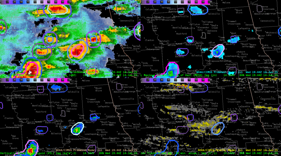
Figure 4: The storm in Figure 3, at 01:44 UTC.

ProbSevere v3 again had a jump on this storm before PSv2. At 01:44 UTC, right after the initial severe wind report, PSv3 was 55% vs. v2's 9% (Figure 4). PSv3 was showing both hail and wind as potential threats. The very weak low-level mean wind (5 kt) was keeping ProbWind v2 low (5%), and the modest flash rate and MESH, and very low hail CAPE (~250 J/kg) were combining for a ProbHail v2 of only 9%.

In contrast, the top contributors in ProbSevere v3 were the modest flash rate (18 fl/min), modest MESH (0.72"), the effective shear (47 kt), and the low-level lapse rate (8.1 C/km). PSv3 was able to integrate the marginal radar signature with favorable NWP data (from HRRR) to provide a better indication of severe probability.

Figure 5 highlights the higher probability of severe in PSv3 well before PSv2 shoots up, which was after the initial wind report. This storm later produced severe hail and another wind report.

Figure 5: Time series comparing PSv3 and PSv2 probabilities during the developing stage of the supcercell in Figures 3 and 4.


Thursday, June 15, 2023

6/15 Feedback for AMA

 PHS

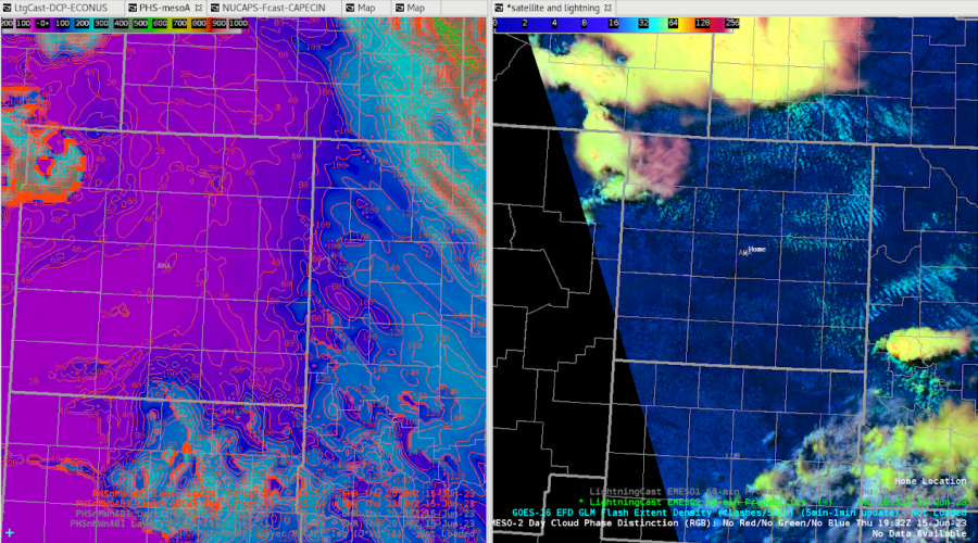
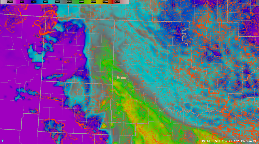
The surface based CINH at 20z lined up rather well with the satellite imagery showing the slightly more stable clouds over the eastern CWA.

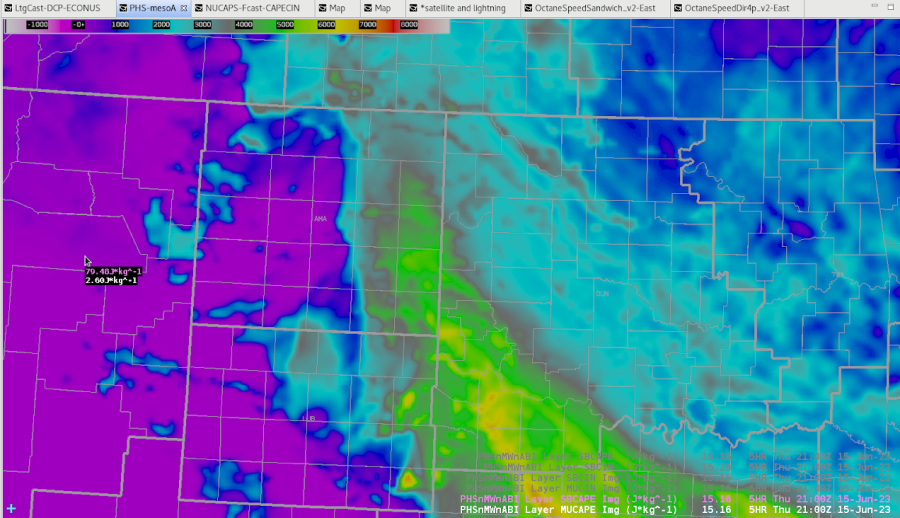
When sampling an image versus contours, the contour sampling has the entire product name in the readout

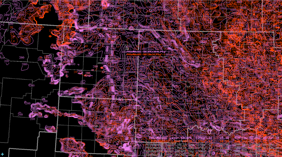
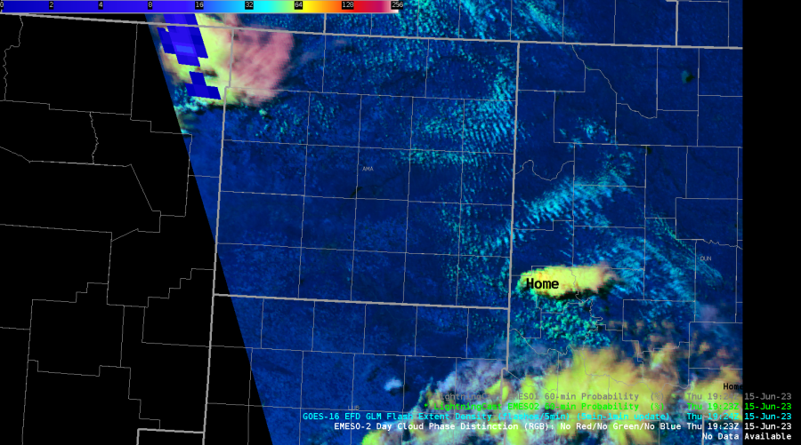
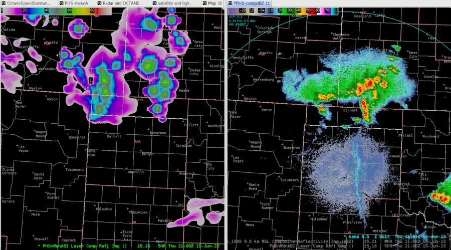
PHS captured the initial convection just east of AMA well, even though the convection started an hour earlier than PHS indicated.  Image on right is PHS SB CAPE and contours are PHS SB CINH.  Home is roughly where the storm is located.  Satellite image is around 1930z and PHS forecast is 21z when CINH dropped from 80j/kg to 40 j/kg.

PHS did a reasonable job predicting the general storm coverage by 21z from the 16z run.

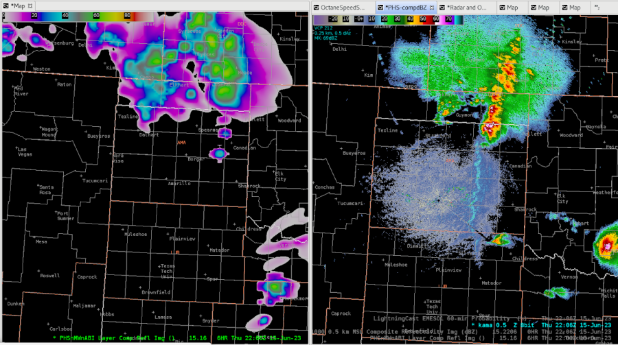
Toward the end of the exercise, the storm coverage was well captured by the PHS 16z run.  Should have taken this into account for my public graphics when describing the storm evolution.

NUCAPS

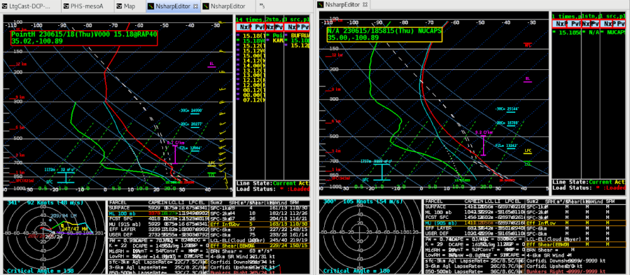
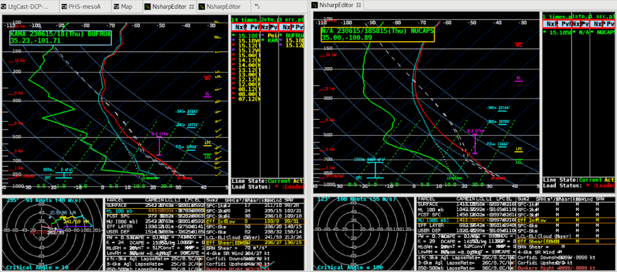
This is a NUCAPS sounding in the TX panhandle near AMA vs. a RAP40 sounding at the same point.  The RAP has the same trend in the dew point profile as NUCAPS, but is lower.

Noticed the NUCAPS sounding didn’t have the lower dew points around 400 mb as shown in the special sounding.  NUCAPS did have a hint of the weak cap near the surface though.

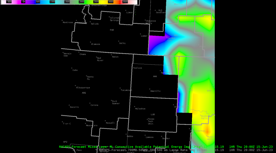
NUCAPS 700-500mb lapse rates from the gridded data was a constant 34.17 C/KM across the map.

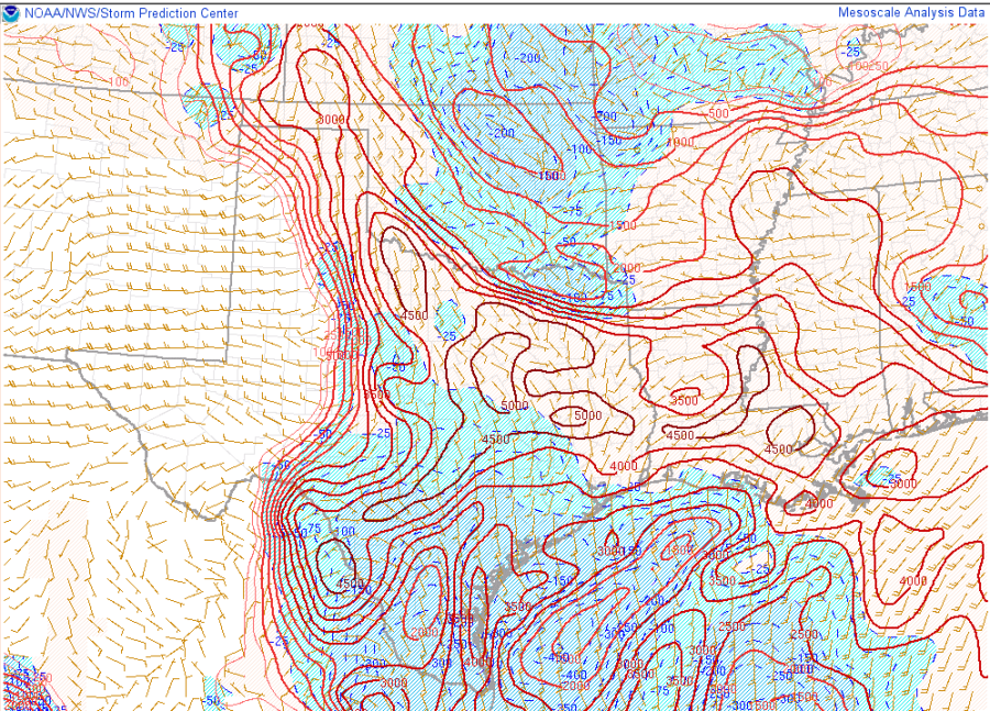
NUCAPS forecast for ML CAPE was slightly less than what SPC mesoanalysis had at the same time of 20z.

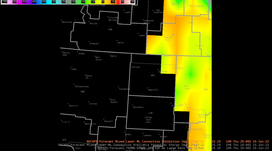
NUCAPS ML CINH was higher than SPC Mesanalysis for 20z, with some parts of the CWA having almost 90j/kg of CINH south of Liberal, KS.

The 700-500mb lapse rates matched well with SPC meosanalysis for 20z.

OCTANE

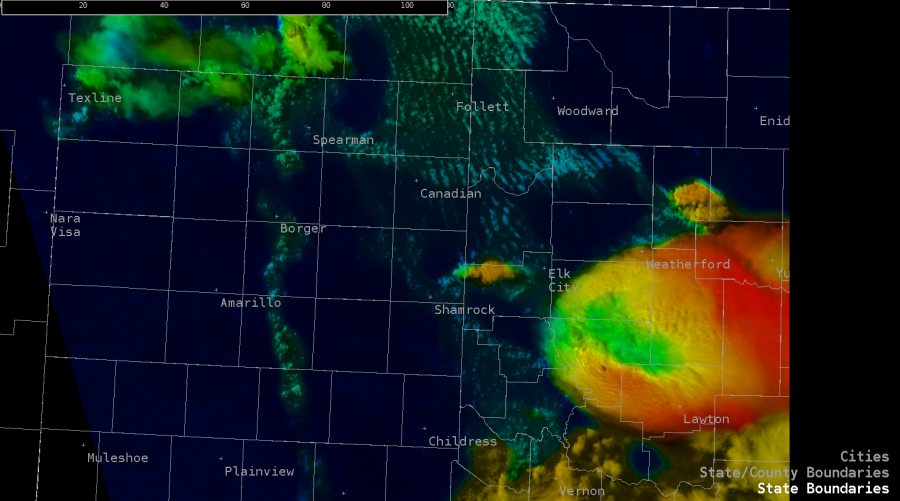
OCTANE showed the cumulus developing along the dry line and warm front well.  Can also distinguish which clouds are becoming taller.

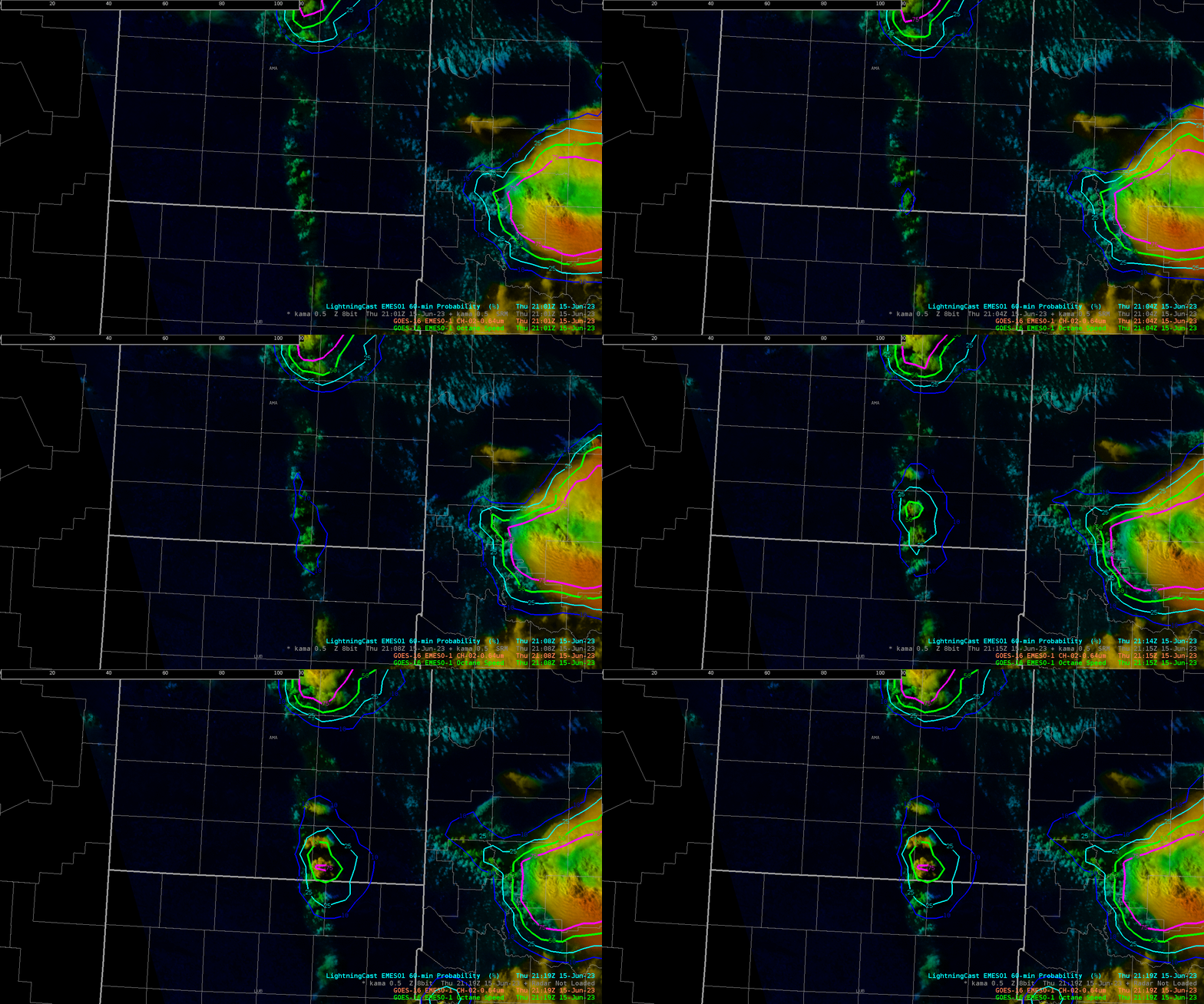
OCTANE highlighted where convection was taller, and Lightning Cast started to show probabilities for those same updrafts.

ProbHail

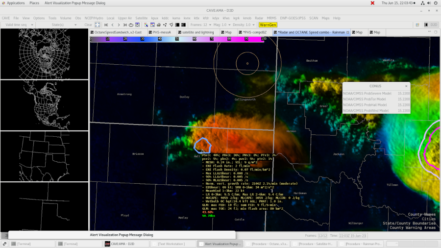
Noticed what could be an above anvil cirrus plume with the storm in question.  Prob Hail only had a 35% chance for severe hail at the time.

Prob Tor

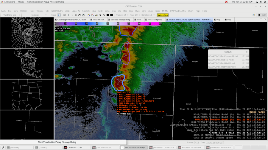
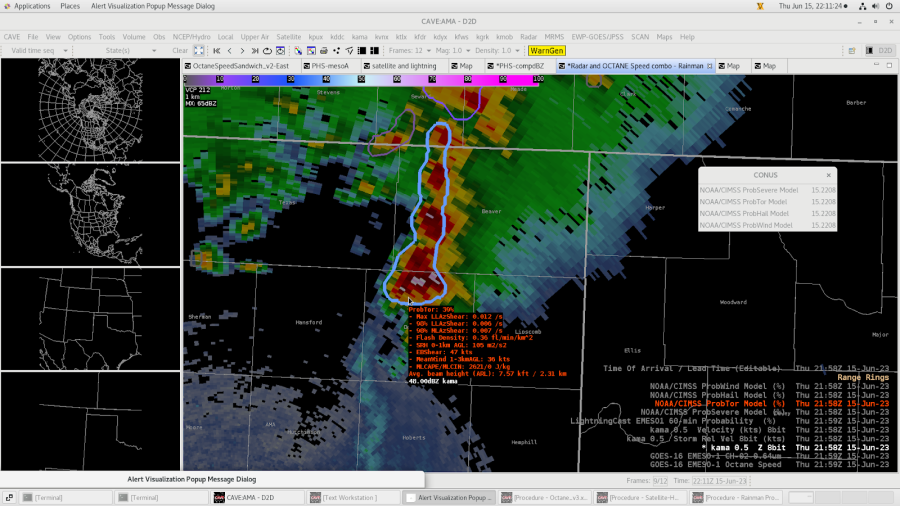
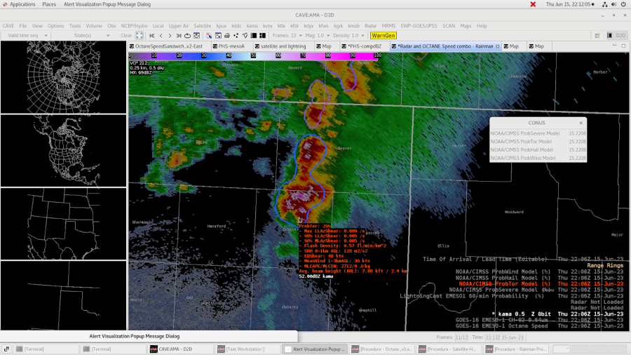
Noticed the Prob Tor jumped up depending on what cells it was encompassing.  Took three screen shots to denote the trend.  Seemed reasonable for it to increase since the end cell was ingesting the dry line at the time the probabilities increased.

-Rainman

6/15 HWT OUN SuperCell

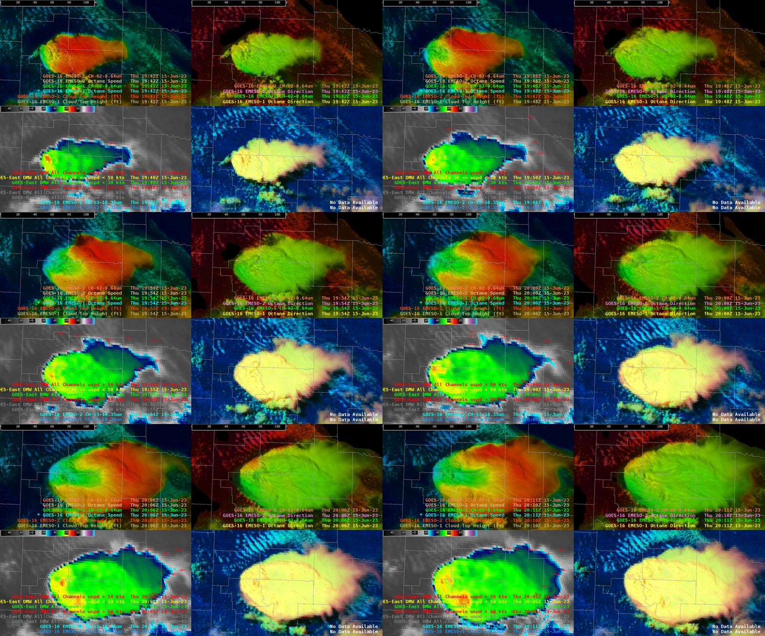
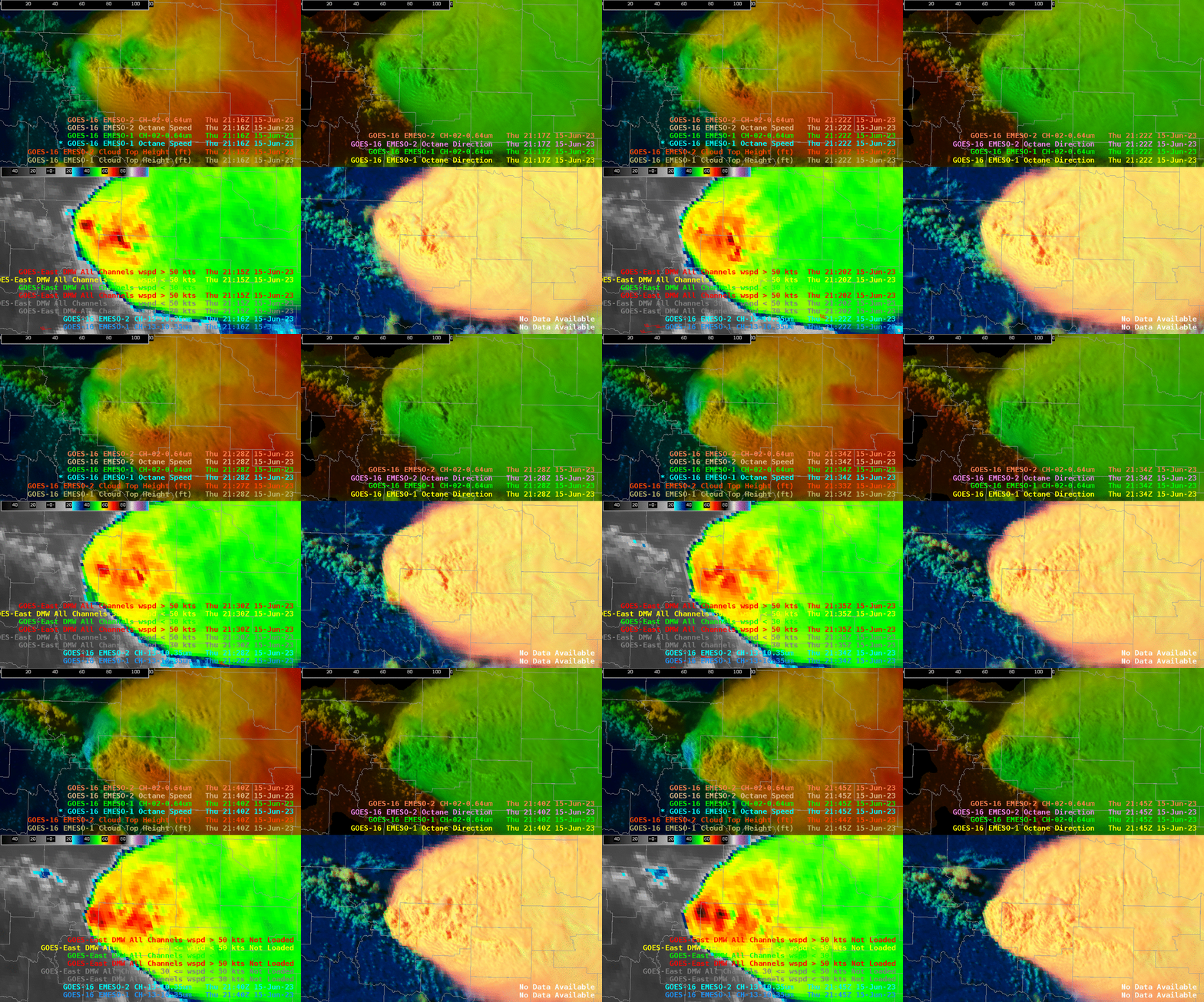
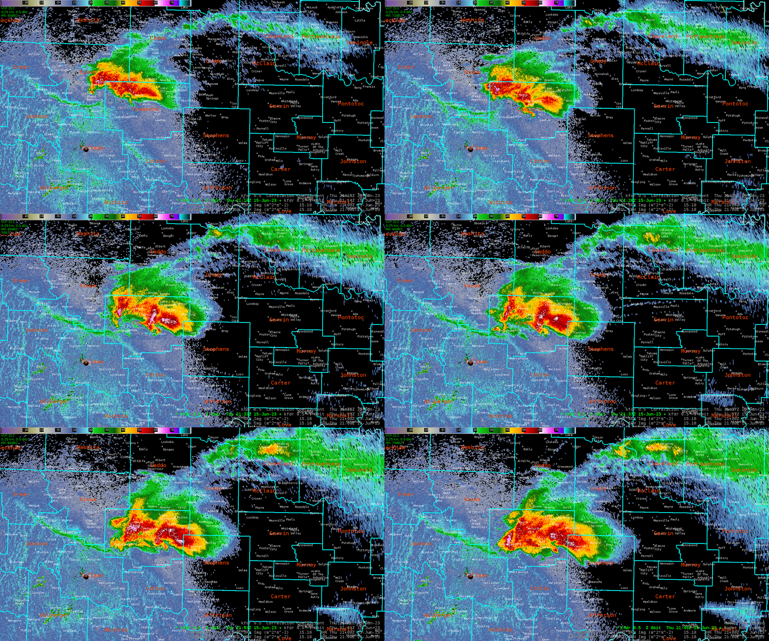
 A very intense supercell formed across western portions of OUN CWA. This cell underwent many transformations including splitting and merging at other times. Octane was very interesting to watch as this cell went through the various processes before eventually producing a tornado. Octane was able to show the storm splitting before it occurred on radar.  PHS was also showing corridors of stronger 0-3 and 0-1 SRH; SPC Mesoanalysis was showing this as well but I did like how the PHS was able to highlight exactly where these occurred. Seeing that and a near stationary boundary did increase my confidence that if a storm was able to latch on it would become tornadic. Probsevere/MESH did struggle to catch on to how large the hail actually was initially before finally picking up on the hail size.

4 Panel with Octane on the top row; appears to be two distinct divergence signatures occurring

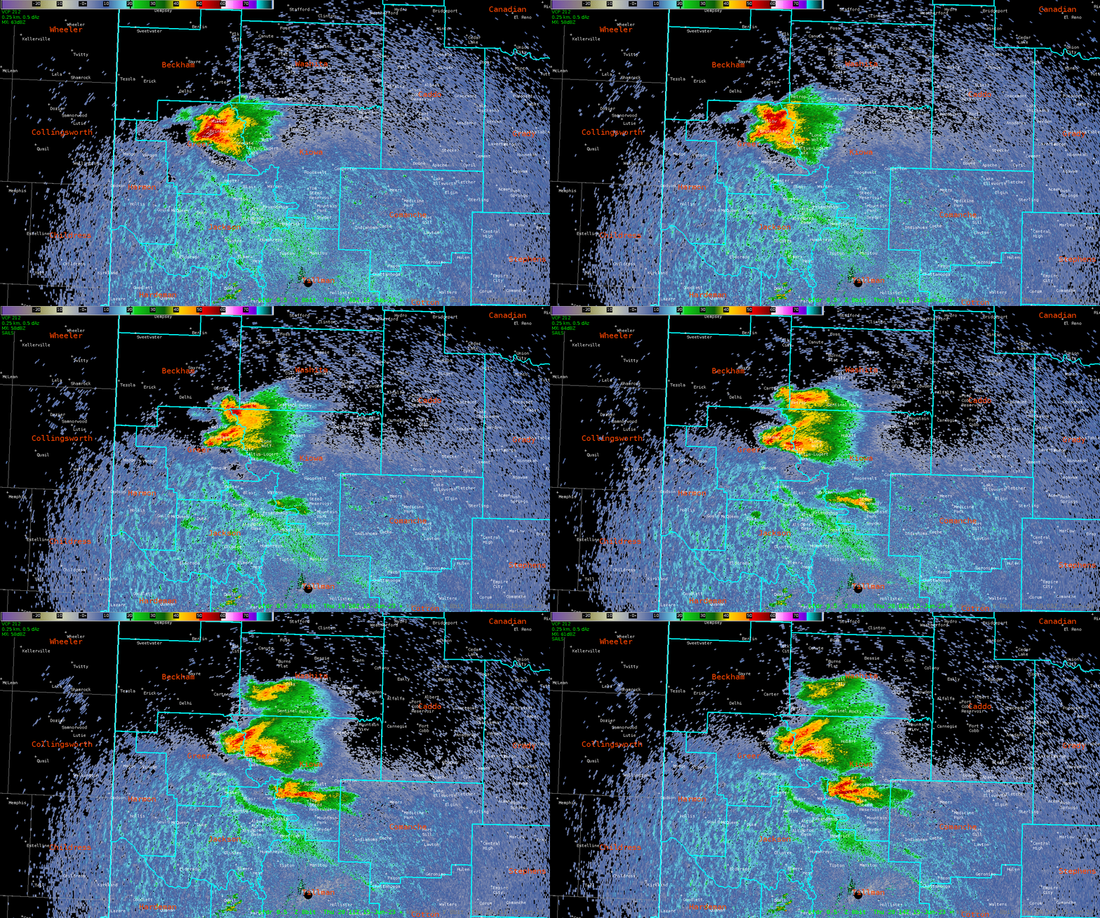
Radar Loop of storm splitting shortly after Octane signature…. Notice how the left mover dissipates.

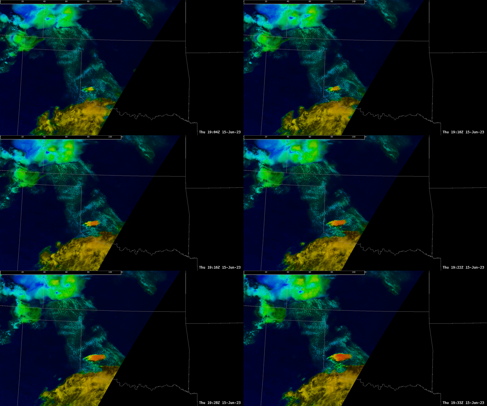
Using the 4 panel with Octane, IR and Day Cloud Phase it was also beneficial to see the upper divergence signature on Octane correlate with the cooling cloud tops of IR and Day Cloud Phase. Although it didn’t seem to create any additional lead time with that aspect; at least that I was able to notice. It was overall a very interesting storm to watch for this experiment.

4 Panel Intensification of storm.  Note the rapid color gradient to blue (upper level divergence)on Octane towards the end of the loop.

Radar loop around the same time as the 4 panel above   

- Tor Nader

6/15/23 HWT - AMA

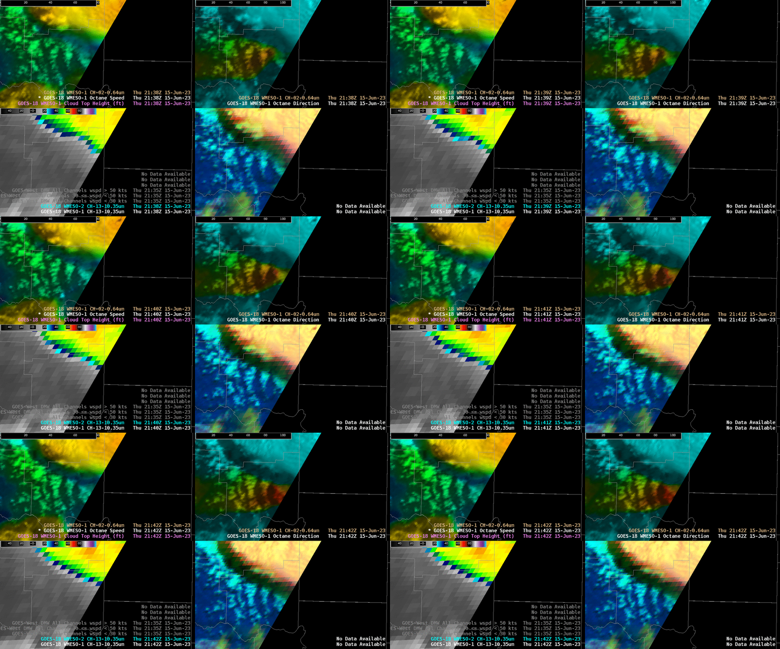
 What appears to be a nice distinction between sheared / lesser sheared convection across the Octane window. Stronger shear across SW OK producing much different appearance versus SW KS convection.  Nice quick visual distinction for operational use. The idea of a quantifiable divergence contour and/or grid would be welcome also.

Octane data from Goes west meso sector was zoomed in along the inflow region across the SW OK supercell (not our CWA but I had to look). The upper right panel is the directional component and the color scale was changed to highlight approximately 210 - 150 degree range. The increasingly warm colors represent a backing of flow at approximately 4.5 kFt. This level of storm integration (if appropriate) would be advantageous to warning operations.

ProbSevere time series plots do not sample. I would like sampling tied to the cursor as in the parent CAVE window. The element assignment within ProbSevere did cause a problem with the time series information with a storm that strengthened on the southern end of a developing line. The storm initially had a defined area for the region of interest but once ProbSevere assigned it to the larger line the probabilities became much less representative. This impacted ProbTor values which were being monitored ahead of an eventual tornado warning in the Tx Panhandle. I was the warning forecaster today and used ProbSevere extensively for my decisions. It is not the deciding factor but it certainly weighs into the decision process.

PHS model output was interesting and the Updraft Wind element was noted as something not usually seen with model output. It was viewed initially but I didn’t monitor the model output once storms developed and warnings were being issued.

NUCAPS forecasts were unavailable until the very end of the operational window. I did view the 19z overpass soundings and found the familiar  trends of errors at the boundary layer when compared to nearby surface observations. This limitation continues to impact my confidence in the product.

- jbm

Tennessee storm seeing huge difference in ProbSevere v3 vs. v2

 We're in the Great Plains today, but I just wanted to document this storm where ProbSevere v3 was much higher than version 2. Powerlines were reported down on I-65, south of Nashville, shortly after the image time in Figure 1 (at 18:28 UTC). PSv2 was 9% while PSv3 was 51%. The kinematic fields were likely dampening PSv2 probabilities, while the azimuthal shear and flash rates were only modest. The low-level lapse rate was also strong, contributing to an elevated probability of severe (in version 3). PSv3 was higher than PSv2 for quite a while, until the azshear increased and the version 2 probabilities (see Figure 2).

Figure 1: ProbSevere contour and MRMS MergedReflectivity for a storm in central Tennessee.

Figure 2: Trends in ProbSevere probabilities for PSv2 and PSv3, for the storm in Figure 1.


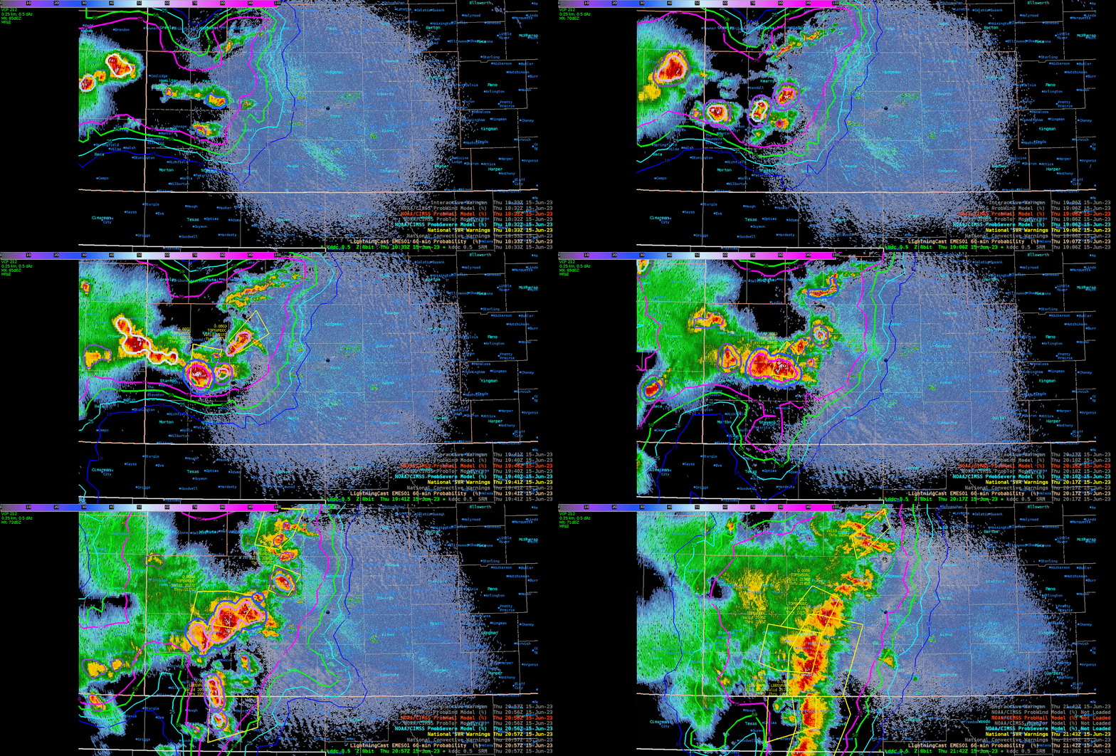
ProbSevere and LightningCast During Severe Warning Operations

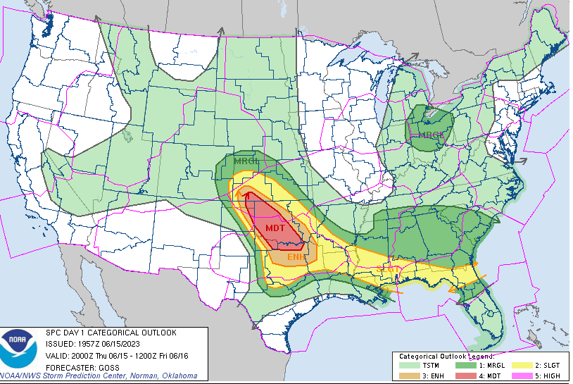
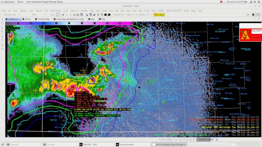
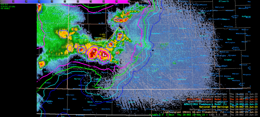
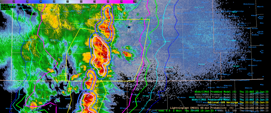
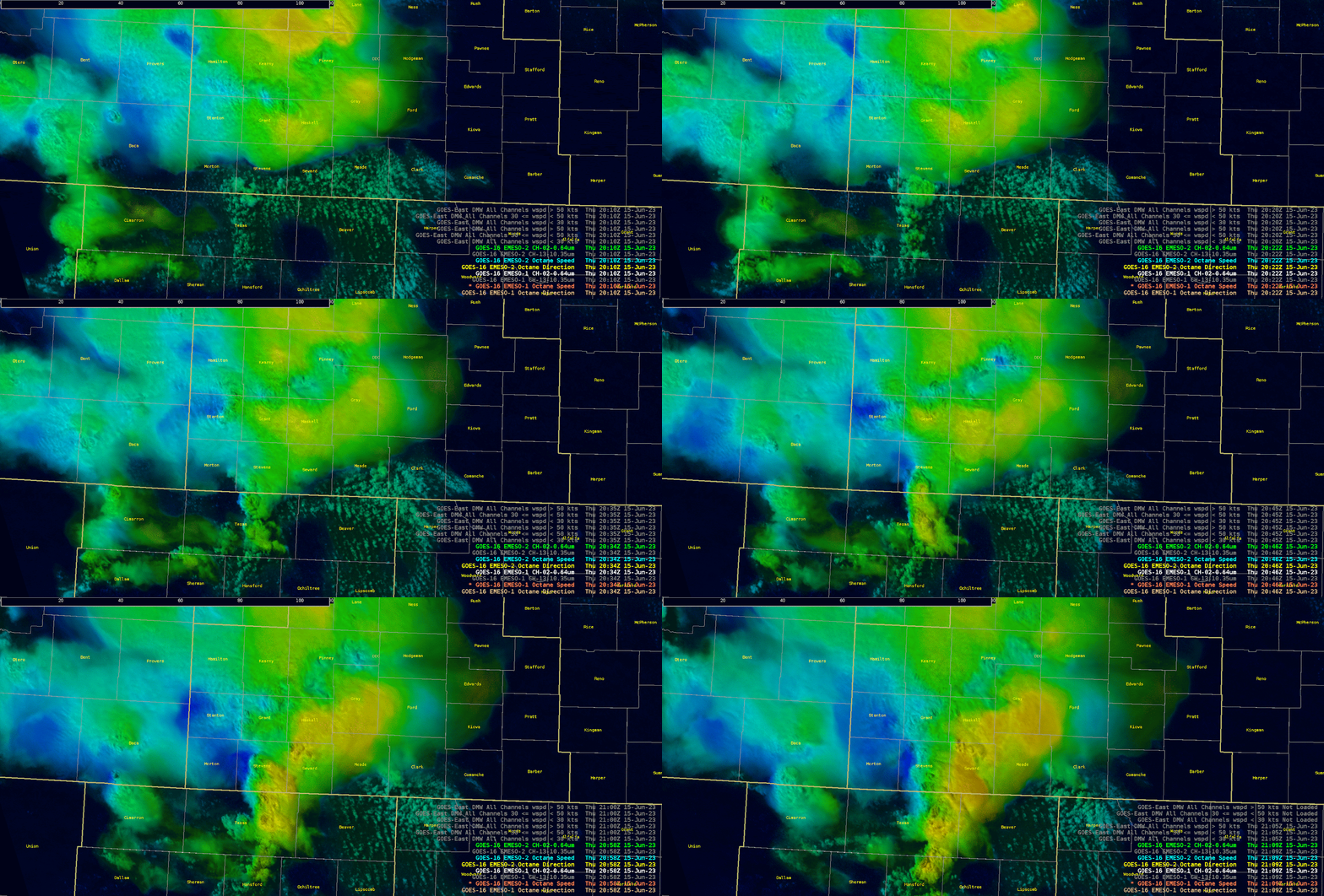
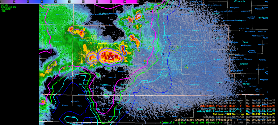
 A moderate risk for severe storms was forecast for the Southern Plains with hail, wind, and tornadoes as significant threats.  Storms quickly initiated in southwest Kansas (See Figure 2) and were ongoing when the testbed started at around 19z. Primarily used during warning operations were ProbSevere, LightningCast, and radar. Thrown in for good measure I used OCTANE to aid in storm motion and direction.  ProbSevere was helpful in issuing warnings but was vital in assisting in the hail size mentioned in the warning text.
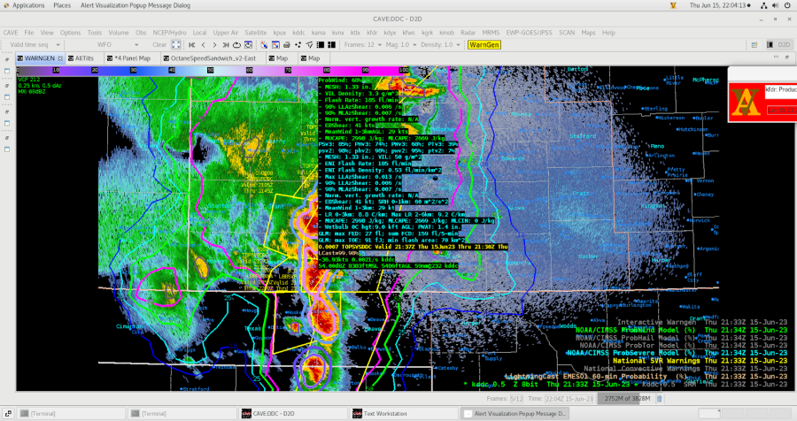
Figure 1: SPC Day 1 Outlook for June 15, 2023.

Figure 2: 2011z showing ProbHail with a MESH of 2.17” provided the confidence to mention 2-inch hail in the text.  There were two separate storms that eventually merged later in the afternoon.

Figure 3: storms were beginning to merge and ProvSevere was as well and thus prompted just one warning instead of two.

Figure 4: New warning with ProbSevere now depicting just one storm.

Figure 5: Storms continued to merge and evolved into a wind signature more than a hail producer.  Thus the ProbWind had a nice uptick to 68% at 2133z.  Before this time it never rose bout 40%.

Figure 6: Once the convection evolved into a linear wind producer, LightningCast became helpful in how far east to extend the polygon.  I used the 75% contour and issued a 60-minute warning.

Figure 7: Captured much of the event to show the evolution of convection and ProbSevere.

Figure 8: OCTANE aided in determining the area of cell merger in southern Grant and portions of Stevens Counties. 

- Podium       

Wednesday, June 14, 2023

Probsevere and Octane

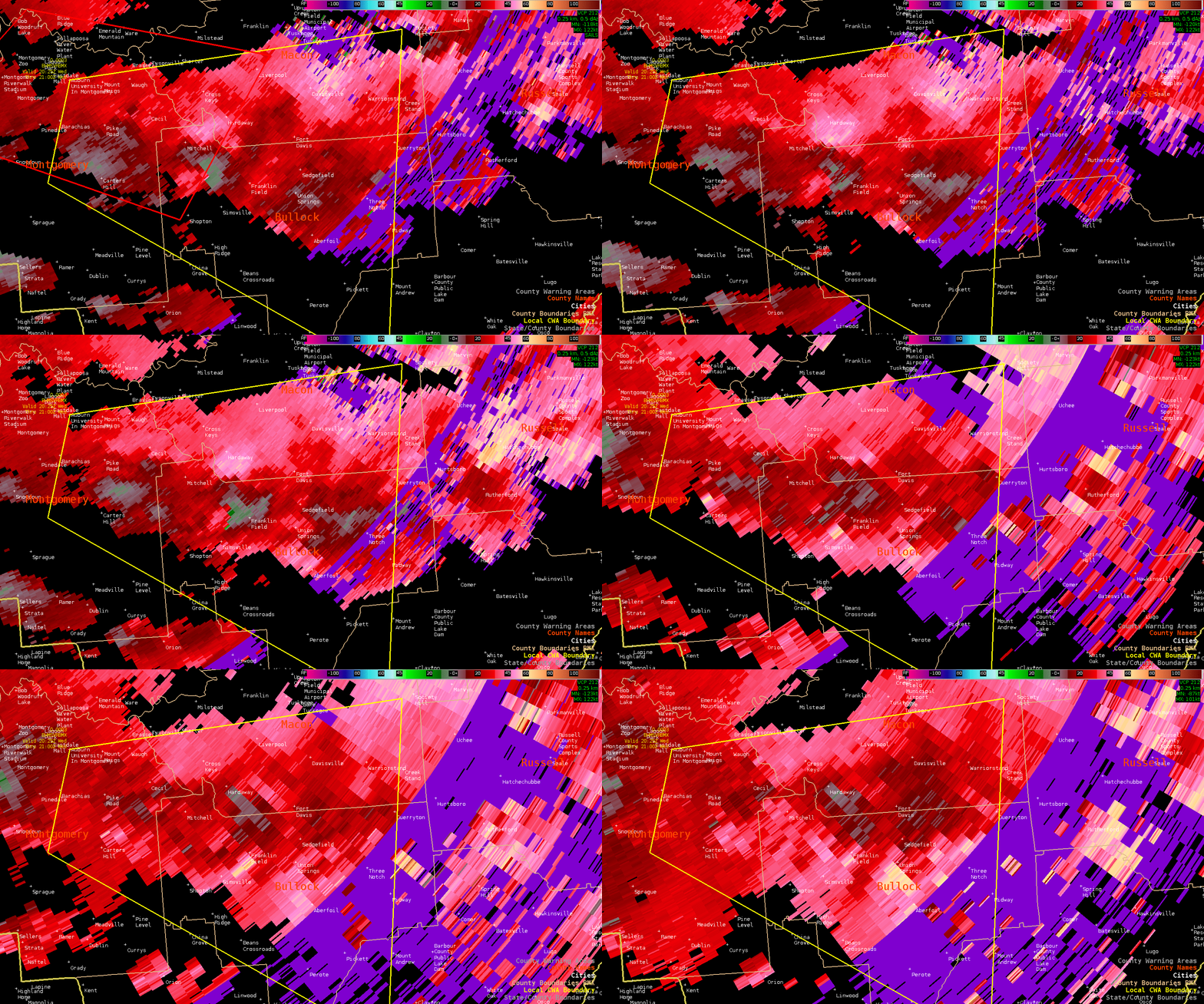
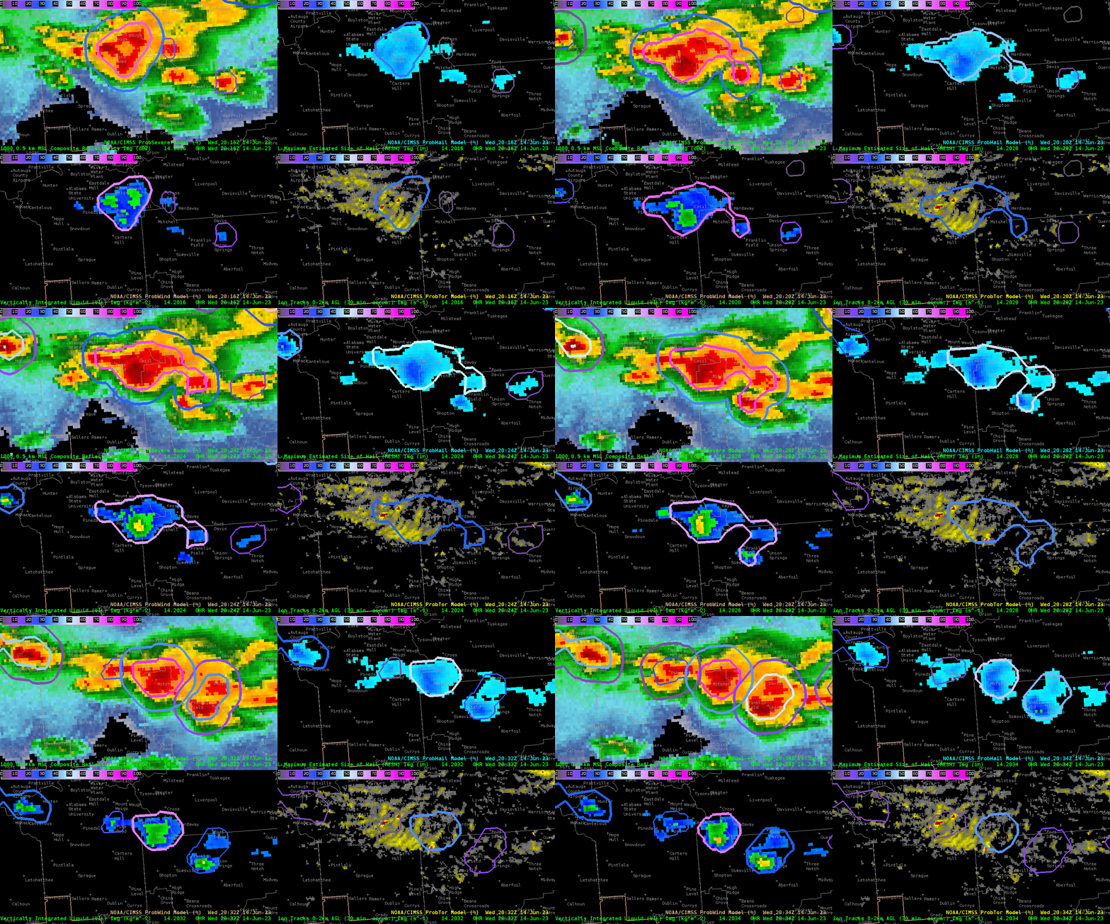
Widespread severe storms have been ongoing over portions of the southeast CONUS nearly all afternoon. ProbTor was doing a decent job with picking up on a couplet in Montgomery county Alabama around 1950Z. Overall it seemed that ProbTor V3 was giving higher tornado probabilities than V2. It was noted that V3 is based off of the HRRR whereas V2 is based off of the RAP. So that was rather interesting to me that the HRRR was potentially picking up on better areas of rotation.

Image of ProbSevere with ProbTor in the bottom left

Loop of tight couplet that ProbSevere V3 was picking up on

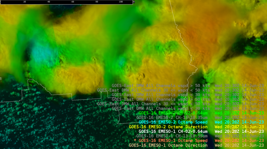
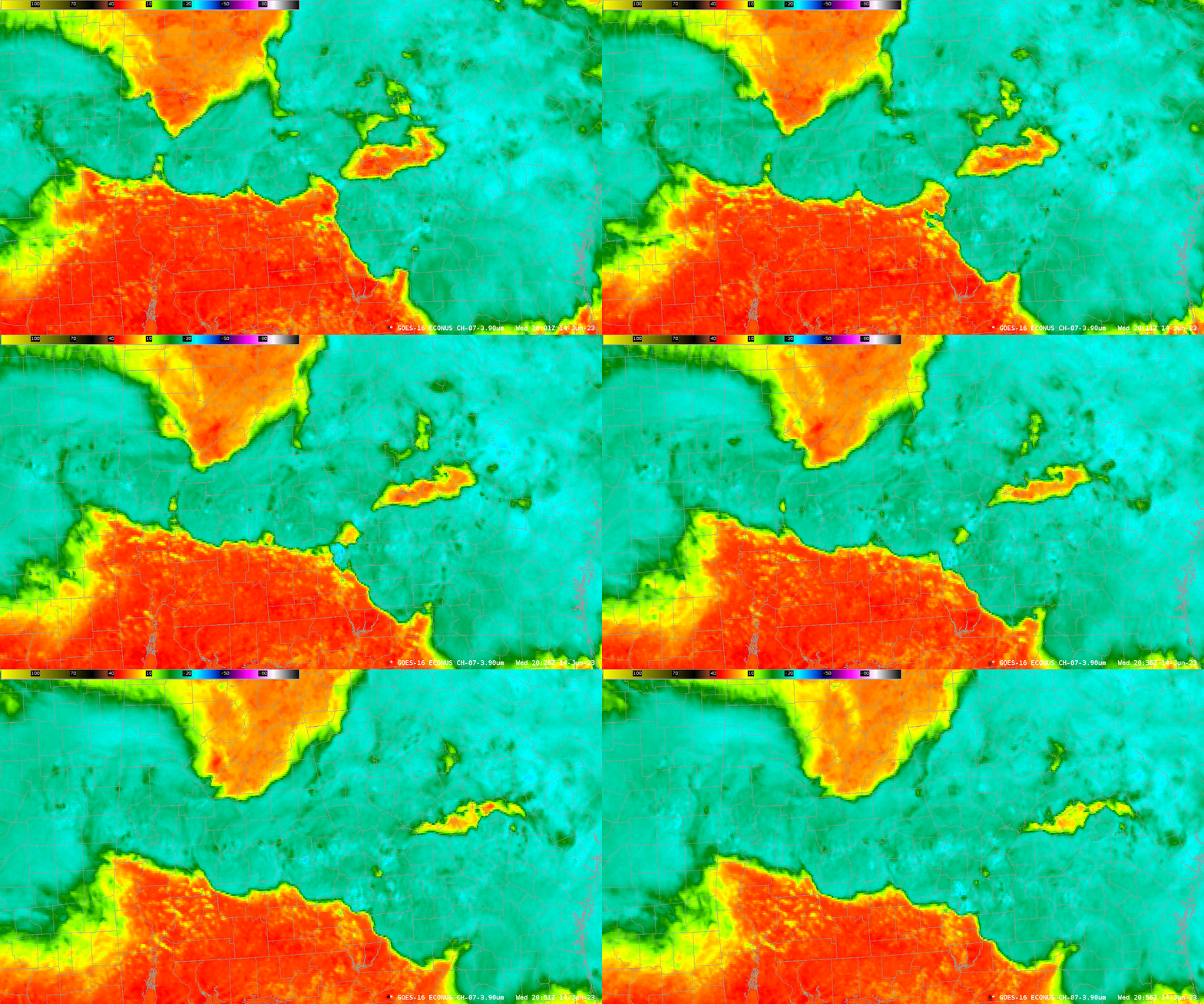
The other really interesting feature I noticed on the part of Octane. The Octane vertical divergence fields which is noted by a sharp gradient of blue in the coloring. This was occurring around the same times as cooling cloud tops that were seen on IR imagery. This also seemed to be a precursor to when storms began to intensify on radar. Along with that intensification was when a better couplet began appearing on radar and an increase in ProbTor V3. Overall I thought that those three correlations were rather neat to see in real time. If this correlation does continue to show up then this has the potential to be another important feature of the Octane product.

Loop of Probsevere with intensifying cluster of storms

Still image of Octane showing the “Blue” Divergence aloft features

Loop of cooling cloud tops via IR

- Tor Nader