Tuesday, June 4, 2024

Tracking convection across DLH CWA with Octane, LightningCast, and GREMLIN

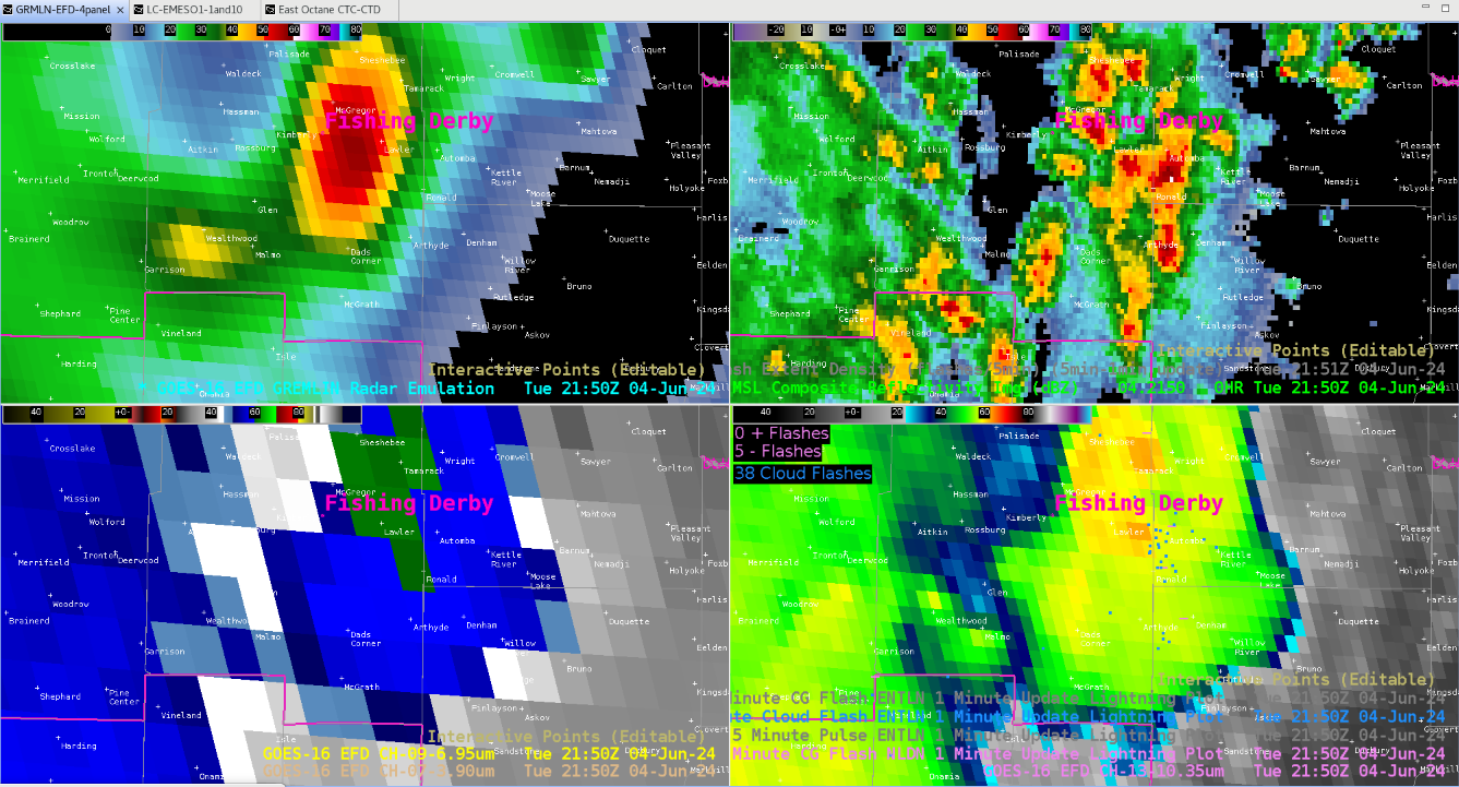
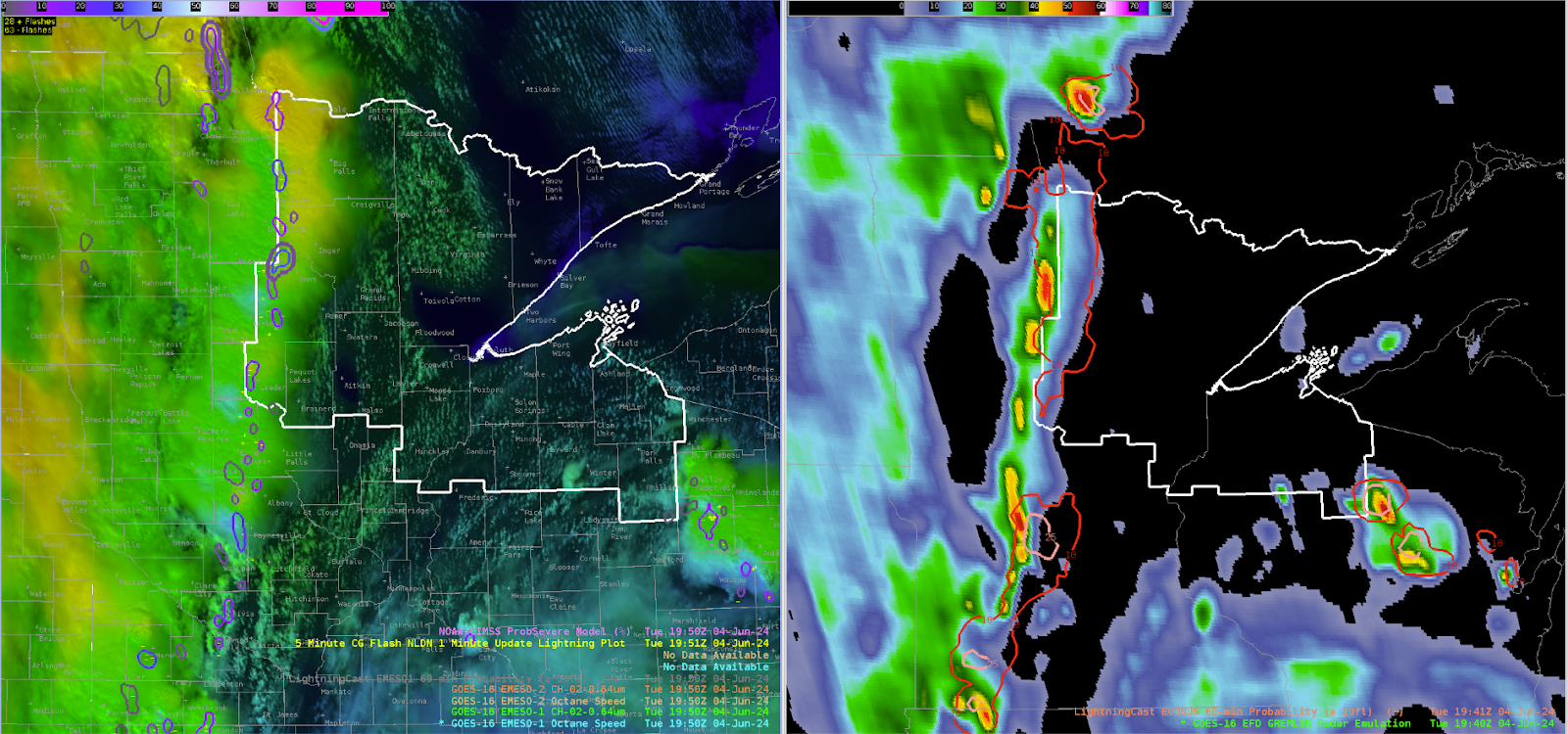
Forecasting in DLH today was challenging due to the radar being made unavailable. However, some of the satellite convective products were able to create accurate forecasts regarding the location of storms and lightning. Firstly, looking at Lightningcast there were gradients of ~25% appearing 1 hour out around the DSS point indicating the possibility of lightning developing within the next hour. This was also supported by Octane, which was showing storms initiating to the south with early signals of cloud top cooling and divergence occurring. Around 1 hour later this seemed to mostly come to fruition, which can be seen on the 4 panel image with GRMLN data on it. Lightning seemed to be mainly concentrated east of the DSS point which was shown in lightningcast. Also these storms originated from the south which Octane began to hint on early out. Overall, it looks as if all three of these satellite convective products did a good job in forecasting possible convection without the use of a radar.

-Sven The Puffin

RADAR DOWN IN DULUTH CWA

Without the use of radar out of Duluth more reliance was given to Satellite derived observations and satellite derived output.

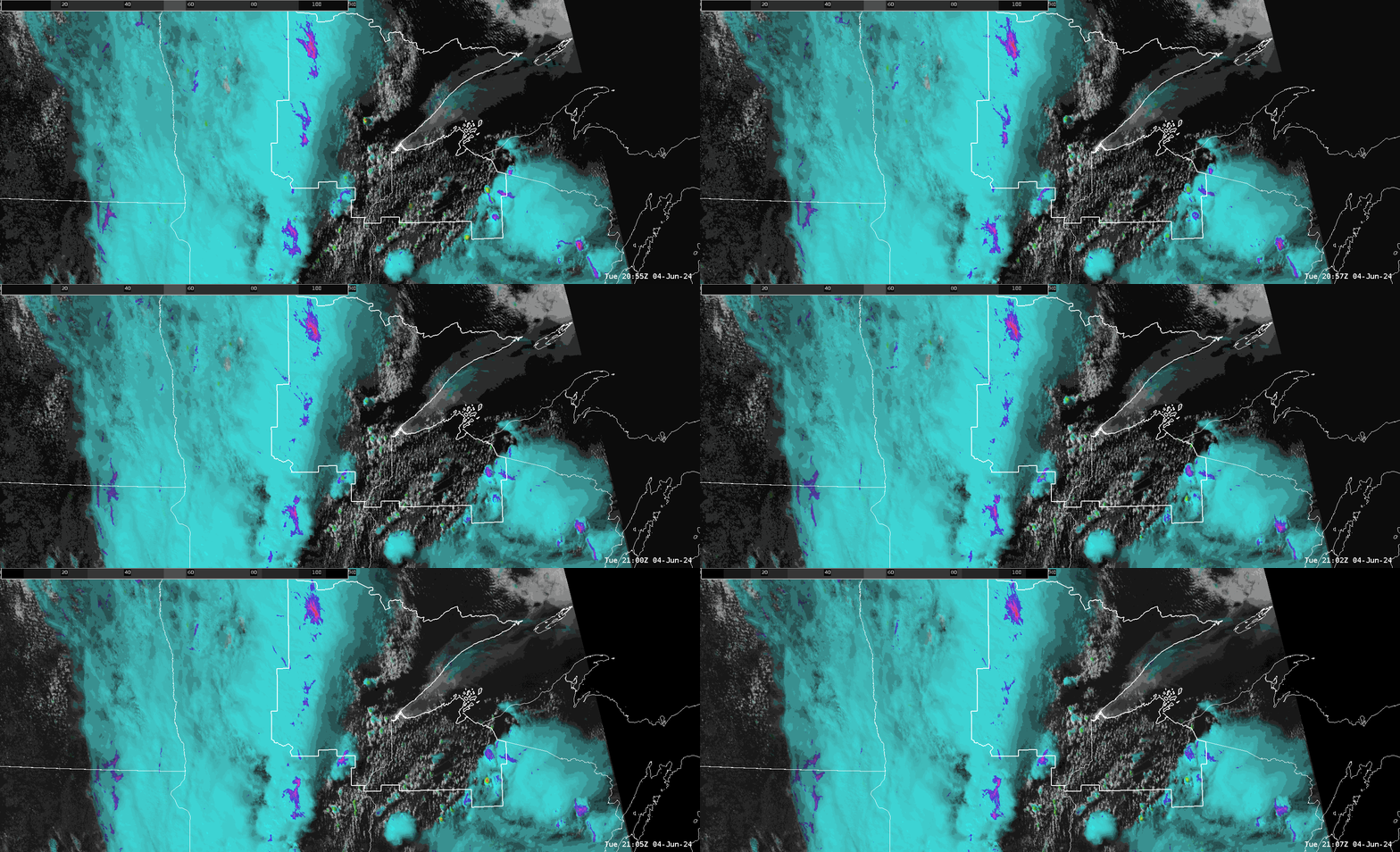
Below is the OCTANE cloud top cooling and cloud top divergence product.  You may notice in an area of moderate but increasing instability there is convective initiation ahead of the main line of convection.  However, you can notice early in the loop that there is convective cooling indicated in the south-central portion of the CWA and the far SE portion of the CWA.  Notice how in the far SE portion of the CWA there is the purple shading indicating cloud top divergence.  And in south central portions there are “hotter” yellow and tiny red(s) (may be hard to notice due to scale) pixels indicating cooling cloud tops, but with no purple shading and thus no meaningful divergence at the cloud top.  This is indicative of orphan anvils. The moral of the story here is that without radar the OCTANE product heightens your attention to the cells in the far SE portion of the CWA, and this would be where to consider SVR or SPS product release, with the activity across South Central portions of the CWA failing to produce significant convection at this point in time despite moderate to strong instability.

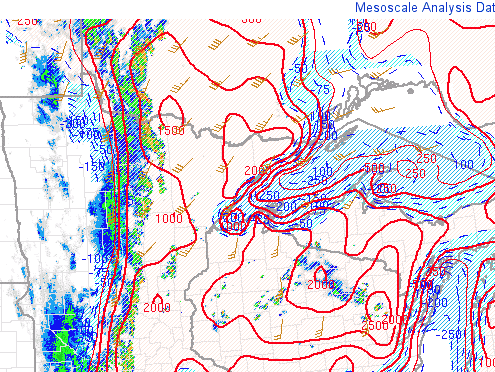
Further southeast however notice that there is stronger instability over SE portions of the CWA, thus the OCTANE product is giving you a result which coincides with where there is higher instability (higher MLCAPE - see SPC mesoanalysis).

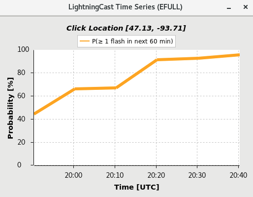
Lightning Cast continued to show high confidence of lightning over the next 60 min with the linear MCS moving into western portions of the CWA.  This lead to high confidence in forecasting lightning for a DSS location (Solana State Forest) during this event.

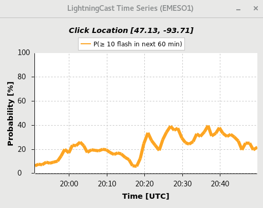
Steady behavior with the greater than or equal to 10 flashes in the next hour.

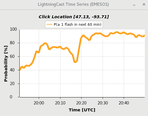
High probability of 1 flash of lightning in the next hour, increasing then holding steady

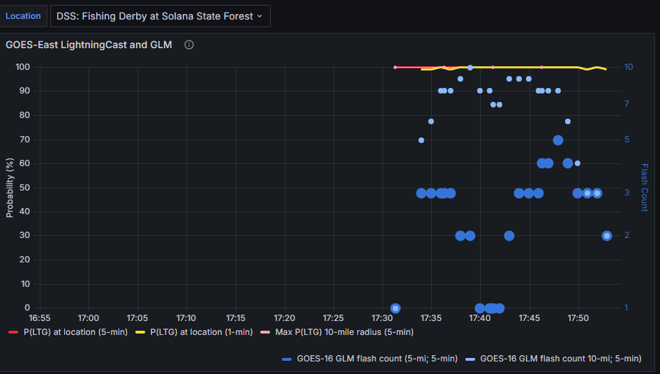
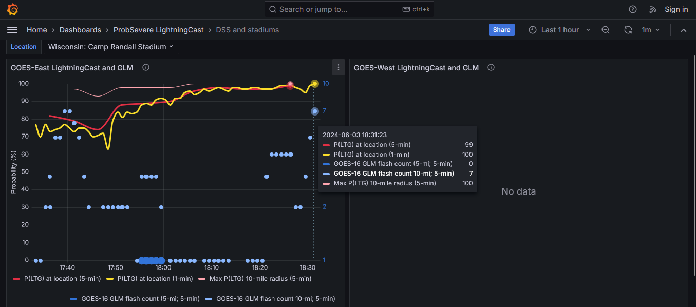
Here (below) is the Lightning Cast and GLM dashboard output comparing the forecast to the GLM flash count.  Note: the dashboard was down initially but came back online

Thus we were able to give a high confidence lightning forecast for DSS.

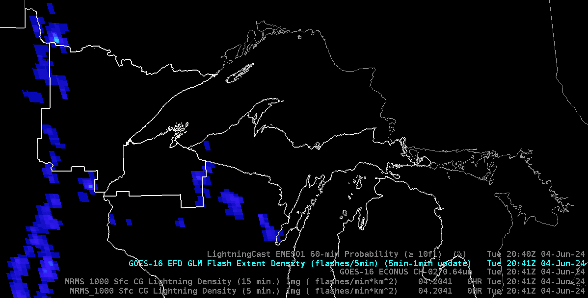
Here is the GLM Flash Extent Density at the time of the Lightning Cast 1 hour forecast.

- 5454wx

Monitoring Convective Trends across WFO MPX

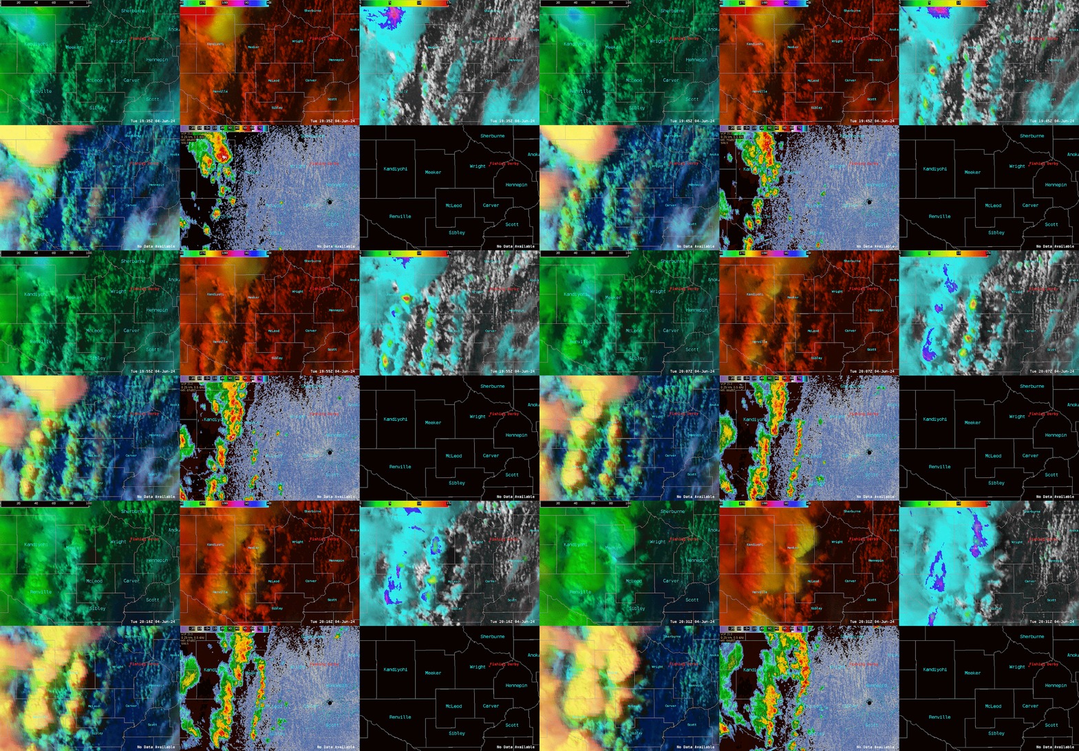
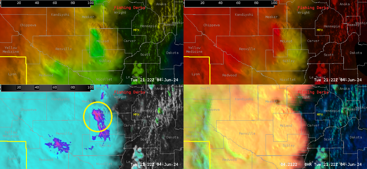
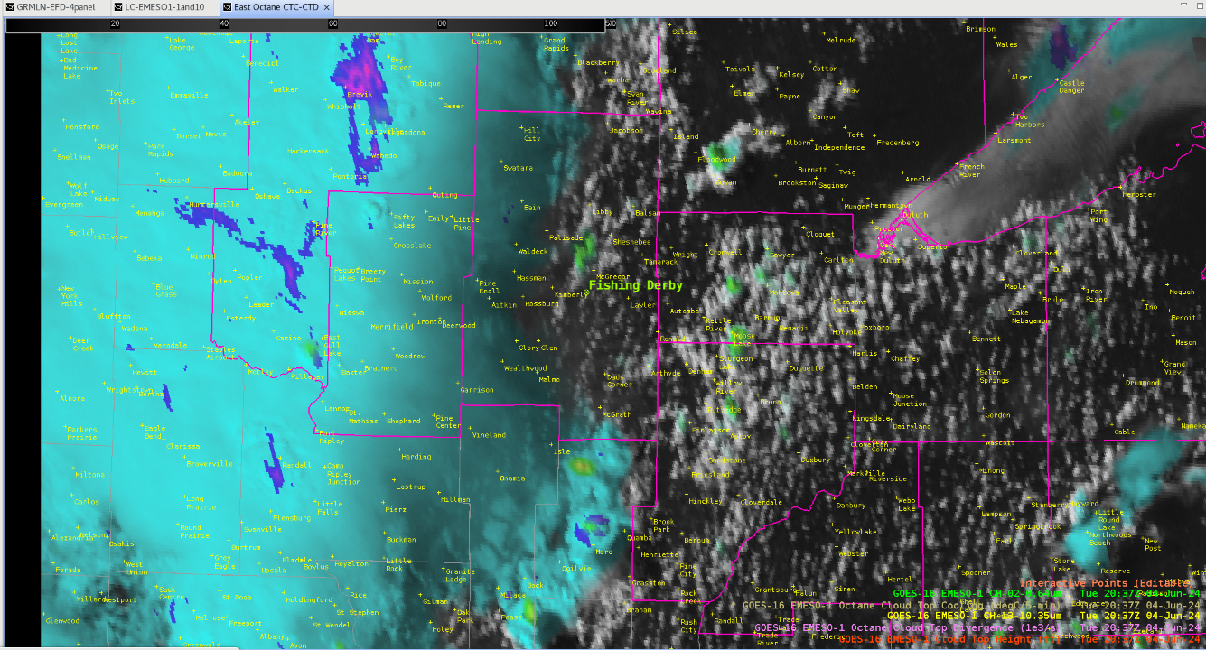
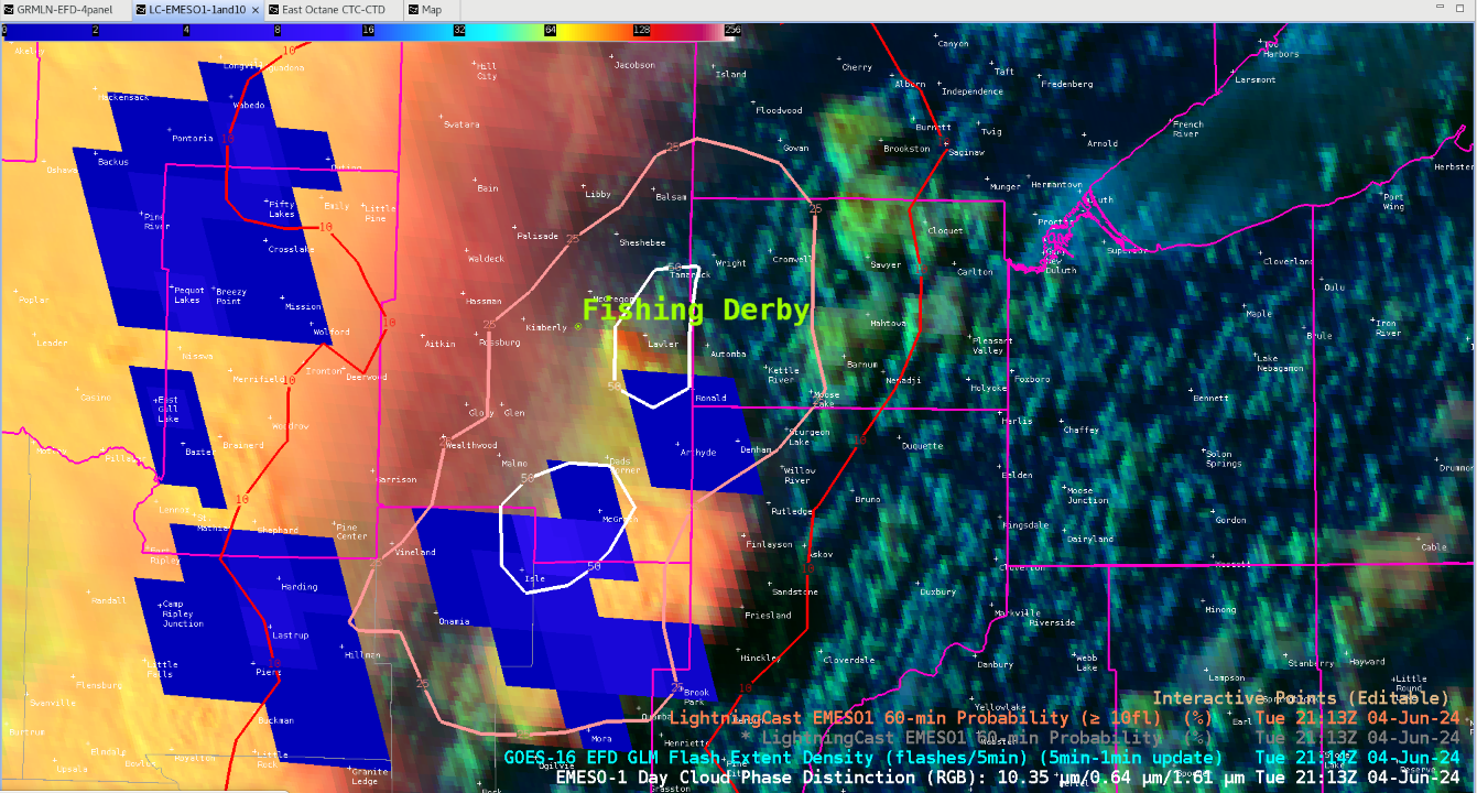
 This scenario began at WFO MPX with a broken line of strong thunderstorms approaching from the west. Many small-scale features were identified using OCTANE and radar trends, with focus on a DSS event ongoing “Fishing Derby” in Wright County, MS.

Doppler radar and Day Cloud Phase Distinction both illustrate new development ahead of the main activity to the west, ahead of an eastward surging outflow boundary. This led to the first DSS notification giving the event a heads up for >30mph winds and lightning in the next 1 to 2 hours. LightningCast was helpful showing probabilities increasing from the west.

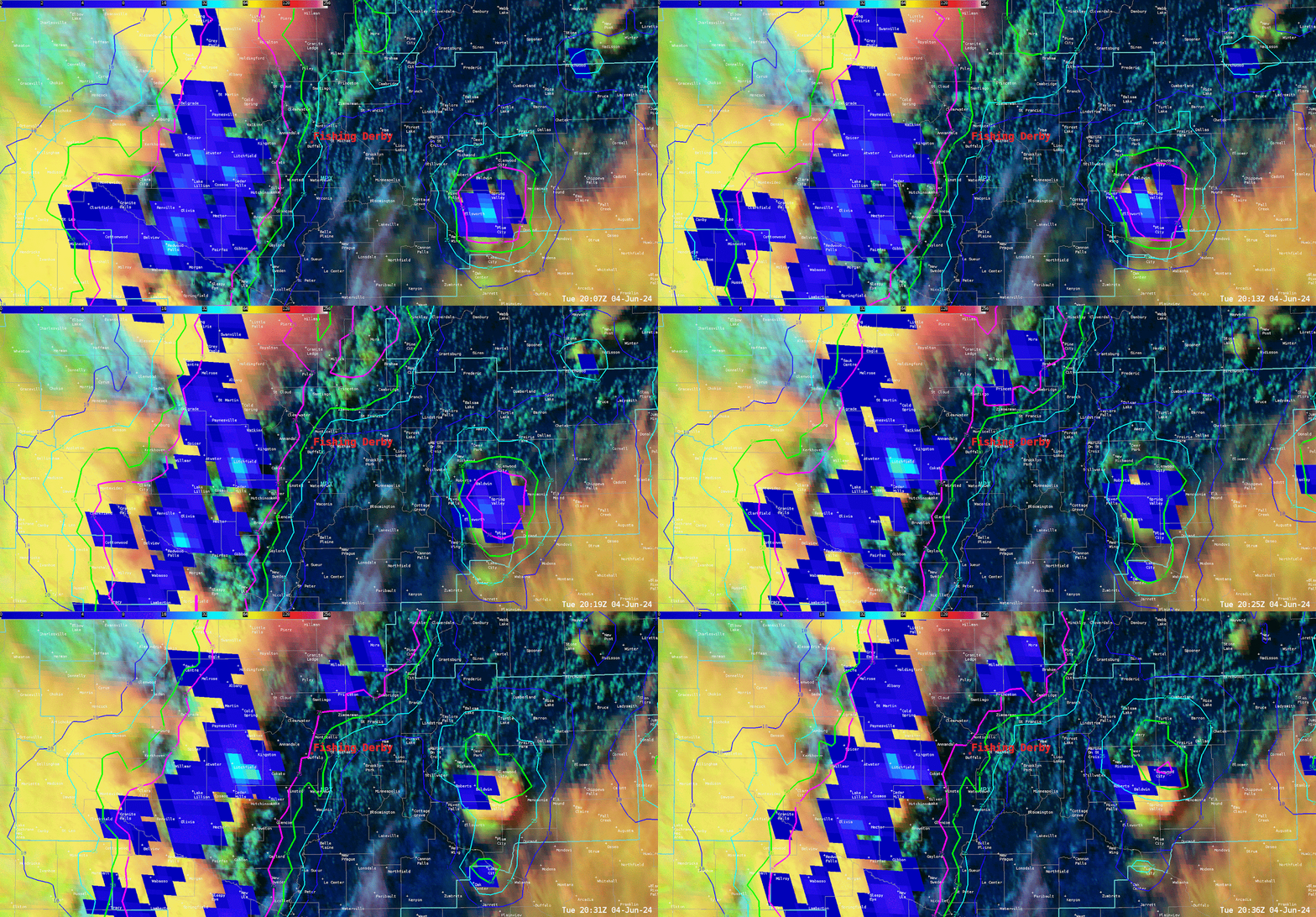
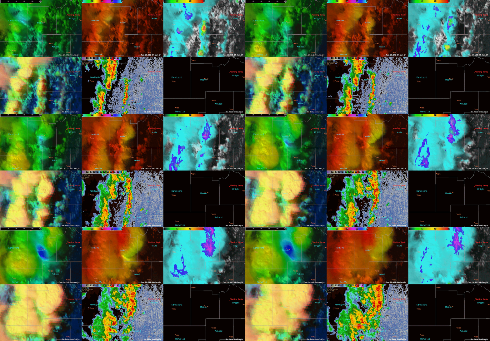
One specific updraft noticed around 20:00Z, with the decision for a warning to follow along with 40dbz around 40,000ft ARL. OCTANE products were specifically helpful, especially by modifying the colorbar settings for OCTANE Speed. Decreasing the MAX from 200 to 100 and increasing the MIN from 0 to 15 gave a greater contrast and “bullseye” to help diagnose strengthening divergence.

Several additional DSS notifications were sent to the site to alert them of not only the approaching activity, but how long the activity might last over the next following hour.

A TSTM Wind Dmg LSR followed with this storm that led to an injury.

LSR:  *** 1 INJ *** Corrects previous tstm wnd dmg report from 7 N Hutchinson. Relayed report from sheriffs office of a shed with roof blown off and sides collapsed

Again, OCTANE gave great situational awareness to support alongside with radar to lead to proactive warning decision.

- RED11248


Confidence Builders With OCTANE

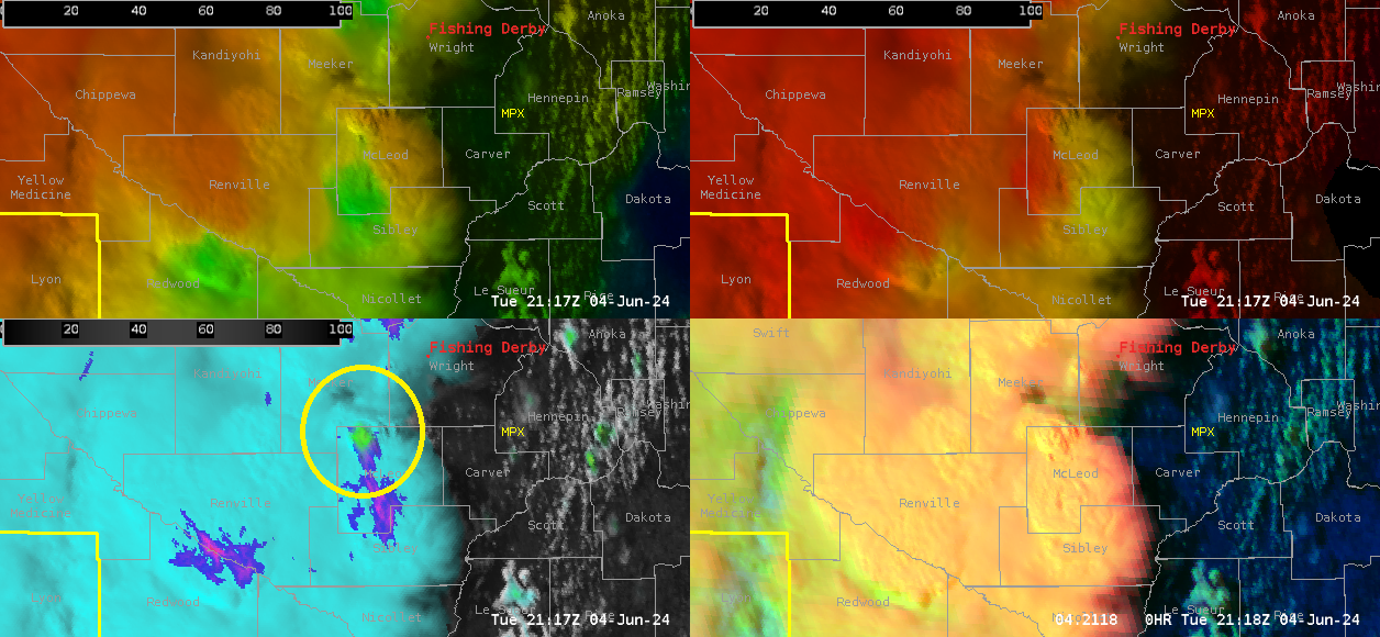
 Looking at OCTANE Cloud-Top-Cooling and Divergence parameters, confidence began to grow on strengthening of storms in the Chanhassen forecast area today.  In the image below you can see the bulls-eye of Cloud-Top-Cooling (Circled).

 A few minutes later, Cloud-Top-Divergence increases as shown in the picture below (Circled).

-ULMCUBMAN

Central Minnesota Overview & LightningCast Behavior in Northern Wisconsin

 As of 20z, a strong line of thunderstorms associated with sharp mid-level shortwave and surface cold front is pushing across into central Minnesota. For a brief overview (DLH radar is down), GREMLIN shows a broken line of moderately strong convective cores dotted along this line, but overall the lightning production remains meager; LightningCast probability of greater than 10 strikes has only peaked out around 25% at any point within the line. The convective cluster sliding across northern Wisconsin remains the most highly active lightning producer around. OCTANE divergence fields further support the lack of strong-severe updrafts throughout the line for the time being.
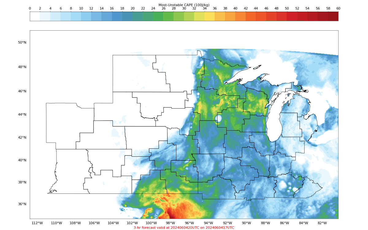
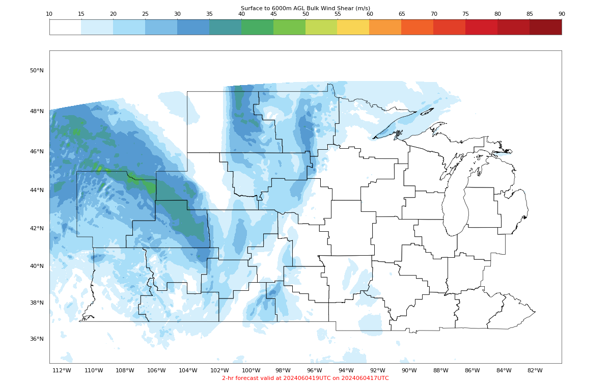
PHS fields across the region suggest weakening deep layer shear but increasing instability to the east. This generally falls in line with other guidance (SPC Meso, HRRR).
As of 2018z, interesting LightningCast signal in northern Wisconsin with 70%+ prob for greater than 10 strikes in the next hour. Not clear exactly why this is the case but it is a very strong signal moving forward. OCTANE fields for both cooling and divergence are not too intense. Cell to the west exhibited fairly strong cooling as well temporarily but appears to be weakening.
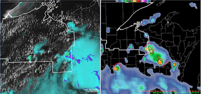
Note @ 2030z: Likely orphan anvil and more mature cells across northern Wisconsin with weaker orphan cell to the west and stronger to the east. Despite relatively few ground strikes, the GLM did produce > 10 flashes (verifying the high lightningcast probs).
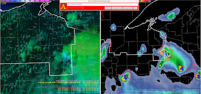
And @ 2045z: Orphan anvil has totally dissipated, verifying the lightningcast low probabilities and the eastern storm steadily dissipated with weakening OCTANE divergence.
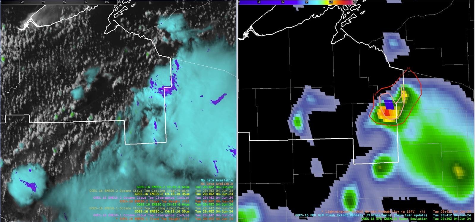
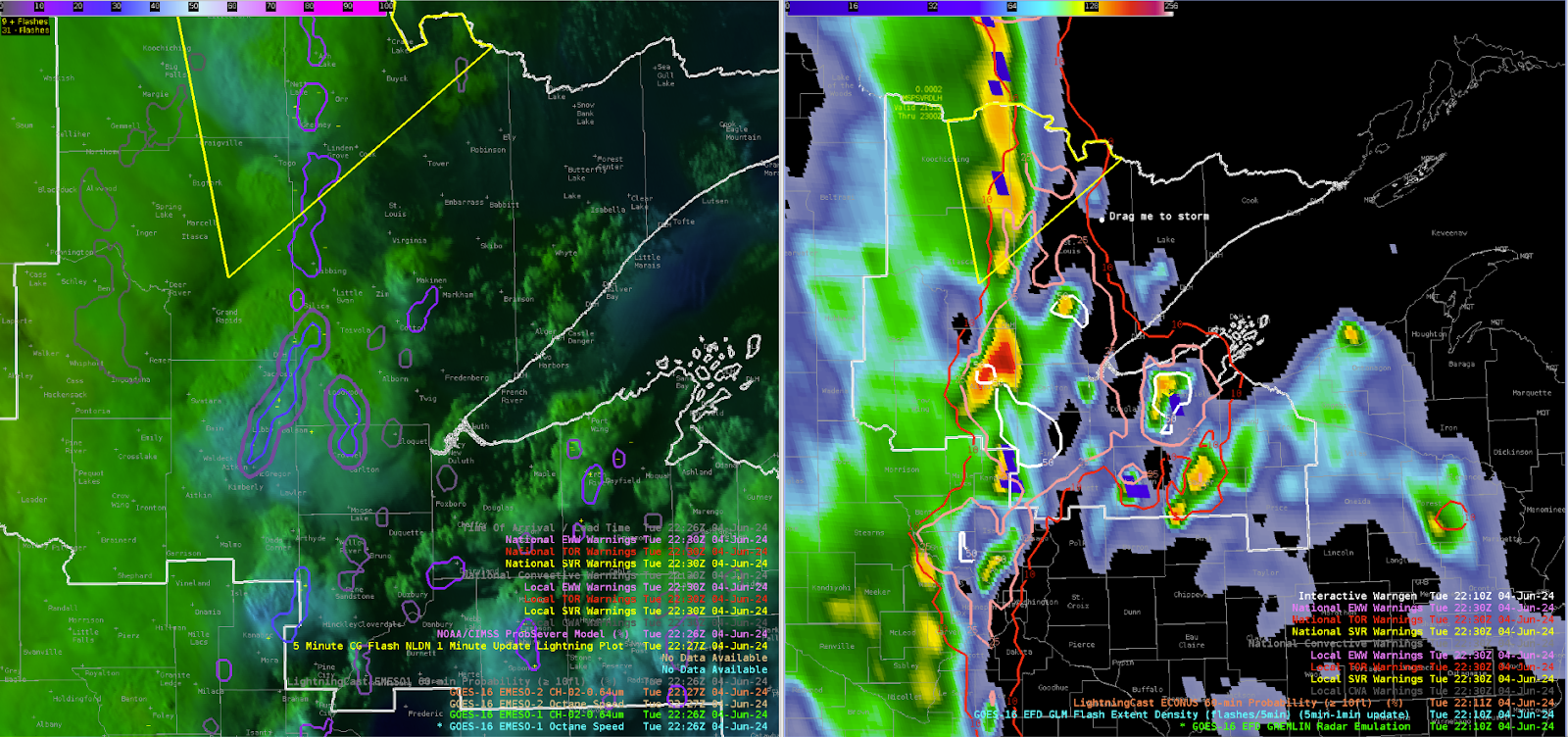
2100z: Convective coverage beginning to move closer to the Duluth area with the primary frontal band to the west and some prefrontal convection developing ahead. OCTANE cooling is lining up well with the GREMLIN coverage for these prefrontal storms, with a moderate-high signal in the lightningcast data. Still no indication of severe storms in any of the available products, PHS instability increase to around 2500 j/kg but 0-6km bulk shear falls off to around 20-25 knots. However, the instability axis looks to be displaced to east and helps explain to the not very impressive cloud top divergence in the OCTANE fields west of Duluth.

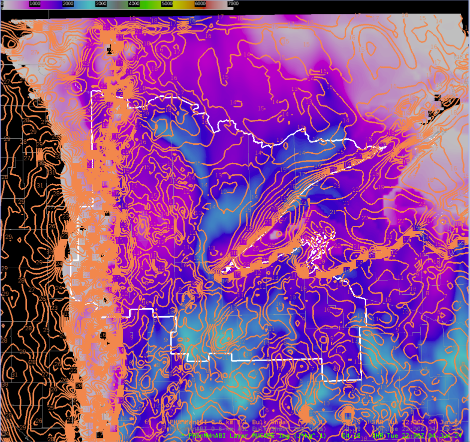
2130z: Overshooting tops seen across the northern tier of Minnesota. PHS instability and shear are maximized across this area. GREMLIN and GLM is not very impressive yet however, but cooling in OCTANE is noticeable.
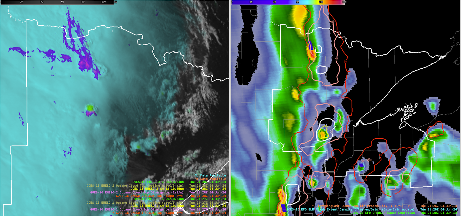
2150z: Issued a severe thunderstorm to cover the strengthening line of convection across northern Minnesota based on OCTANCE divergence, GLM, and increasing GREMLIN dBz. PHS environmental data maximized shear and CAPE across the region with 2500+ j/kg and 30-40 knots of 0-6km shear. OCTANE anvil cumulus cooling was noted for multiple times along with persistent divergence. GREMLIN radar signatures helped tune where the spatial extent of the warning would be.
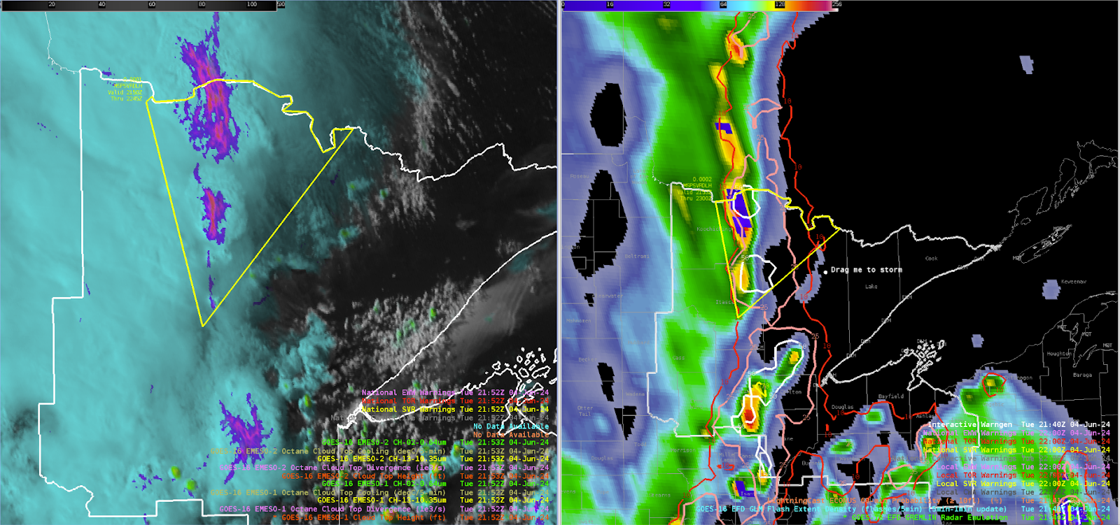
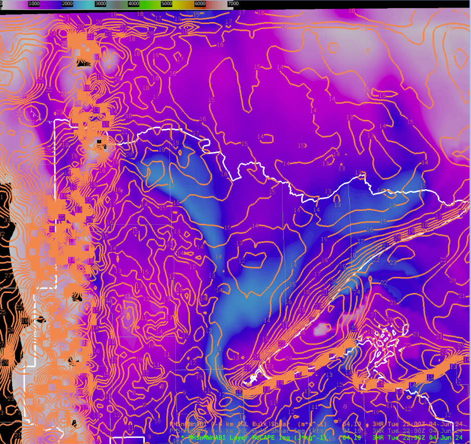
2230z: Interestingly strong signal in the GREMLIN west of Duluth. Unclear exactly why, OCTANE and GLM are not very impressive at least relative to other storms today.
-Hellothere
GREMLIN Observation with Light Radar Echoes/Cirrus

 Testing the blog abilities/functionality, but also wanted to highlight an observation I had regarding the GREMLIN data and its handling of light precip echoes and cirrus.

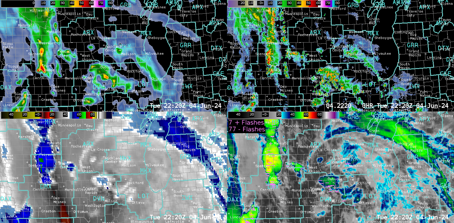
As expected, the stronger echoes in the line of storms to the west of Minneapolis are handled very well by GREMLIN, given the model’s training on colder cloud tops and areas with lightning present. However, and per an earlier question I had regarding how it might handle lighter precipitation areas, I decided to look at some of the areas of weaker showers near my CWA du jour.  For this post, I will focus on the area of lighter MRMS echoes near Madison, WI (near center of image), as well as what appears to be cirrus blowoff being picked up by the radar just to the north.

GRMLN-EFD-4panel image over southern Wisconsin at 2210Z.

The lighter dbz cell right over Madison in these images is still being picked up rather well by GREMLIN, though there do appear to be a couple of lightning strikes associated with it, so that is likely helping. I also noticed some colder cloud tops (what appears to be some cirrus) just to the north of that cell, possibly blowoff from the Madison cell. GREMLIN is picking up on that area, and other apparent cirrus areas as well. However, actual radar tends to pick up these areas as well, especially if the cirrus is thick. That is usually a negative in the operational environment, in that it can make discerning light precip from cirrus difficult. However, for the purposes of evaluating GREMLIN and its ability to mimic actual radar, it could be considered encouraging. Maybe not a mind-blowing observation, but one that struck me as significant enough, especially for light precip or maybe high-based shower situations.

- Loki

Monday, June 3, 2024

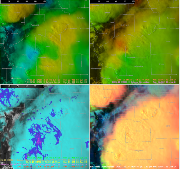
OCTANE Speed Product Shows Weakening Trend in Storm Well

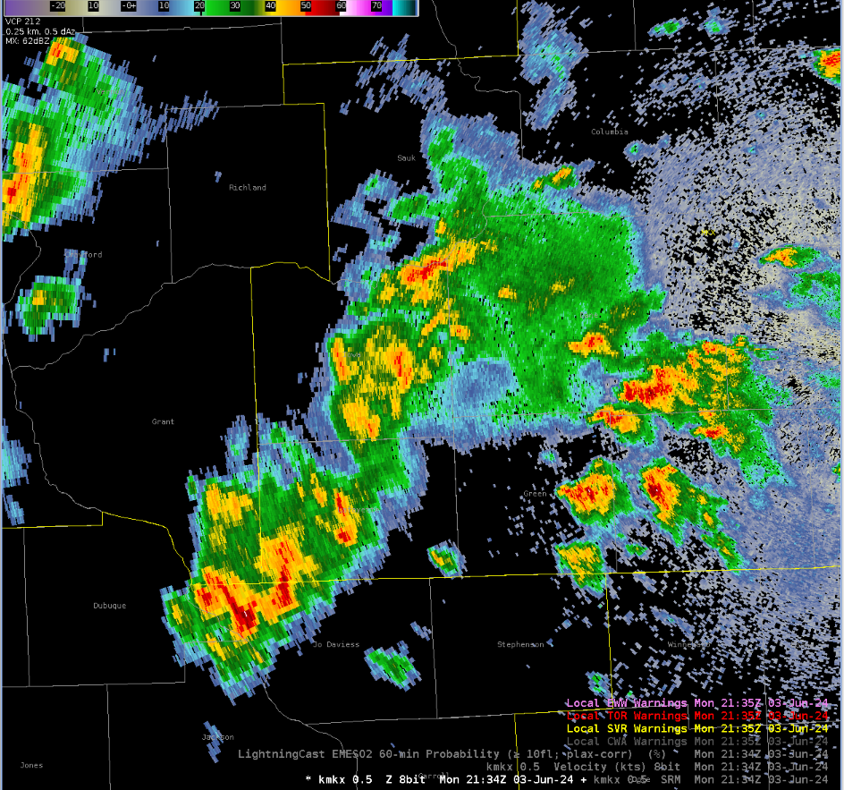
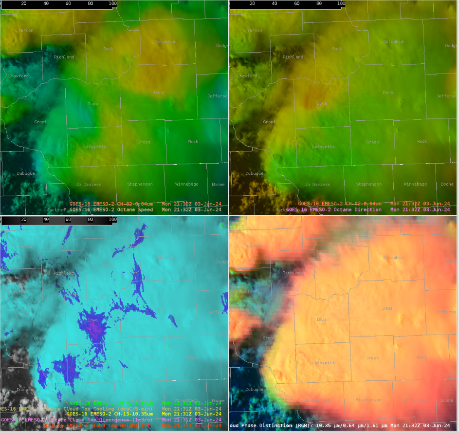
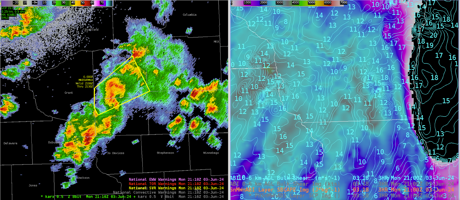
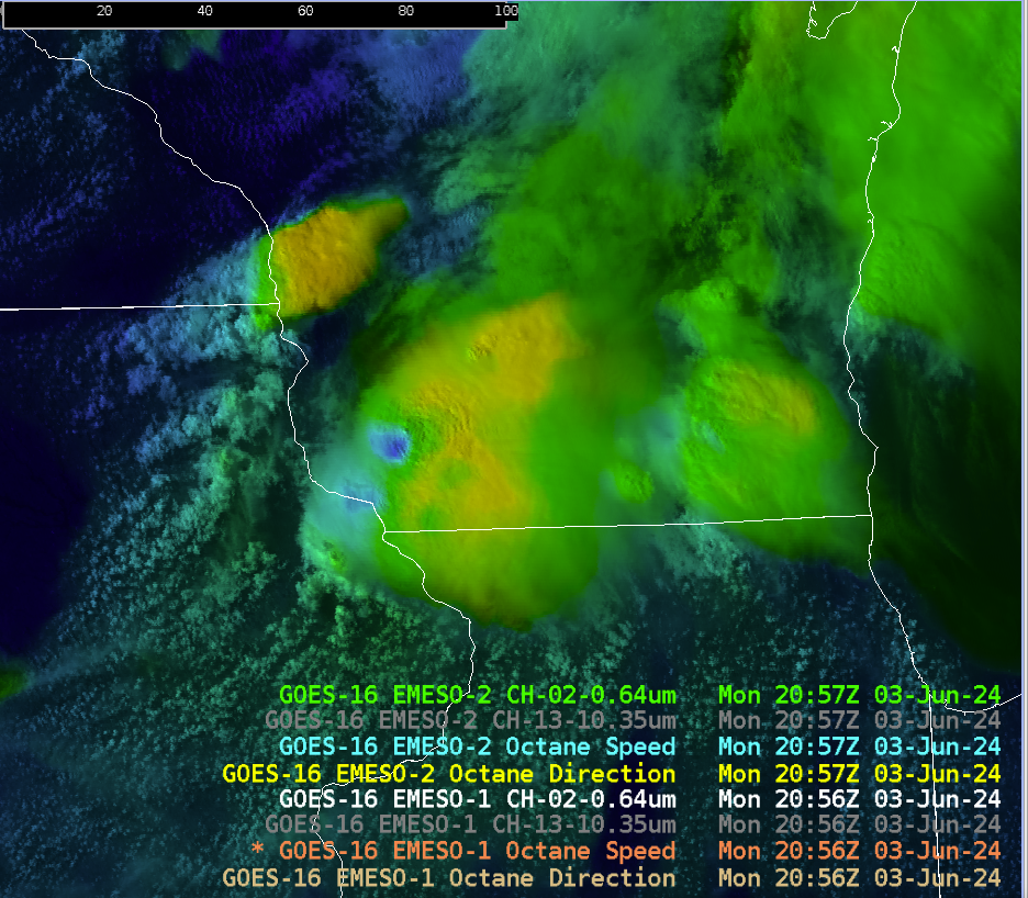
A strong storm with a well defined mid-level mesocyclone entered the western portion of the MKX CWA at around 4:00 PM CDT. At the time, the OCTANE speed product showed a well defined gradient and the divergence product showed fairly high values, indicating that the updraft was quite strong. We decided to issue a severe thunderstorm warning with a tornado possible tag on this cell as a result.

Not long after the warning was issued, we noticed a significant weakening trend in the reflectivity signatures. This weakening trend was supported by the OCTANE products as well, with a much more diffuse gradient in the speed product and lower values in the cloud top divergence. An interesting thing to note, though, is that the Day Cloud Phase imagery looks nearly identical to when we issued the warning, so it did not capture the weakening trend.

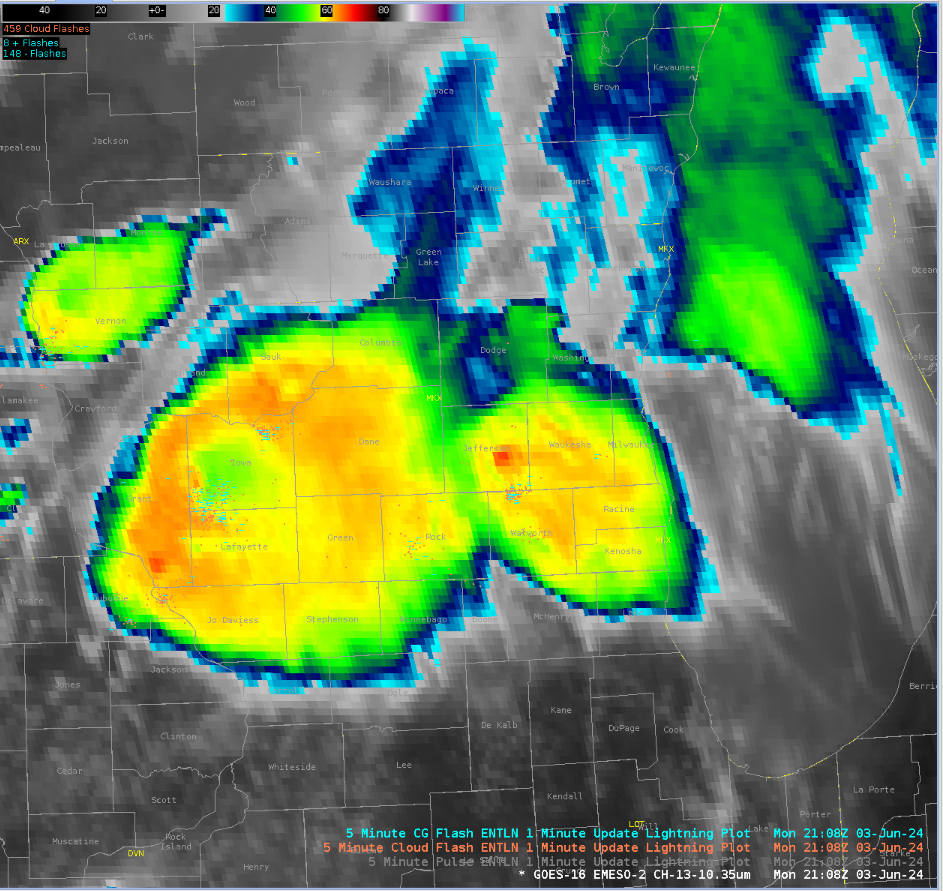
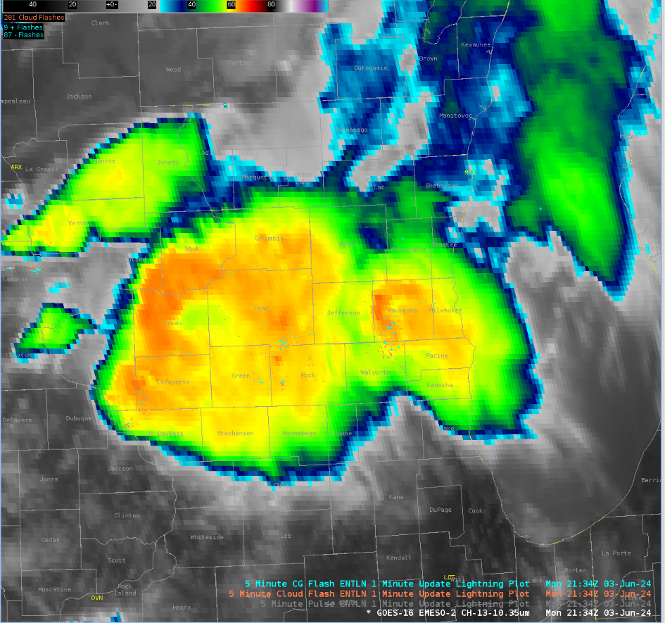
Another interesting thing to note is that the IR imagery did not seem to indicate that there was as much weakening either. One image from around the time of warning issuance and one from around the time when the warning expired are shown below.

In all, the OCTANE products seem to be very useful in assessing the strength of a storm’s updraft. Looking forward to gaining more experience with it and the other products throughout the rest of the week.


- EI2018

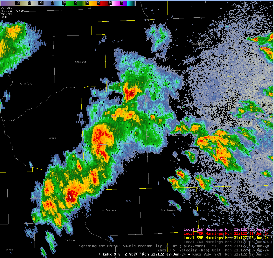
Severe thunderstorm warning issued for South Central Wisconsin

 Solid signature from both nearby radars but the beam height was at least 8k feet. PHS environmental fields were supportive of a primary wind hazard. OCTANE divergence fields distinctly noted this cell with persistent strong divergence as it moved into the CWA. Low level wind fields were not as impressive with widespread STP of less than 0.2, despite strong instability in the PHS fields.

-Hellothere
THE TALE OF TWO GUIDANCE SYSTEMS

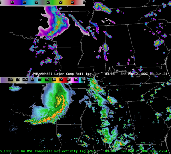
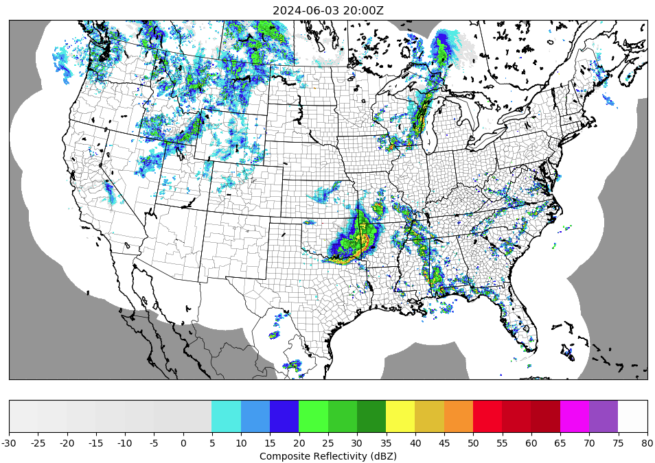
THE PHS MODEL GUIDANCE has had difficulty providing an accurate near term forecast with respect to the purely linear mode to the MCS as it moves east into the Texarkana region. This is most noticeable with respect to the southern portion of the linear convection. This can be seen easily below with the 3 hr forecast (in the image below) is the top panel of the image. The composite reflectivity (considered verification) is the bottom panel of the image.

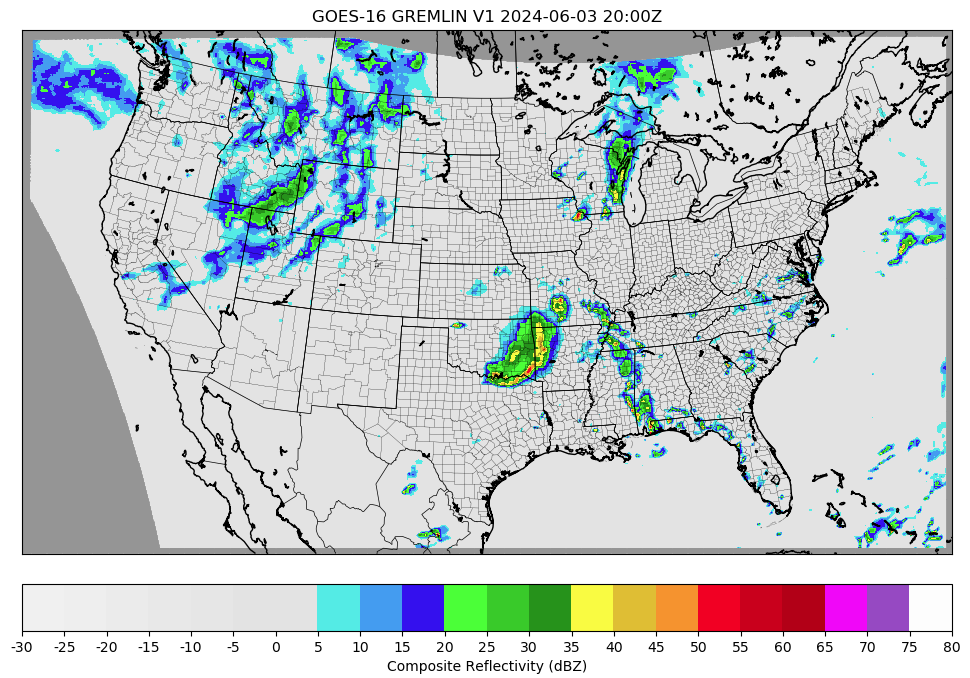
THE GREMLIN MACHINE LEARNING GUIDANCE on the other hand has performed very well with the linear MCS in the near terms, along with other convection further downstream to the east. In the images below Gremlin is the top image and MRMS (considered verification) is the bottom image.

-5454wx

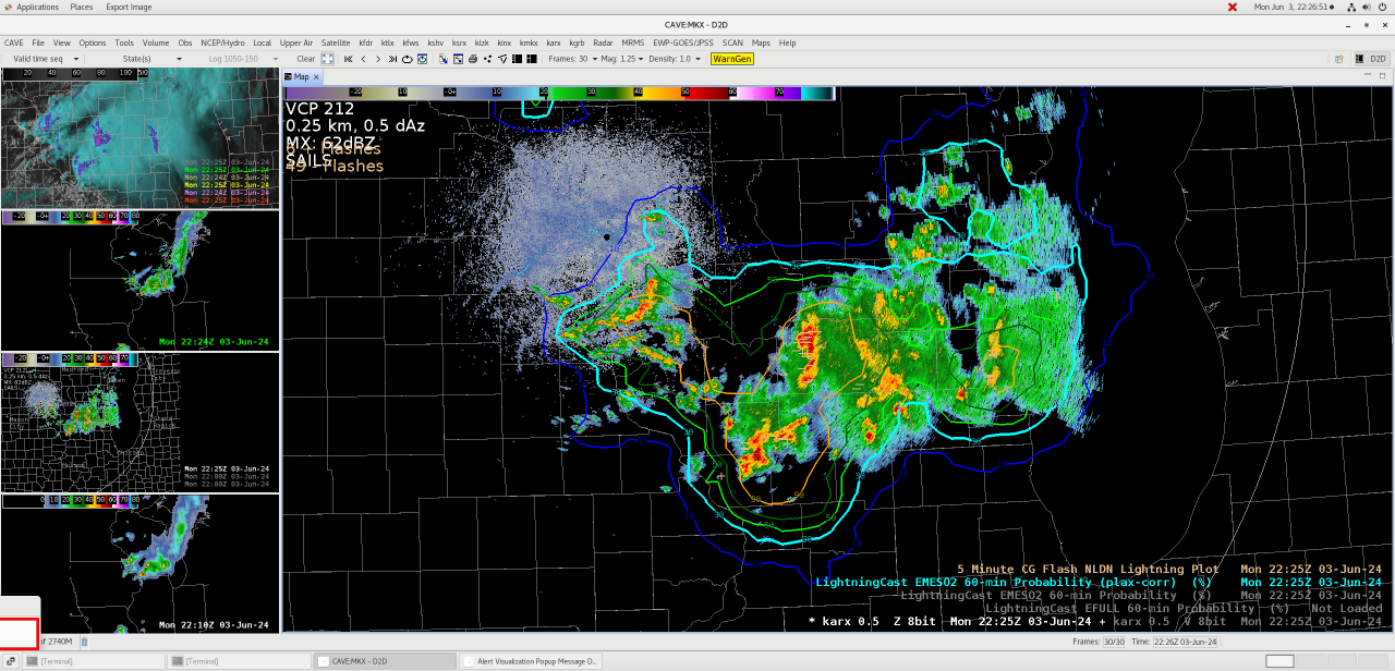
High Confidence in Lightning activity:

There is high confidence in lightning activity with the storms moving across southern Wisconsin this afternoon into this evening.  Based on the lightningcast product shown below, there is a greater than 90% chance of lightning within the orange outlines over the next hour.

As you can see on the image below, this is a point forecast for Camp Randall Stadium, showing the same results.

-ULMCUBMAN