Wednesday, June 7, 2023

Examination of LightningCast and OCTANE in Idaho and Oregon

 Near the Idaho/Oregon border, we observed splitting cells on the afternoon of Wednesday, June 7. We believe we were able to see the first hints of this process get underway with the help of the OCTANE product. Subtle gradients were observed on the left side of the main storm prior to the ultimate cell merger. 

In the image on page 2, we see a nice comparison using LightningCast between an environment characterized by cirrus contamination vs an environment that was not contaminated. On the eastern side of the CWA that was characterized by cirrus contamination, LightningCast probabilities peaked at 50% on a storm that ultimately produced lightning. In contrast, two thunderstorms to the west (developing in a clear, cloud-free environment) both saw LightningCast values exceed 80% on two storms that ultimately produced lightning.
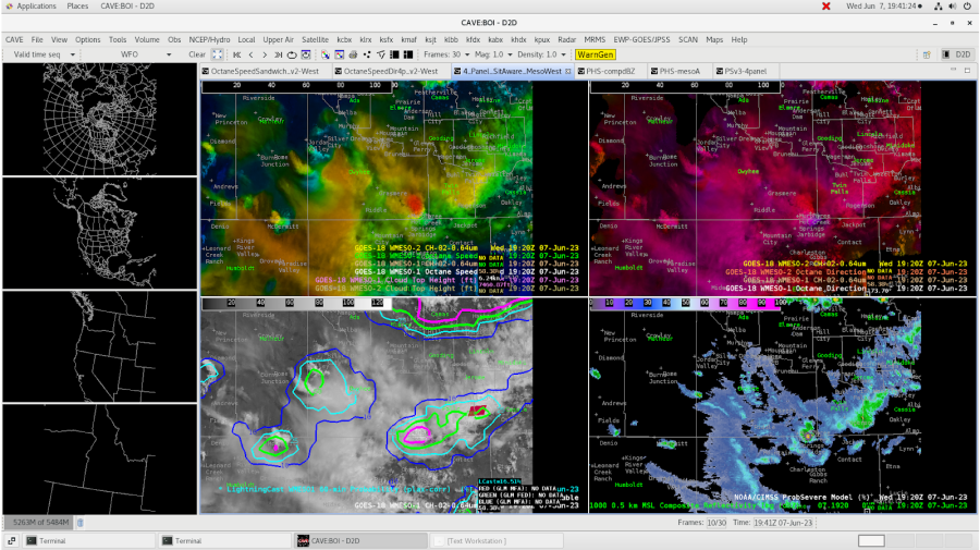
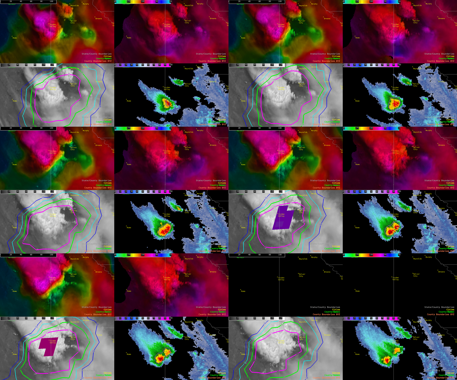
Above, we see perhaps the first instances of a splitting cell in progress, and OCTANE helped give us a first indication of the split (upper left in particular)
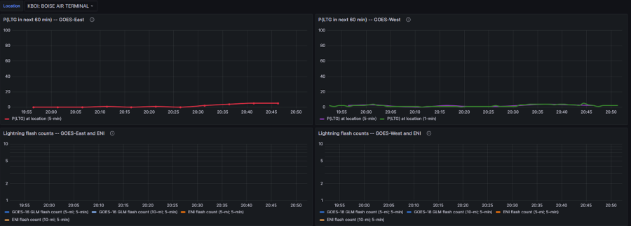
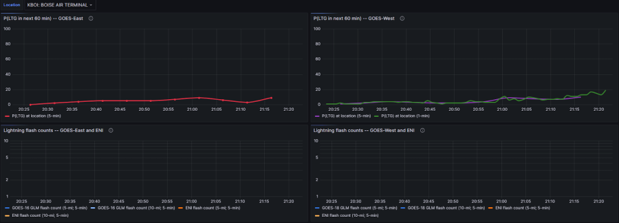
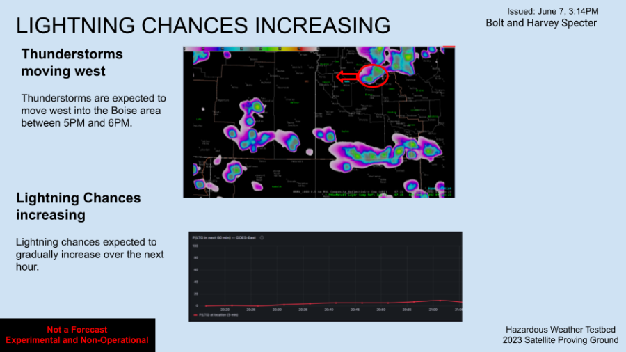
Above: LightningCast Meteogram as of 2053z, depicting a small trend upwards, albeit extremely minimal, within the next 60 minutes for some lightning impacting the American Aquarium at Hayden Beverage in Boise (DSS location).
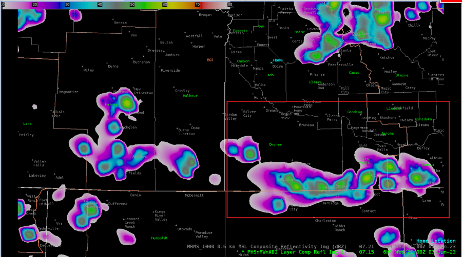
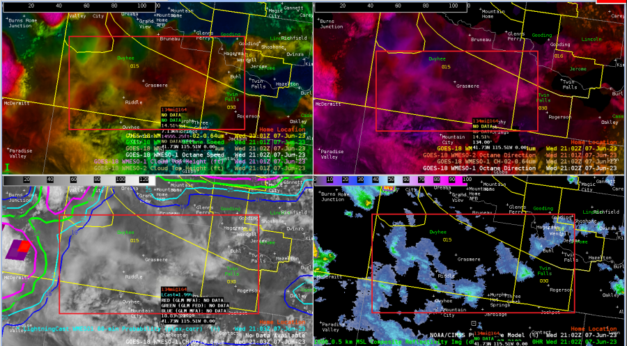
Above: 21z PHS shows development of convection in Owyhee and Twin Falls counties (southern BOI CWA) depicted by a red box; however, the 4 Panel Situational Awareness is indicating that doesn’t seem to be the case, with mere cirrus cloud development. Perhaps the timing is off?
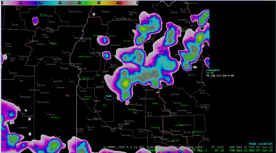
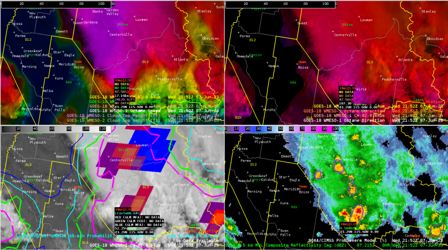
Above: On the other hand, PHS is doing a fairly good job depicting the convection just east of the DSS site. Currently (almost 22z), a few decent cells depicted by ProbSeverev3 (right around 15-18% probability, where MESH values are just over 0.50”)
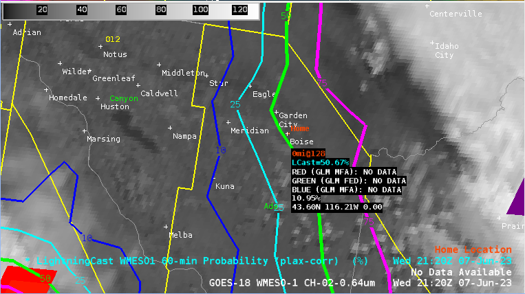
Above: 2123z: LightningCast indicating just above 50% probability of lightning within the next hour yet the Meteogram is well below 20% for the GOES East reading. It is suspected that this is because the AWIPS readout is Plax-Corrected, whereas the Grafana Meteogram may not be?
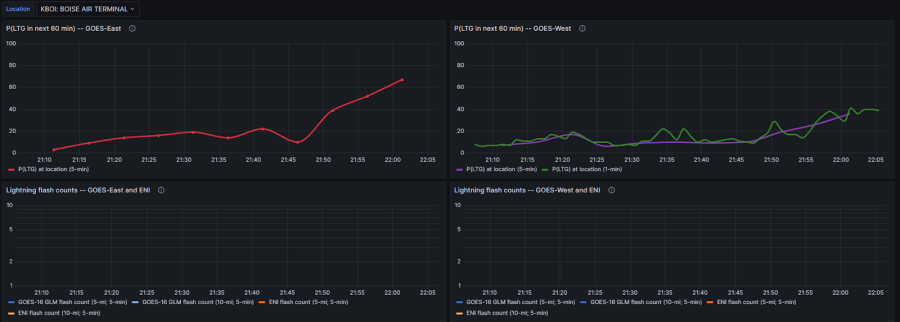
Just after 22z, Grafana Meteogram (above) shows GOES East  ProbSevere Lightning to be 67%. This latency further aids in the belief that the Meteogram is not Plax-Corrected.
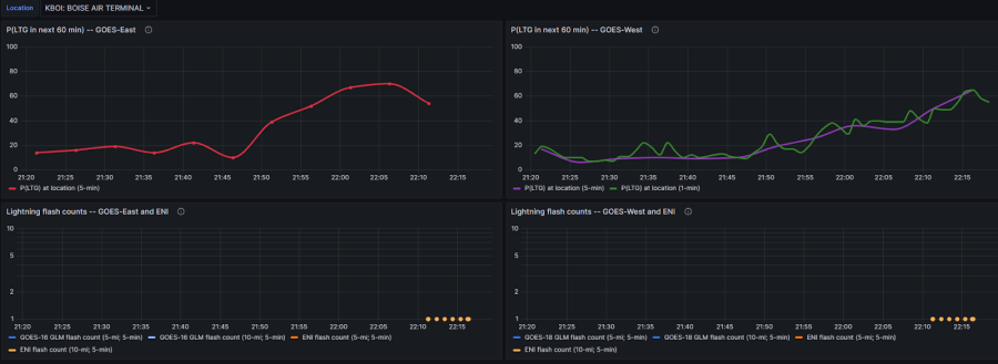
As of 2220z, downward trend displayed with regards to the Grafana Meteogram (topped at 70%, now showing 54%). This is indicative of the cells east of Boise (DSS area) initially showing signs of weakening…HOWEVER…

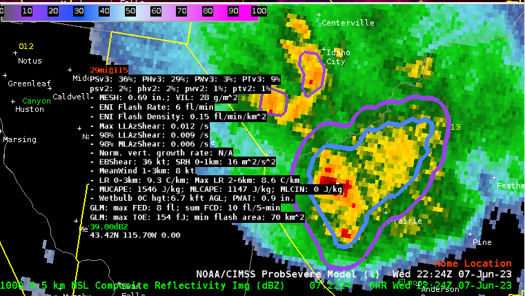
Things are starting to get juicy at 2224z with ProbSevere v3 showing the cell south of Idaho City has increased to 36% probability (below).
- Bolt and Harvey Specter
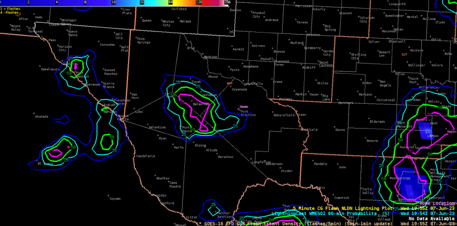
MAF Convection

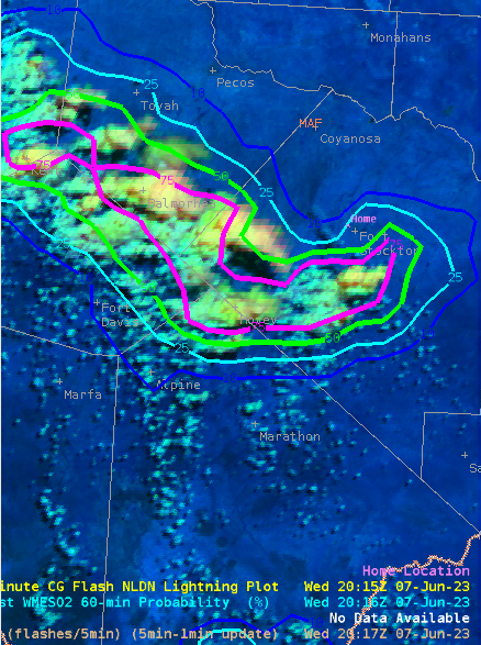
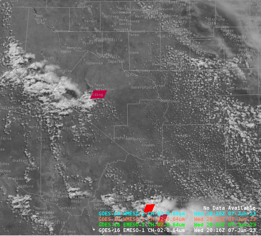
 Convection has been slow to initiate in W TX, but we’re finally seeing some vertical extension and greater texture in the CU field on the NE side of the mountains. LightningCast is now showing higher probabilities in this area, after several scans of sub-50% contours.

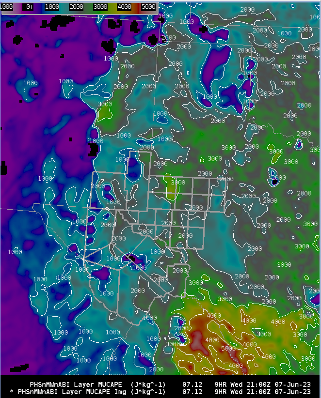
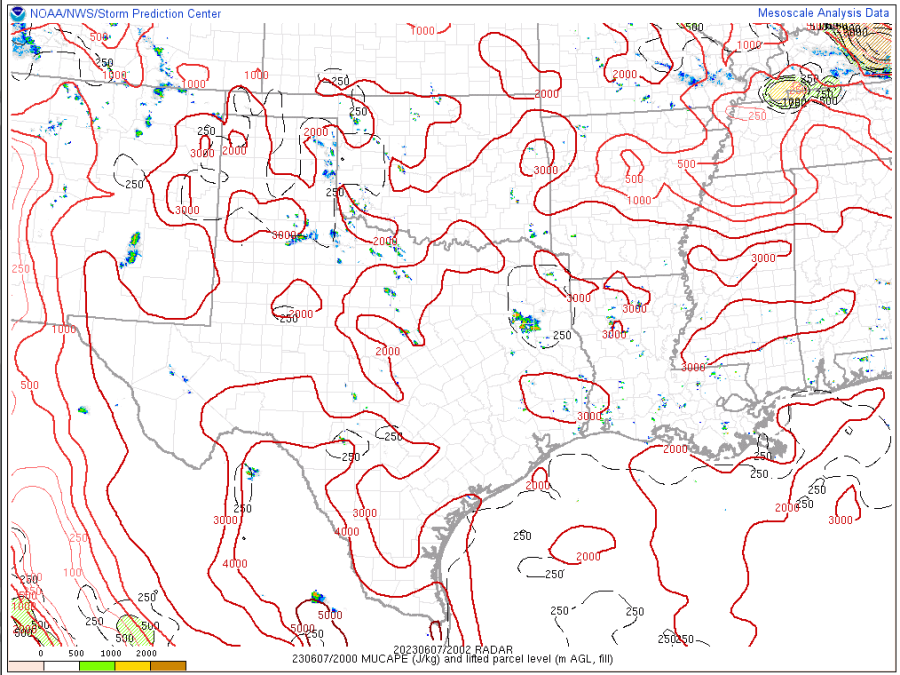
We are seeing good destabilization. The PHS MUCAPE compares quite well to the SPC mesoanalysis.

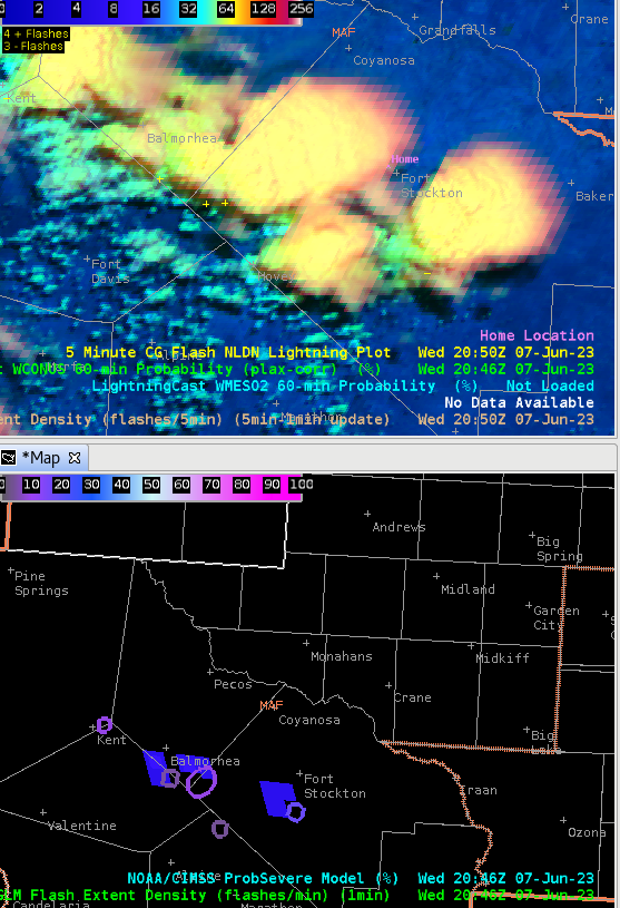
LightningCast probabilities continue to climb, and we’re finally seeing a few flashes on GLM imagery.

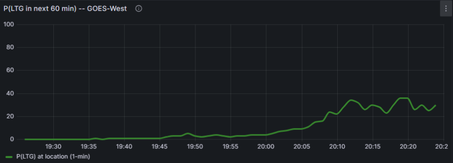
Our LightningCast meteograms are finally showing some higher probs in the next hour near our DSS site in Fort Stockton.

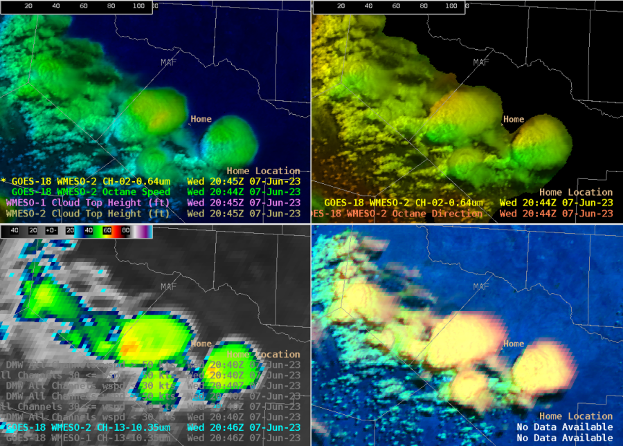
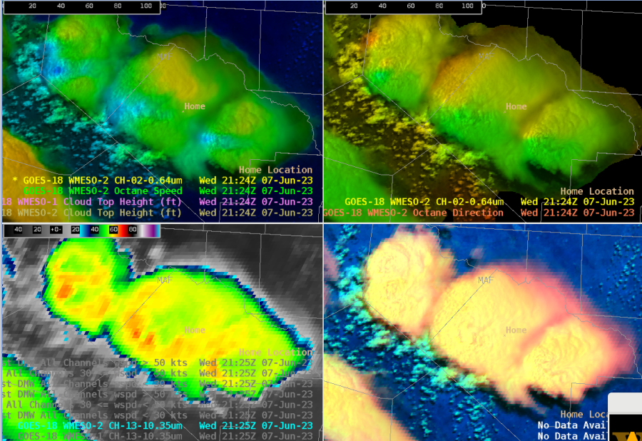
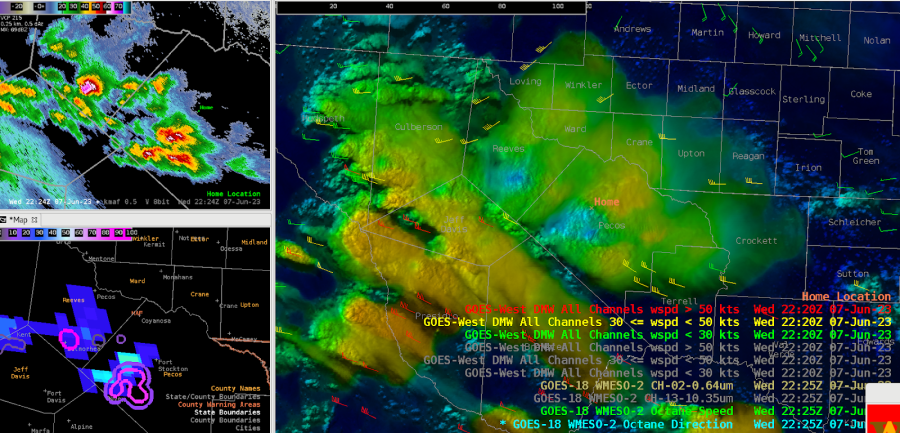
We’re now seeing more defined features in the Octane imagery, including cloud top divergence signals and cooler brightness temps, down to -63C. But our ProbSevere markers remain low.

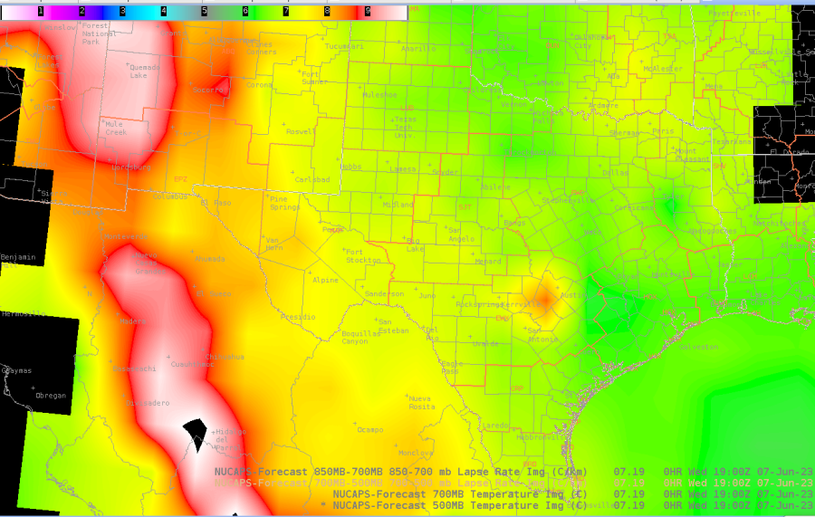
Looking at the NUCAPS-Forecast initialization at 19z, the mid level lapse rates are lower in areas NE of the higher terrain, where convection has been a bit slower to strengthen, as compared to the storms to our SW over Mexico, where MLLRs are higher.

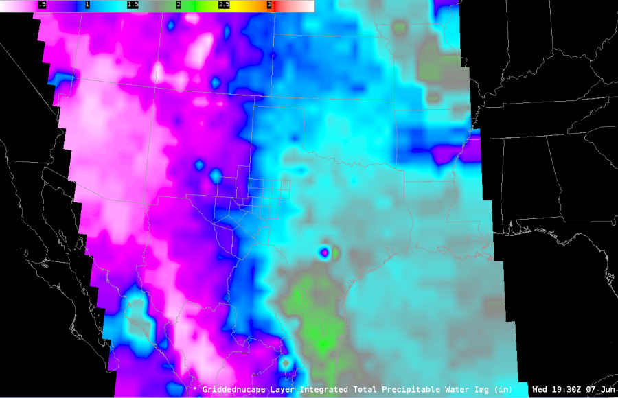
The new TPW imagery from NUCAPS shows well the delineation of the moist air to the E and drier air to the W.

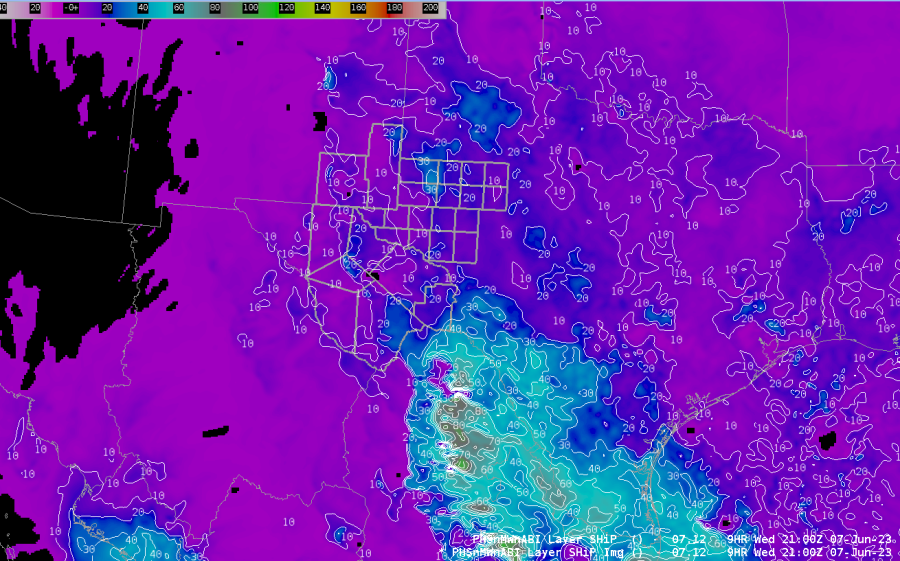
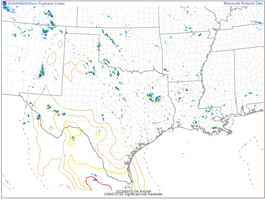
The PHS SHiP pattern looks good, but its magnitudes appear way off, compared to the SPC meso page and how SHiP is calculated.

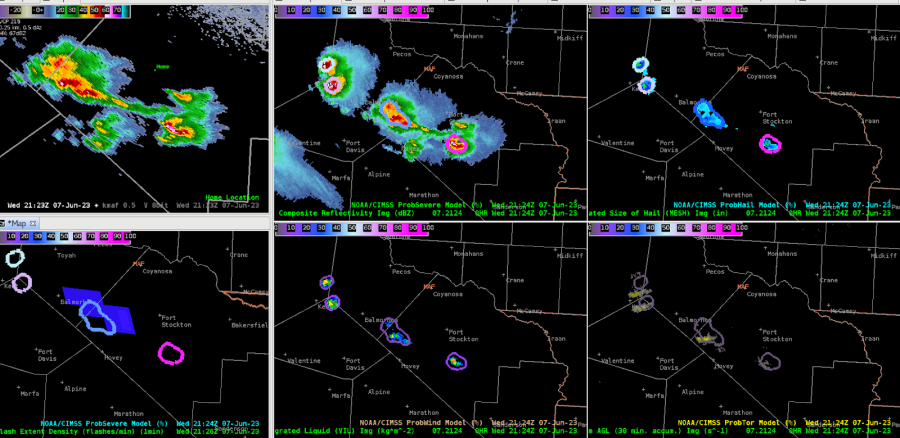
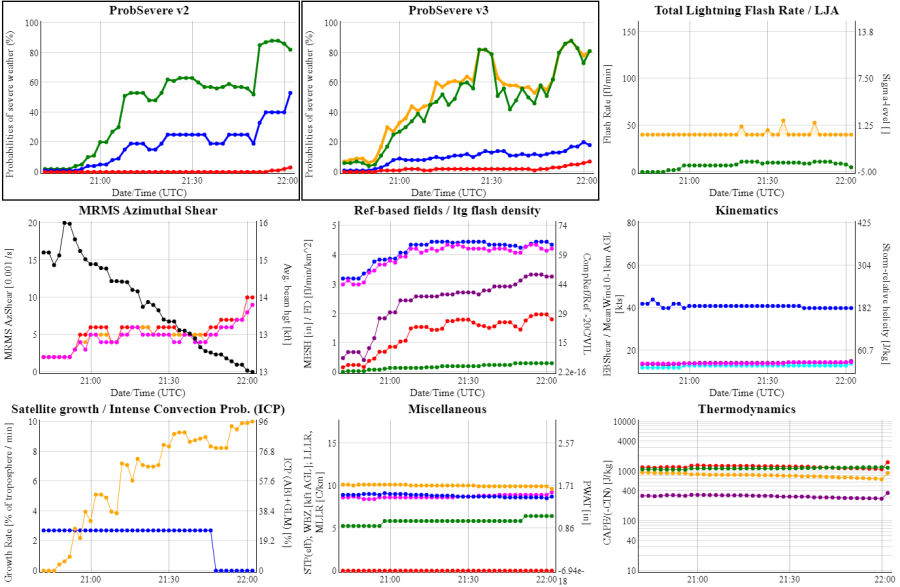
Hail probs are exceeding 80% now on ProbSevere, although our GLM lightning is rather low! Interesting how assumed large hail presence doesn’t necessarily equate to classic charge separation that would prompt high electrification.

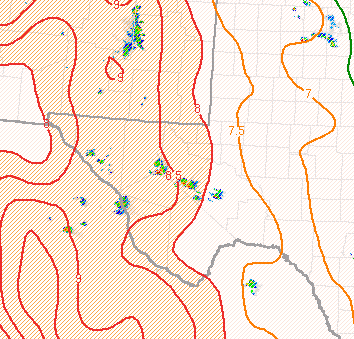
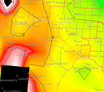
21z 700-500mb comparison of SPC Meso (top) vs 21z NUCAPS-Forecast (bottom)
    - Some differences in lapse rates between the two, with NUCAPS about .5-1°C/km  lower than SPC Meso page. 

ProbSevere, Octane, and IR imagery supports warning issuances for Reeves and Pecos counties.

With the warning now out for Reeves and Jeff Davis counties, this storm continues to exhibit high hail probabilities on PSv3.

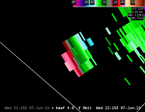
Up to 120 kts of ST divergence with the warned cell (at about 50 kft).

Interesting how ProbSevere identifies objects. There appears to be 3 separate updrafts in Pecos county, however PS is seeing one object.

- Edgar and StormofCentury

Tuesday, June 6, 2023

Albany and Columbia WFO for the HWT Testbed

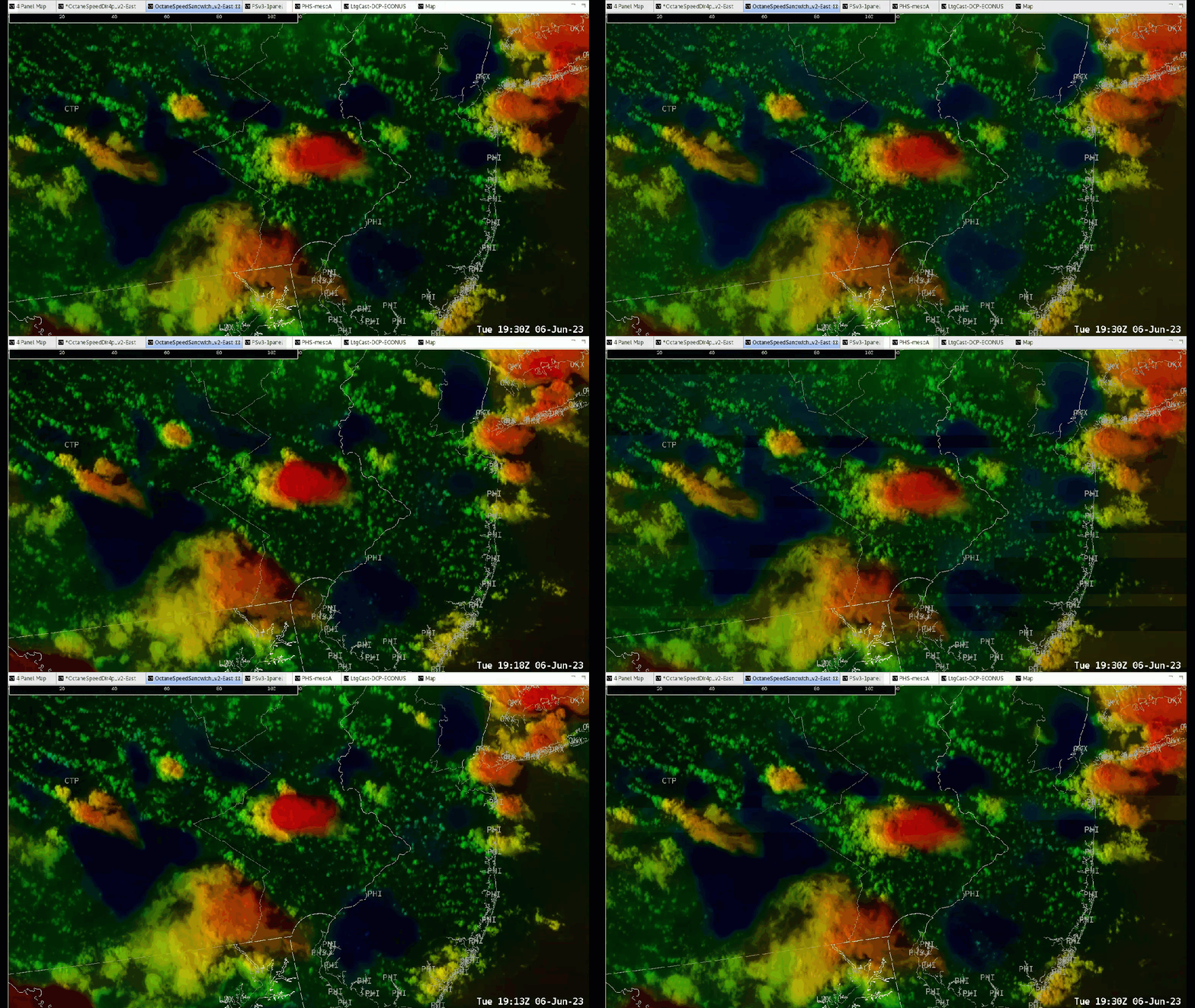
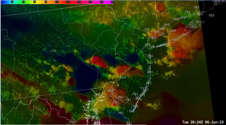
 The environment is mostly within northwest flow, so some decently sheared storm tops are noted on the OCTANE speed product, ranging from about 25 kts to 60 kts at anvil/storm top level.

The OCTANE Speed Product over eastern PA.

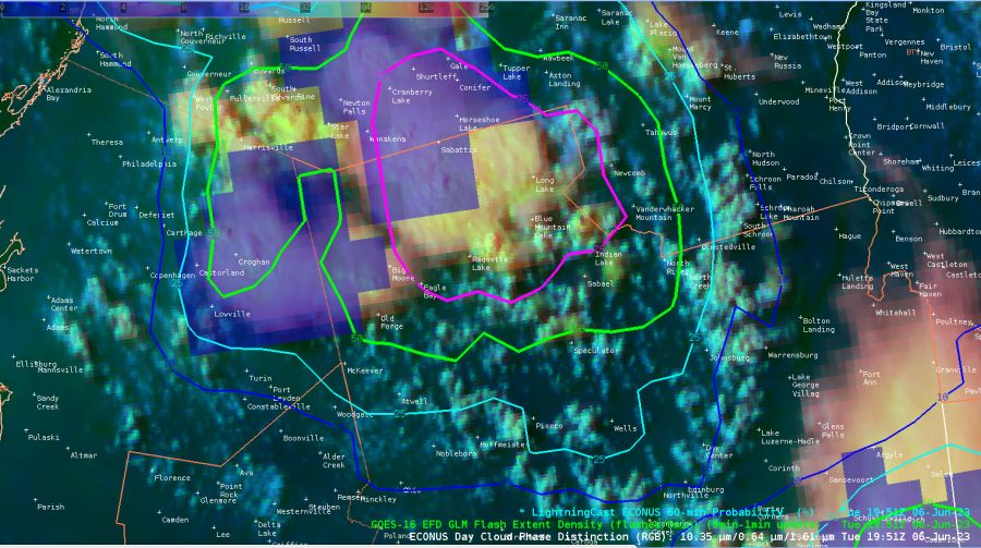
DSS for Twigs Craft Fair - Speculator, NY.

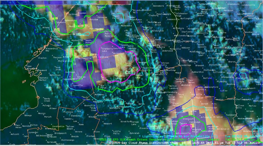
Increased lightning chances developing and going up over 50% now at our DSS site. This is a concern as people at the festival will likely need to take shelter soon as storms approach from the north. Lightning is possible ahead of the storm given the environment it is in and favorable synoptic setup.

GOES 16 GLM and LightningCAST near our DSS site at Speculator, NY.

Additional imagery with a zoomed-in view.

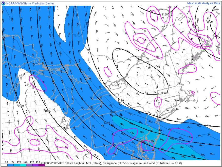
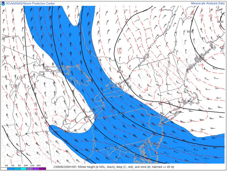
The overall storm top speeds line up fairly well with SPC Mesoanalysis between the 300mb and 500mb layer where speeds of 40-80 kts are noted over eastern PA and western Long Island, NY. Our storms have between 50-70 kts of speed at storm top, so it lines up fairly well with what the RAP mesoanalysis has. Very interesting. See the images below.

3:35pm CT: 1-min LtgCast has increased to ~90% at DSS point, with GLM showing ~1-2 flashes/5min.

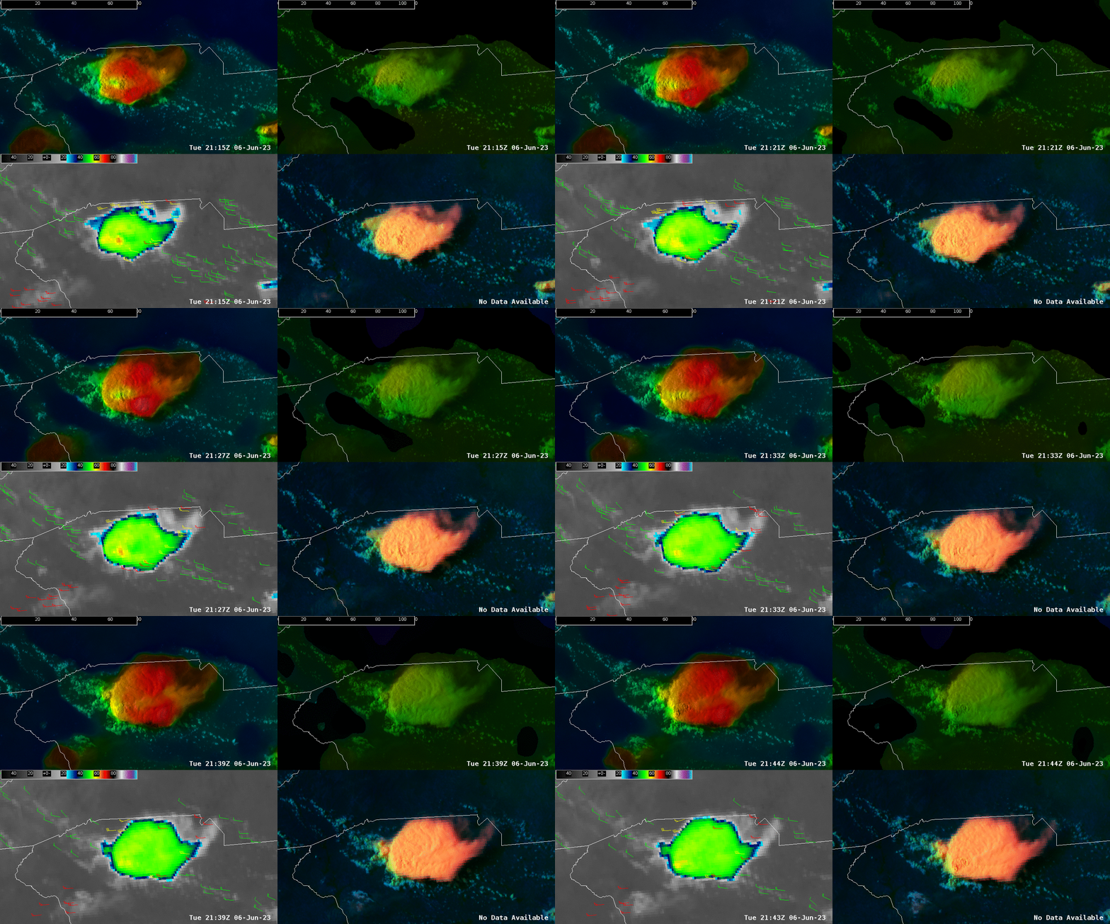
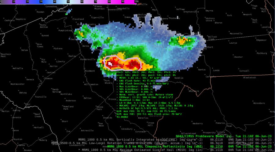
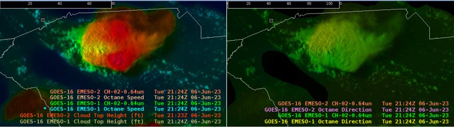
Interesting feature on a storm over upstate South Carolina to the west of Columbia. Some weaker winds aloft behind the overshooting top of the storm. Additionally, cooler cloud top temperatures are noted in the overshooting top. Increase in PSv3 values are notable as well with a ramp up in severe threat. The storm was severe warned at this time.

Additionally, you can note the fairly decent divergence aloft at anvil level with the OCTANE direction product.

-Satellite Steve & Displar