Tuesday, June 6, 2023

Monitoring South FL Convection for the Miami Open

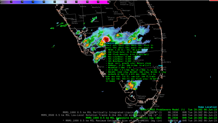
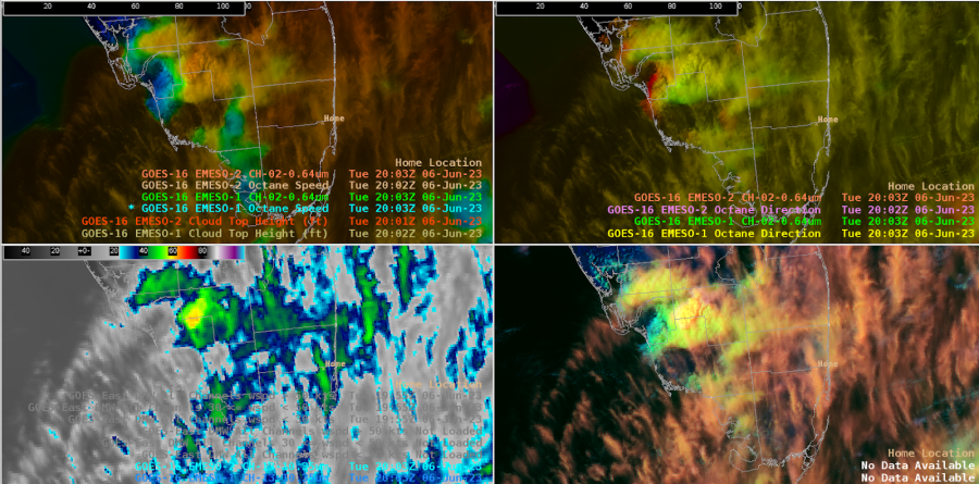
 We’re closely monitoring for CI near the Miami Open Tennis Tournament (location noted by the Home marker). Thus far this afternoon, the deepest convection has been in the west, NE of Naples, where the Band 13 imagery shows high cloud tops with cool brightness temps (-66C), and Octane imagery shows a good divergent signal.
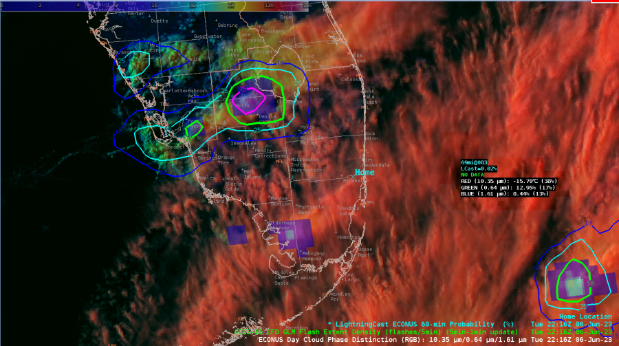
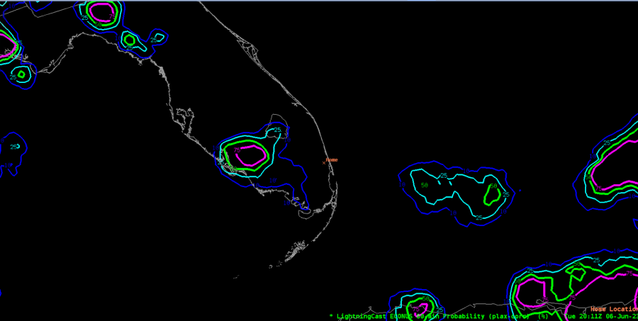
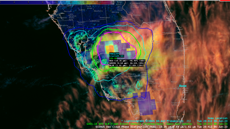
So far, LightningCast has focused on the convection in the western peninsula, with the maximum slowly translating inland and to the N along the inland-tracking sea breeze.
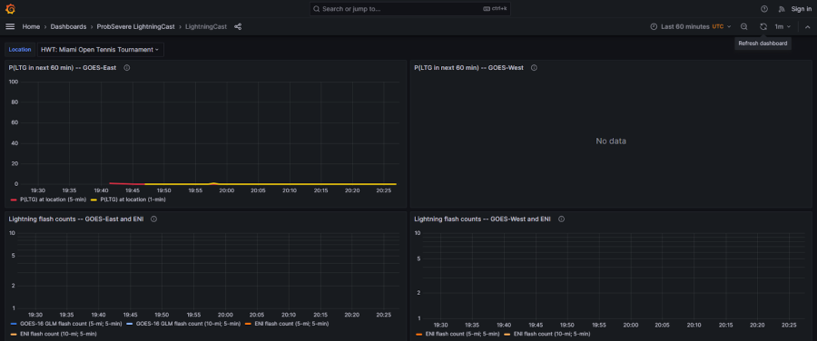
This is further confirmed by the lightning meteogram for the DSS site. Looks like they can keep playing tennis for a little bit longer!
Looking at the storm clusters back west, a NUCAPS sounding near that cell shows plenty of CAPE.

The NUCAPS-Forecast MUCAPE confirms the high CAPE invof the storms.
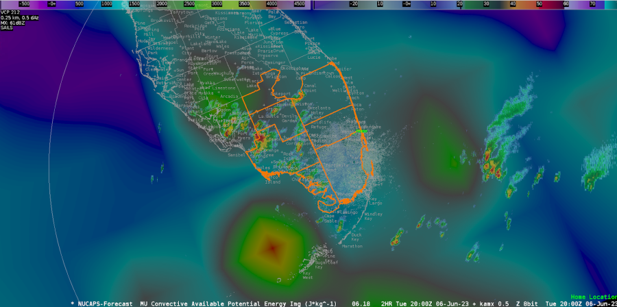
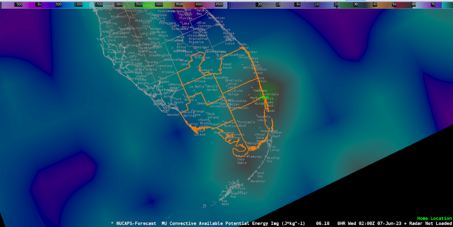
Let’s see what the forecast shows for our DSS event. By 02z this evening, it shows increasing CAPE invof the DSS event. They are not out of the woods yet!
However, ProbSvr3 and LightningCast continue to provide a general idea that the strongest cell remains north and west of the Miami Open, limiting any impacts during the event.
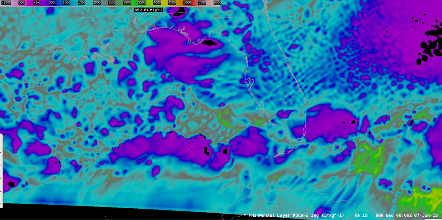
Looking at the PHS imagery, it shows continued moderate CAPE extending into SW FL invof the ongoing convection, with much lower CAPE near our DSS event.
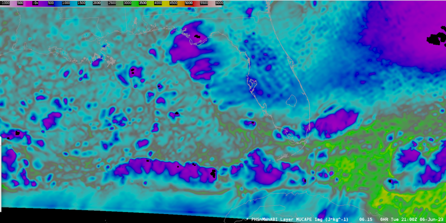
And the projections for 00z this evening show CAPE lowering further.
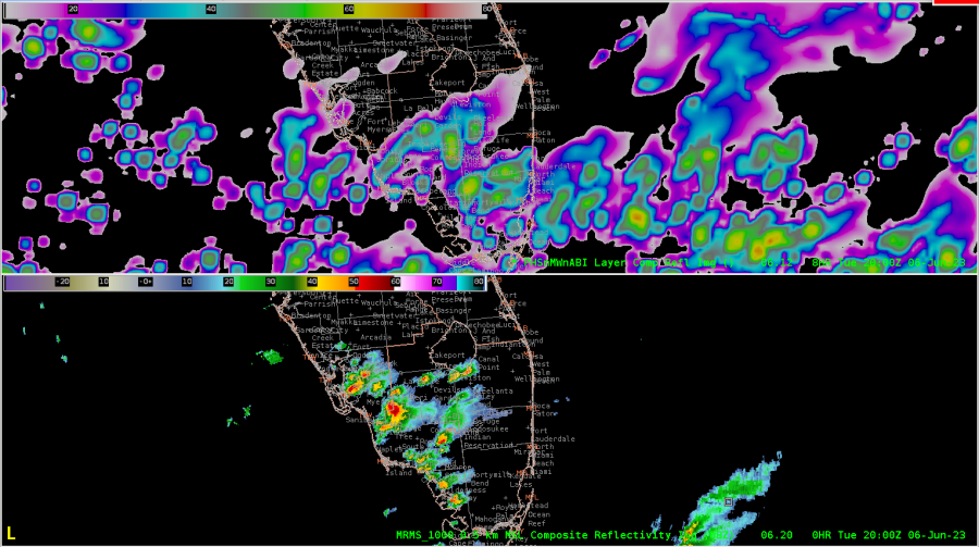
20z PHS Composite Reflectivity compared to MRMS Composite Reflectivity persistently highlights a lot of noise. Understanding from a forecaster’s perspective, this can be mentally filtered out, but at the same time, remains to be a distraction from the overall product’s use.
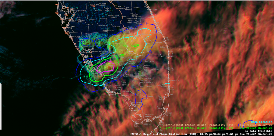
The warned cell over Glades county weakened and merged with other convection, and accordingly, the LightningCast probs declined. But we’re seeing new vigorous convection to the WSW just north of Bonita Springs.
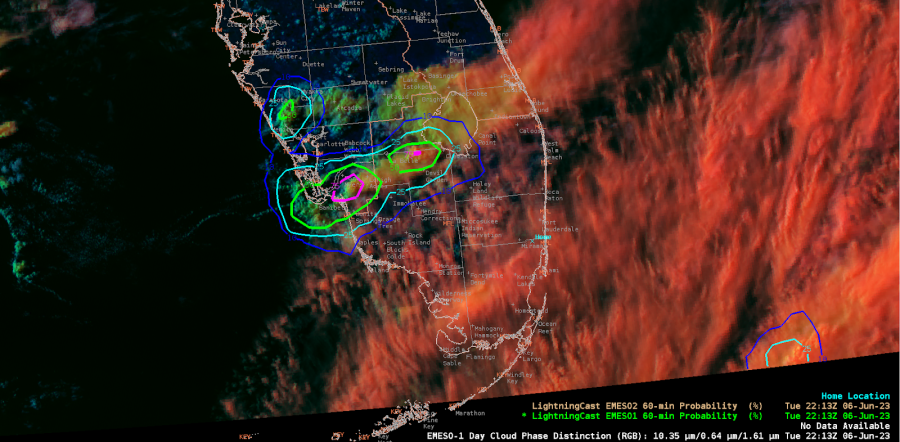
One interesting note. There are new cells developing in far SW FL with lightning noted on GLM, however the cirrus canopy there is too thick to allow LightningCast to detect this convection.
- Edgar and Harvey Specter
LKN LightningCast DSS Event Evaluation

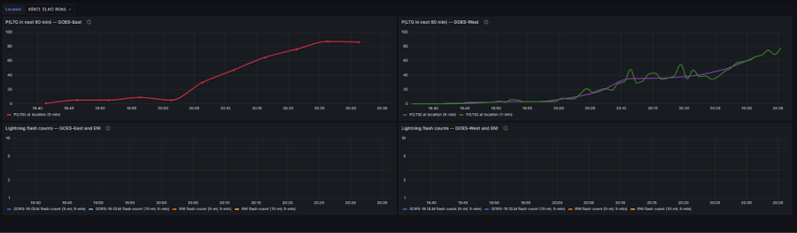
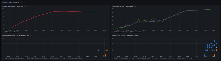
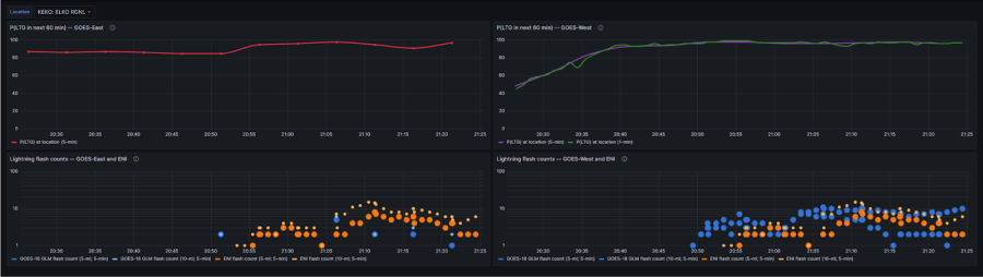
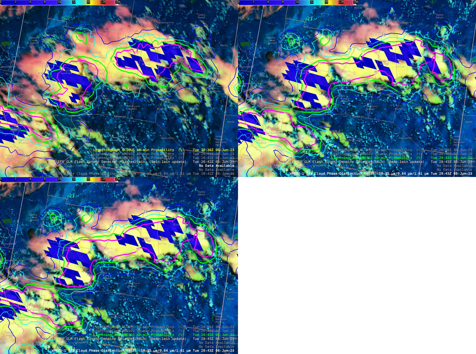
 Several pop-up storms developed in the Elko forecast area Tuesday afternoon. To provide DSS for the Elko Airshow, we looked at lightning products, such as GLM and LightningCast (shown here). There were noticeable differences in northern Nevada between the GOES East CONUS and GOES West Meso Sector satellites. This provided a bit of a conundrum of which satellite would be best to use for our DSS event. However, we noticed the trends in lightning probabilities (time series shown below) were increasing for the Elko Airport area for both satellites, so we hedged on that and blended both to arrive at probabilities. In this case, Lightningcast proved to be a useful DSS tool, as lightning was observed within 5 miles of the DSS event by 2056Z.

GIF showing the difference between GOES East CONUS and GOES Meso West products over northern Nevada.

LightningCast time series trends for Elko Airport.

- Bolt and Burton Guster

Monitoring for lightning at the Twigs Craft Fair

HWT forecasters in the Albany, NY office were monitoring for lightning potential in storms moving in from the north towards their DSS event, the Twigs Craft Fair in Speculator, NY. One tool they used for monitoring trends was ProbSevere LightningCast. The "J" point in Figure 1 is the location of the fair.

Figure 1: LightningCast contours of the probability of lightning in the next hour (blue=10%, cyan=25%, green=50%, magenta=75%), GOES-16 daytime cloud phase distinction RGB (background), and GOES-16 GLM flash-extent density (orange, semi-transparent, foreground). The "J" point is the location of the Twigs Craft Fair.

LightningCast meteograms (see Figure 2) are available via the web for all NWS terminal aerodrome forecast sites (TAFs). For the HWT this week, we're creating custom sites for simulated DSS events. We want to gauge how much forecasters would use or benefit from being able to have an operational on-demand capability for LightningCast meteograms.

In the figure below, the top panel shows the probability of lightning in the next 60 minutes over time, as produced by LightningCast from the GOES-East 5-minute sector (red) and 1-minute sector (yellow). The bottom panel shows observed lightning flashes from GOES-East GLM (blue) and Earth Networks (orange) for two different spatial radii (within ~5 miles and ~10 miles) and within the previous 5 minutes.

Figure 2: Meteograms of LightningCast probabilities and lightning observations for a DSS event ("Twigs Craft Fair") in Speculator, NY.


Monday, June 5, 2023

BRO PHS COMPdBZ comparison

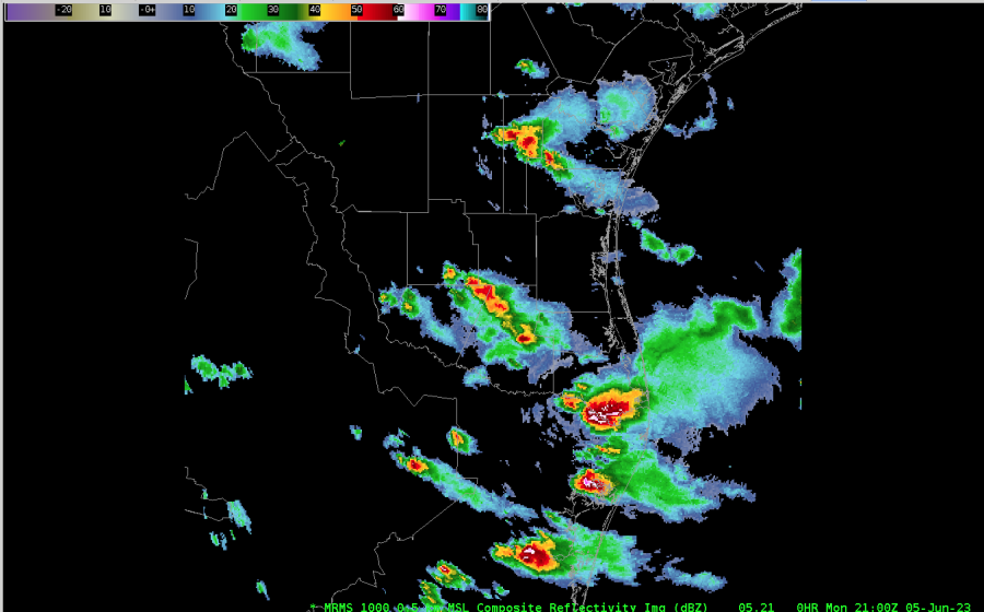
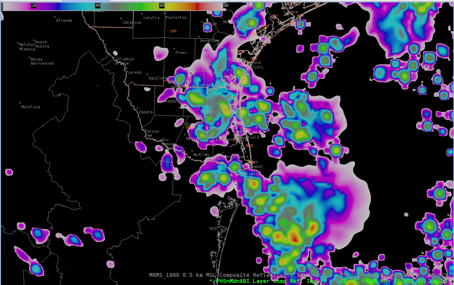
 Here is a comparison of the 15z  PHS Composite Forecast at 21z to the 21z MRMS Composite Reflectivity. Notice that the PHS has more widespread convection than what actually occurred. However, the PHS did forecast the translation really well (not shown here), which would aid forecasters in understanding where current convection is likely to travel.

21z MRMS Composite Reflectivity

15z PHS Composite Forecast for 21z

- Burton Guster, StormofCentury, Harvey Specter

Severe Cell in TFX CWA

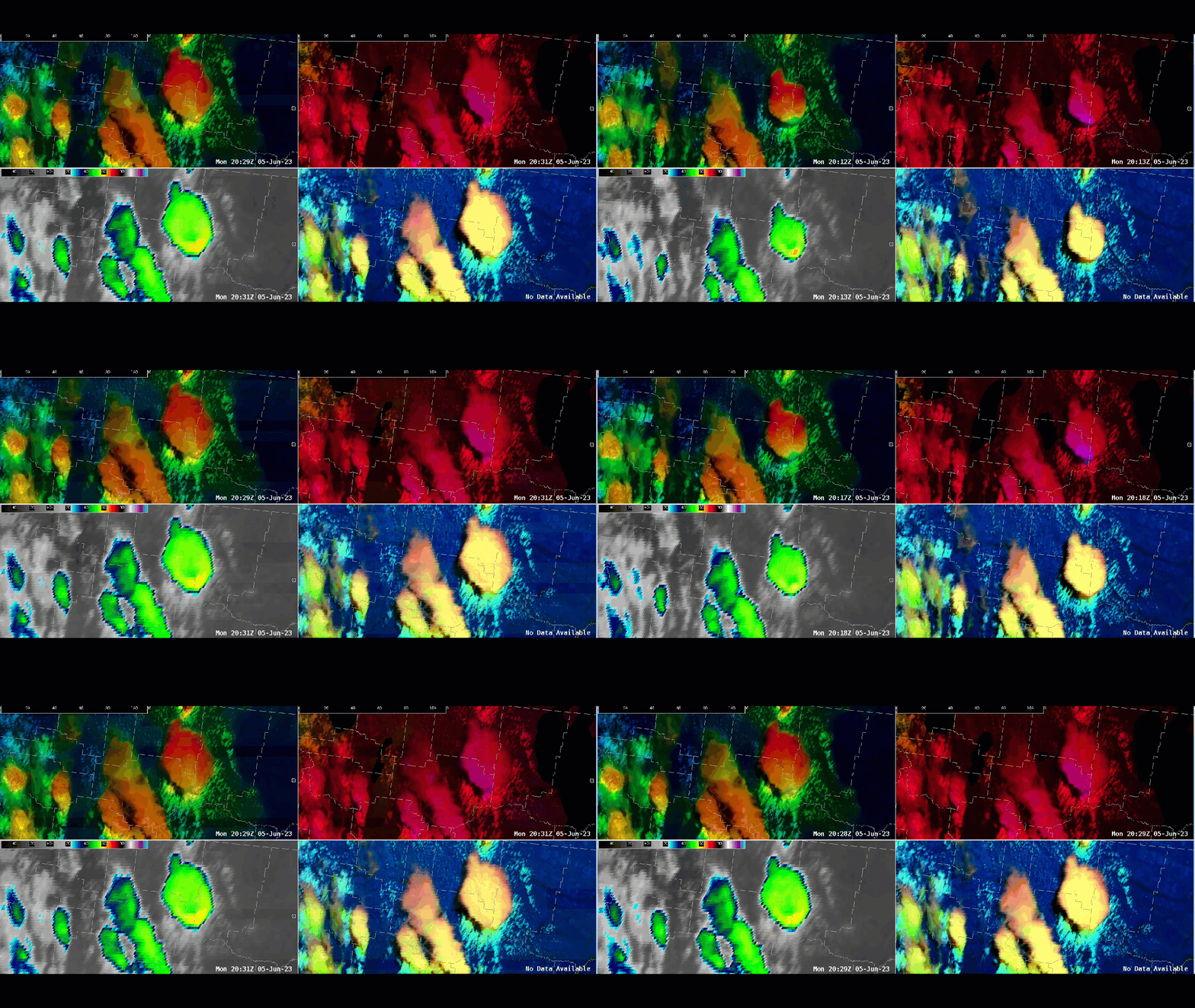
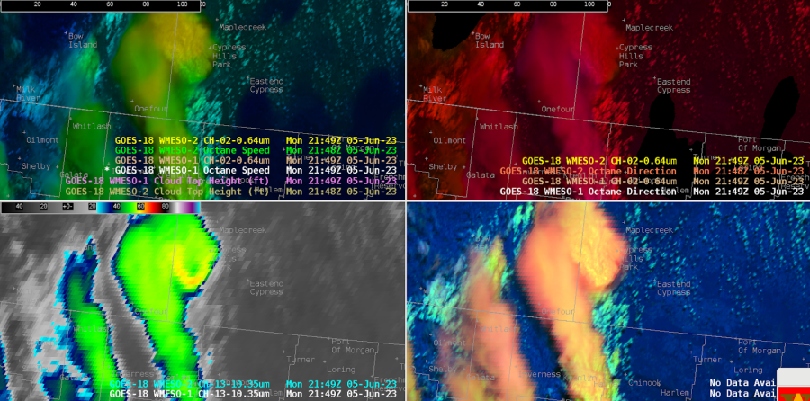
 At WFO Great Falls (TFX), we made use of the Octane speed and direction imagery, plus the IR brightness and day-cloud phase distinction to evaluate a cell northeast of Iliad. This imagery helped us screen the multiple cells over the CWA so we could home in on this particular cell. Characteristics that stood out included the higher anvil speeds on this cell, the diffluent cloud top signal on the Octane direction imagery; the cooler cloud tops (around -62C), and new/robust convection noted by DCPD.

4 Panel OCTANE depiction of severe warned storm near Iliad, MT.

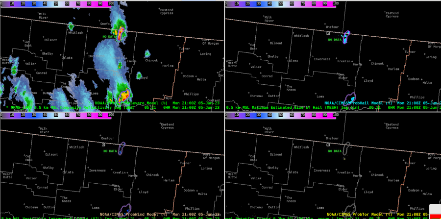
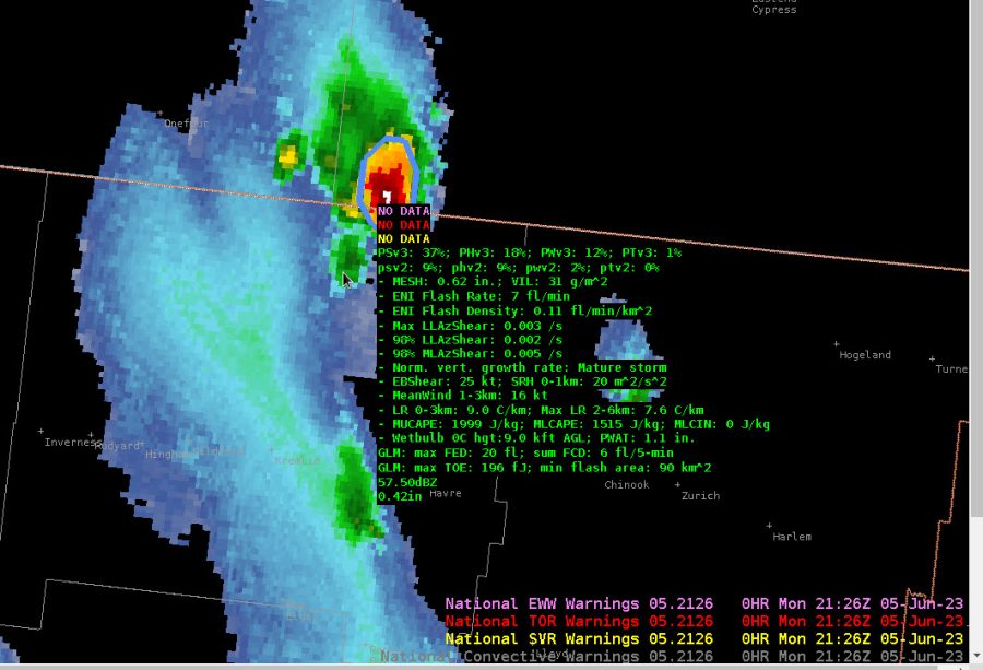
Meanwhile, the cell closer to the Canadian border is becoming stronger. The ProbSevereV3 is trending higher for total severe, up to 19% at 2104Z. The anvil from the storm to the south is beginning to impinge on the cell to the north and somewhat obstruct the view.

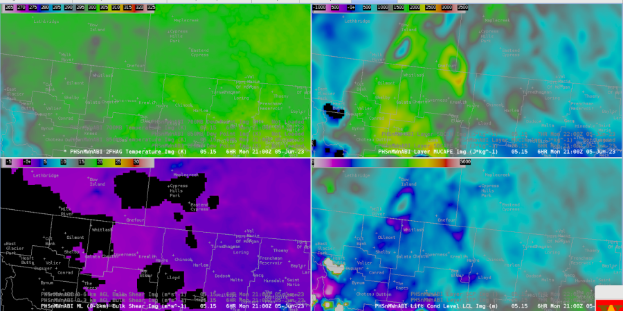
The PHS imagery showed a regional peak in MUCAPE in this area.

Looking a bit later, the total ProbSevere continues to climb. It is well above the individual probabilities, which is curious.

Storms have matured with a notable V notch of cooler cloud tops and warmer tops to the north of the notch. Based on Octane speed, there is a notable difference in speeds from the southern end of the anvil to the northern reaches with 35-40 kts increasing to 65-70 kts. PSv3 does indicate a 50% chance for severe with this storm.

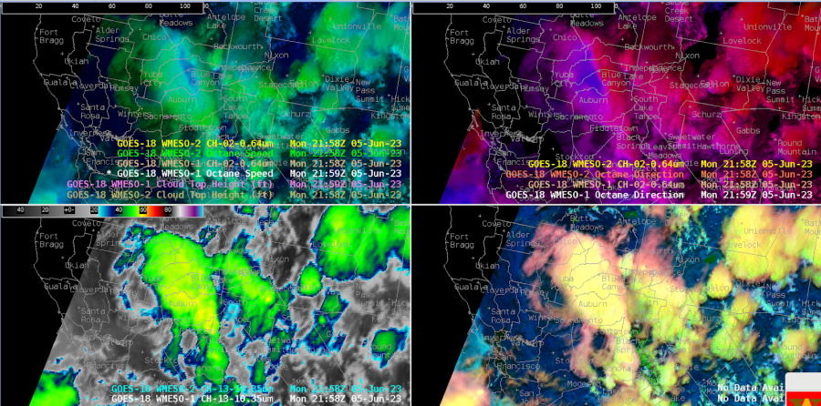
Meanwhile, down in CA, northeast of Sacramento, the Octane direction product is showing an impressive divergence signal!

-  Satellite Steve and Edgar