Tuesday, May 23, 2023

ProbSevere v3 and Octane Speed Sandwich

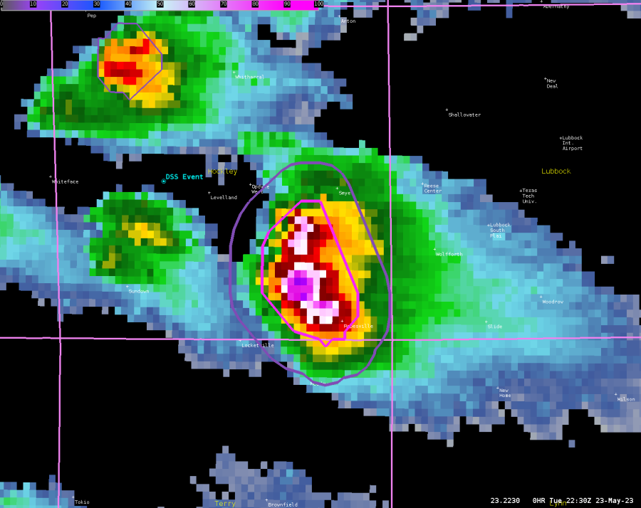
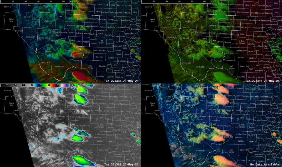
 ProbSevereV3 showed an 83% probsevere contour and an 80% probhail countor. With the Octane Speed Sandwich showing great storm top divergence, and high probsevere values, went ahead and issued a severe thunderstorm warning for the locations just south of our railroad DSS event. 

-Dwight Schrute

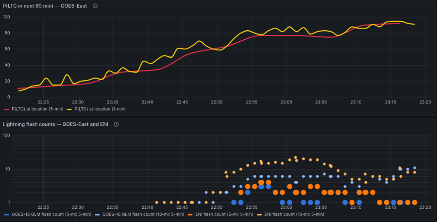
LightningCast Graph For Lubbock Airport


This is a great example of LightningCast application that could be used for TAF forecasts or DSS. As the image above shows you can see the chance of lightning slowly going up for the airport getting to around 20 to 30% before the first lightning strike within 10 miles and above 60% before the first strike before it hit within 5 miles. More localized research would have to be done to see the threshold for DSS and TAFS. But in this example if we used 30% threshold we would have a 15 to 20 minutes lead time before lightning got within 10 miles of the airport.

-Thunderstruck

PHS as a SA Tool for Incoming/Developing Convection

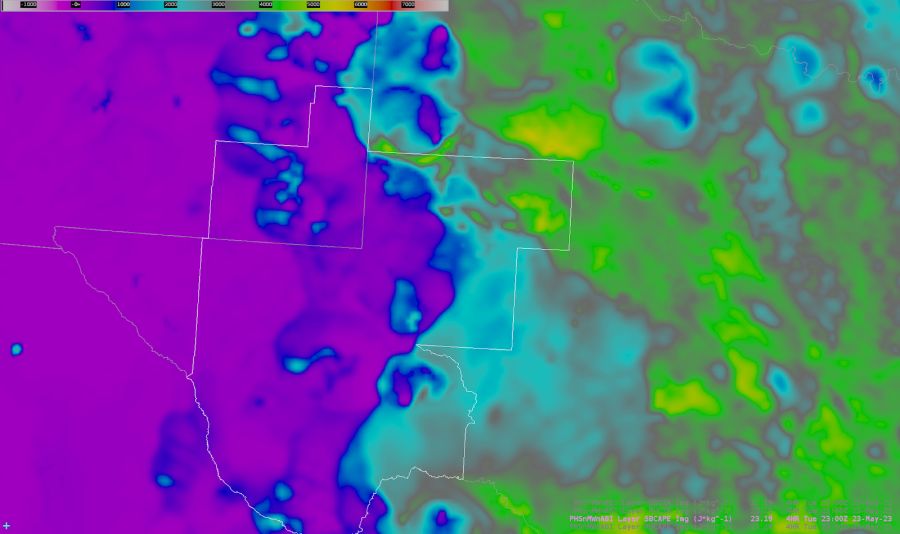
 Thunderstorms advecting (and developing) from the west appear to be moving into a better thermodynamic environment. SB CAPE parameters between 3k and 4k J/KG analyzed by PHS across the northeastern counties of the MAF CWA lead me to believe storms will strengthen in the next couple hours as they move into this region. SB CAPE values from 3,000 to 4,000 J/KG are analyzed by PHS at 23Z.

- Rain-Free Bass Guitar

Sectorizing Initiation Points and Greatest Severe Threats By Low Level Moisture Content


RGB Satellite Product Using Split Window Difference
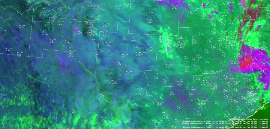
The quality of boundary layer moisture will be important to the severe convective threat across the MAF CWA today. Using the late morning split window difference field (within the RGB shown below), the greater moisture field can be found over northeastern portions of the CWA with the subtly greener shade of color. This color shade in the northeast generally overlaps with surface observations showing >60 F dew points. The color shade is more blue in central portions of the CWA where dew points drop into the upper 40s. While dew points are still lower in the southwest, there is a color shade difference where higher terrain exists (as well as greener vegetation). In this area early morning orographic convection had developed. By the mid afternoon, convection had developed near the moisture gradient in the south central portion of the CWA as well as near the northern moisture gradient along a surface low over the southwest New Mexico border.

PHS Analysis

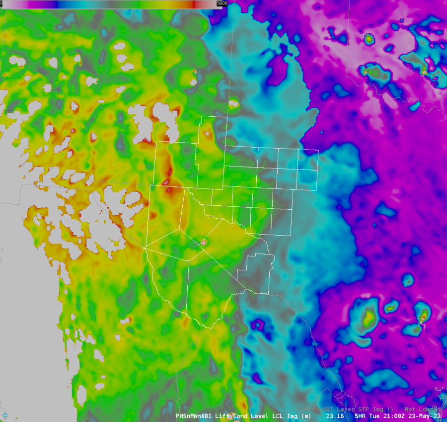
The PHS forecast product agreed with the overall moisture gradient, where greater dew points and lower LCL’s draped the northeast corner of the CWA. Subsequently, the PHS MUCAPE product showed greater instability within this corridor.
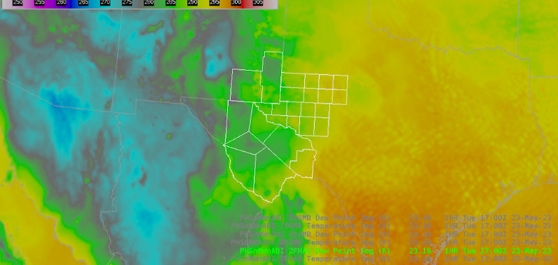
 

PHS Dew Point

PHS LCL
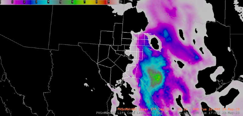
PHS MUCAPE

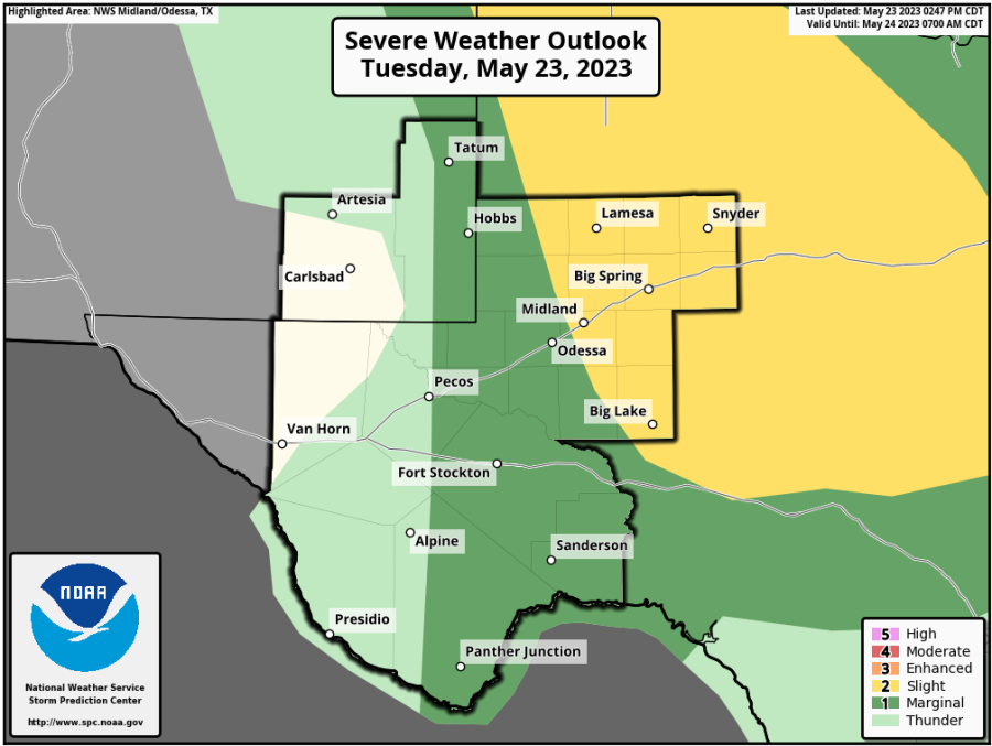
Even with these satellite based products analyzing the moisture content well before the convective threat later today, it lines up well with the forecast greatest severe threat from today’s SPC outlook (shown below), with the Slight risk favoring the northeast portion of the county.

- Joaq
Still Monitoring Convection with Octane and Prob Severe

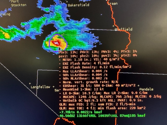
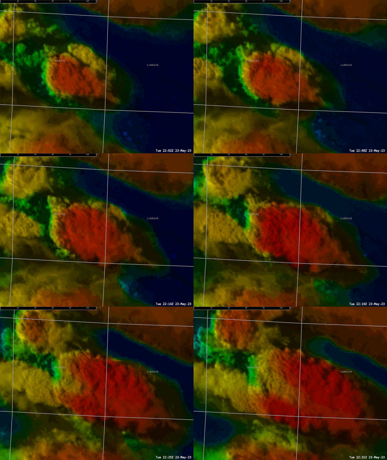
 Octane indicates decent upper level divergence aloft in thunderstorm located east of Ft. Stockton 2240Z (1740 CDT). This prompted me to analyze the storm further with base radar data overlaid with ProbSvr v3.

Octane located in the upper left indicates strengthening values in the storm near Ft. Stockton. 

Further investigation analyzing base radar data with ProbSvr indicates the storm is still sub-severe.

- Rain-Free Bass Guitar

Utilizing Octane in Pre-Lightning Convective Initiation

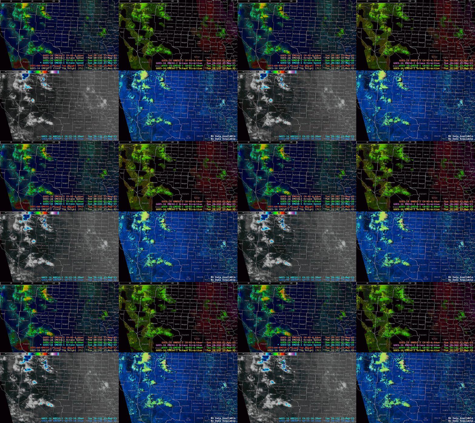
 Growing TCU was noted in the Octane Speed product around 2030Z (1530 CDT). While no lightning was detected by ENI, the Octane product indicated a growing trend in CI.

Octane Speed (Top Left), indicates a growing trend in cloud speed at the cloud top, indicating these cu are growing into a more strongly sheared environment.

- Rain-Free Bass Guitar

Monday, May 22, 2023

HWT 2023 underway

The HWT is back in person this week, after a 3-year hiatus. Forecasters have been working in Lubbock TX, Amarillo TX, and Great Falls MT. ProbSevere LightningCast and ProbSevere v3 are being evaluated this year. Here are few notes from our conversations regarding ProbSevere:

  • Forecasters find the time series capabilities for each product to be very effective, and desire them in operations.
  • Forecasters look mainly at the parallax-corrected LightningCast contours in AWIPS
  • Forecasters have appreciate the improved calibration over ProbSevere v3 over v2. This often means that PSv3 is less than PSv2, but this comes with a much lower false alarm rate.
  • Furthermore, we've seen a number of storms with higher PSv3 probabilities early on, compared to PSv2.
  • Forecasters use both ProbSevere v3 and LightningCast in GRLevel software in their offices, as well as in AWIPS.
  • We had a discussion about making LightningCast contours more configurable, such as custom contours that could be individually toggled on and off. 

Figure 1: LightningCast contours, GOES-16 ABI day-cloud phase distinction RGB, and GOES-16 GLM flash-extent density.


Figure 2: ProbSevere v3 contours, MRMS MergedReflectivity, and NWS severe weather warnings in west Texas.


Octane Speed/Direction Severe vs Normal Thunderstorm


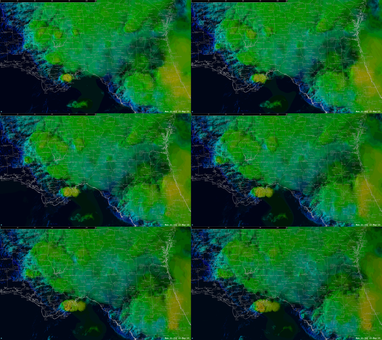
If we look at the top two panels you will see a line of storms. The northern storms have small differences in wind and speed difference (green/light blue for speed and yellow and green for direction). However one of the thunderstorms to the south stick out. It has must stronger difference in wind speed (3m/s vs 16m/s) and direction (180 degrees vs 280 degrees). At the time of this image only the southern storm was severe while the northern storms were below severe.  I feel this is a great example to see how you can use OCTANE flow to spot the strongest storm in a line of developing storms.


-Thunderstruck

Octane Speed Sandwich Severe Thunderstorm Detection

The octane speed sandwich detected a developing severe thunderstorm near the gulf coast, to the south southwest of Tallahassee. Values increased to above 30 m/s (~60 kts) in this cell, compared to  around 20 m/s (~40 kts) in cells to the north and east. Shortly thereafter, a severe thunderstorm warning was issued.

Rain-Free Bass Guitar

Monitoring Storm Evolution Via ProbSevere & Octane Speed/Direction

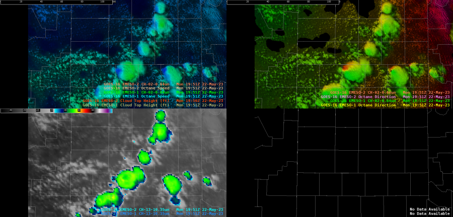
This video shows a storm's evolution as it moves into far SW Lamb County just before 21Z. The upper left hand shows the Octane Speed product...the upper right shows the Octane Direction product...the lower left is the GOES-16 Ch. 13 Clean Window IR Band...the lower right is the Day Cloud Phase Distinction RGB product.

Looking at the Octane Speed product, as this storm is initially growing,  the cloud top features moderate cloud top divergence with the variation in Octane Speed (as the greens and yellows nearby). The storm evolution then plateaus and eventually diminishes in intensity, shown as the cloud top speed becomes more consistent (with the loss of the yellow colors). The Octane Direction product shows a southerly component to the direction across the north of the storm with a westerly component along the southern side of the cloud top. At the end of the loop you can see the yellow (the southerly component) begin to disappear as the loss of cloud top divergence causes the direction to change from the motion of the divergence to the environmental westerly component. Below is an image showing the storm's trends via the ProbSevere Time Series (storm location now just NNW of Anton). Though the ProbSevere values will lag behind the satellite imagery, one can note the storm's gradual increase in ProbSevere values with the "warming" colors of the Octane Speed product. The values then also level off, before dropping off as the cloud tops become more consistent.

Joaq & Bubbles