ProbSevere May Have Caught a Missed Severe Wind Event
The ProbSevere v3 drew attention to a cell near Bloomington, IN on the afternoon of June 8th. Specifically it was drawing attention to the wind threat with a high ProbWind percentage reaching 50% to 60%. However, radar interrogation was only initially yielding velocity of 30-40kts on the inbound side of the cell, sub-severe but certainly SPS worthy. There were a few scans yielding up to 45kts as well. So initially there was a little wondering why there was higher ProbWind percentages. Quick realization of the storm track being perpendicular to the radar beam could explain the lower velocity signatures here. Knowing this, ProbSevere and its ProbWind portion was drawing attention to a scenario that otherwise may have been missed if only looking at velocity data and not realizing the storm track relative to the radar beam.
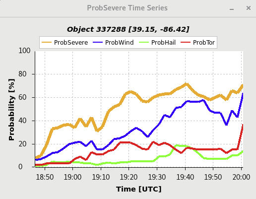
ProbSevere v3 of “Bloomington Cell”
STP went up at 20Z coincident with new SPC mesoanalysis.

ProbSevere v3 readouts of “Bloomington Cell” at 1940Z

KIND Velocity signature of the “Bloomington Cell” @ 1941Z
ProbTOR Missed a Likely Tornado Event - First Example
At 2005Z the KIND radar showed a solid and persistent tornado signature on a cell near Shelbyville, IN. To go along with this in the overall outlook for the day was an MD highlighting the tornado risk and a Tornado Watch that included the southern half of IN. However, the ProbTor parameter did not tick up in response to the tornado signature on radar. The observed uptick at 2000Z, coincided with the intake of the new SPC mesoanalysis data that ProbSevere v3 ingests as described by the product’s providers. Even still, this uptick was small only amounting to a ~5% increase.
ProbTor only peaking at ~15%
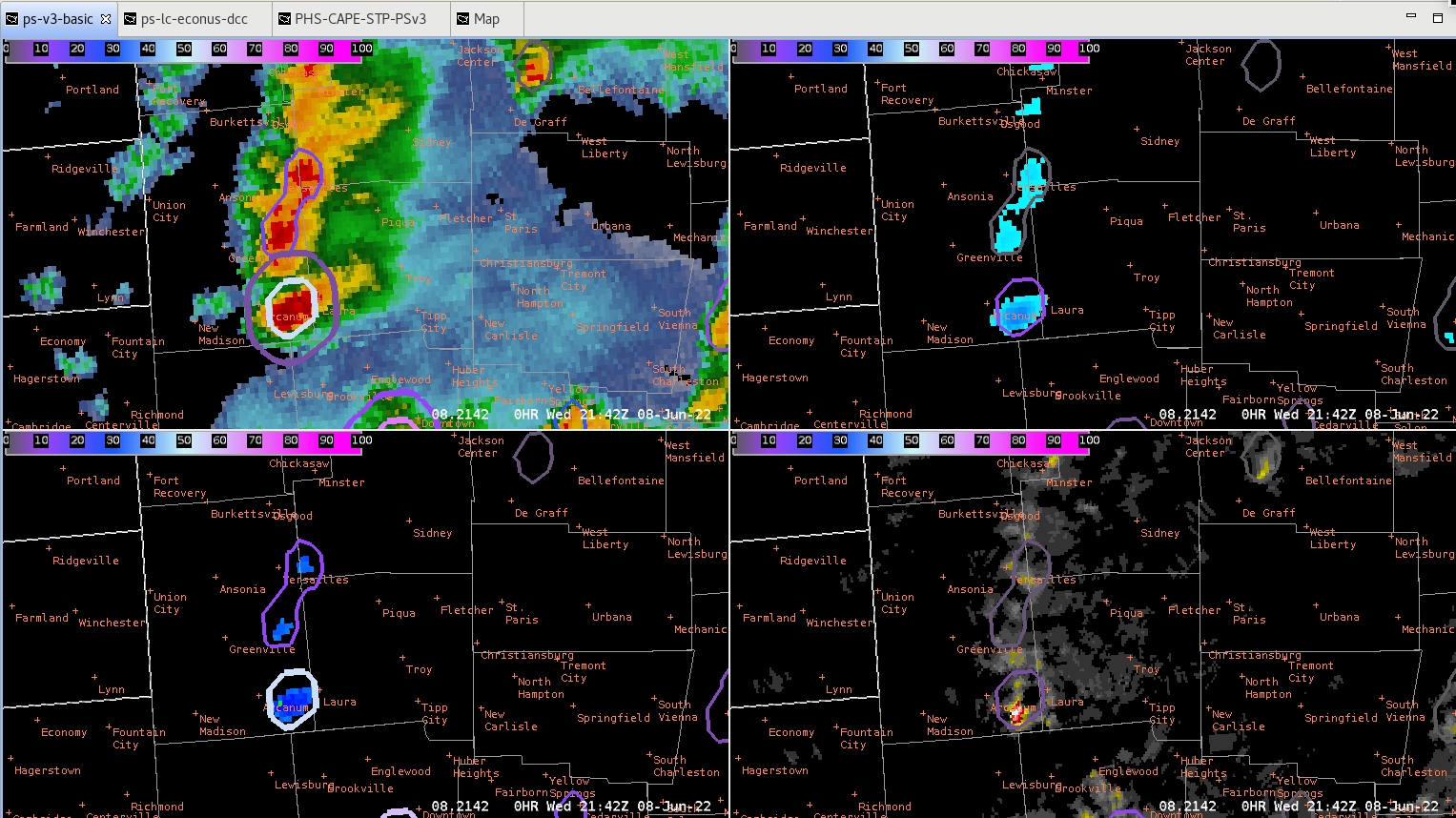
The second image below may explain some of this away, showing that two individual cells were coalesced into a single storm identified by ProbSevere v3. These two cells were relatively close to each other, so much so that they did appear as one on MRMS data. However, the third image of SRM and V show the tornado signature associated with the northern cell. This combination, with the southern cell having a much lower tornado potential and being ingested by the northern cell may have played a role in lowering the overall ProbTor percentage.
ProbSevere v3 showing that cell being grouped with another to its south, could this have inhibited the increase in ProbTor?
SRM (left) and V (right) showing the TOR signature with this cell.
Multiple LSRs for wind damage were observed from this event, with a “tornado possible” added to the remarks.
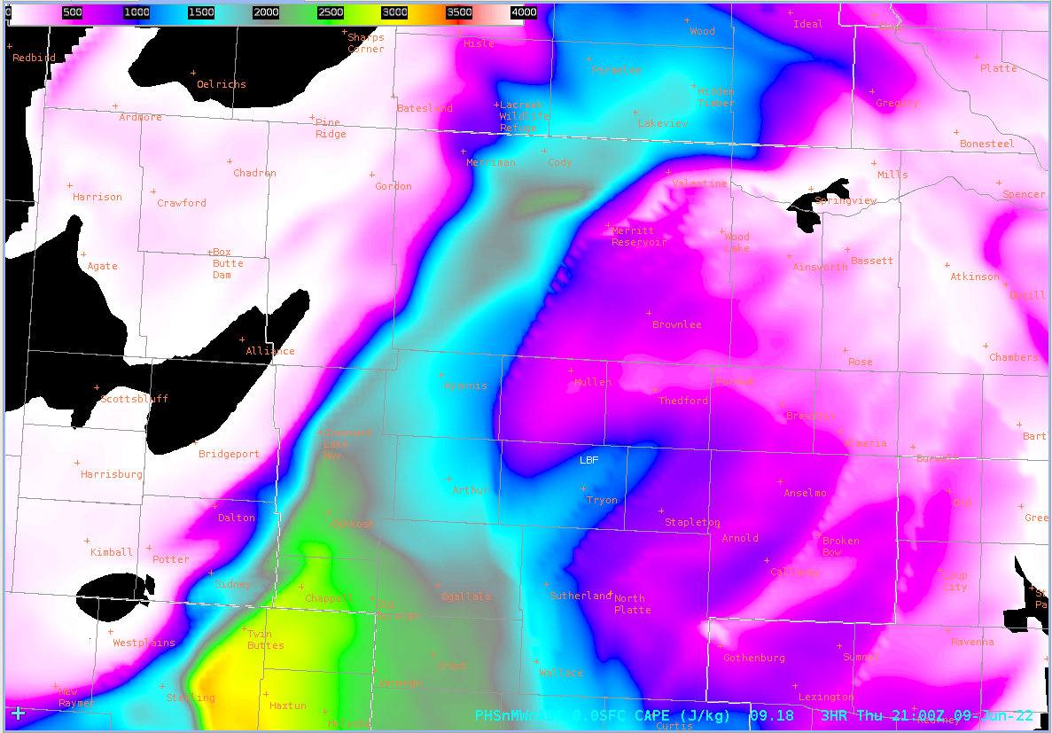
The PHS SigTOR parameter also further supported the tornado risk during the 2000Z hour. The image below shows the PHS SigTOR parameter at 2000Z with ProbTOR percentages overlaid on top. The cell which produced the likely tornado east of Shelbyville, IN is sampled in the image with the ProbTOR only at 9%.

PHS SigTOR parameter pegging the area that produced a TOR. The cell highlighted with ProbTor readout produced the Tornado Warning referenced earlier.
ProbTOR Missed a Likely Tornado Event - Second Example
From roughly 2130Z to 2200Z, a supercell passing west to east through west-central OH showed a persistent meso signature as seen from the KILN radar in Wilmington, OH. This signature eventually depicted gate-to-gate shear and tornado warnings were issued for this cell. The same ongoing Tornado Watch from the prior example also covered this same region. Image three also shows the PHS SigTOR Parameter showing higher tornado potential in the region, although not directly overlaid with where the Tipp City cell was. However, the ProbTor parameter of ProbSevere v3 did not show a corresponding jump in tornado potential. Unlike the prior example which showed the ProbSevere v3 grabbing a second much weaker cell with the tornado producing cell, this was a discrete cell with no merger occurring.
Highlighted in the Tornado Warning issued by the Wilmington, OH office, was a tornado debris signature. The KDAY metar located just south of Tipp City also included “tornado” in the remarks signature, shown in image four.

KILN SRM and V showing tornado signature near Tipp City.

Time series of ProbSevere with persistently low ProbTor for tornado warned storm west of Tipp City.

PHS SigTOR Parameter highlighting higher tornado potential in the region with overlaid ProbSevere - ProbTor percentage for tornado warned cell by Tipp City.

The KDAY metar showed “tornado” in the remarks section for the cell passing through Tipp City.
- Trip