ProbSevere v3
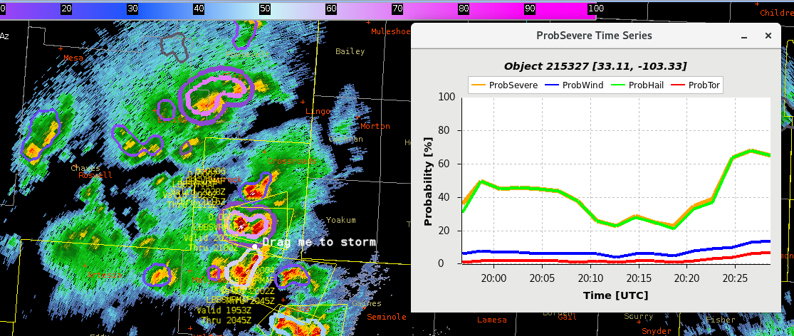
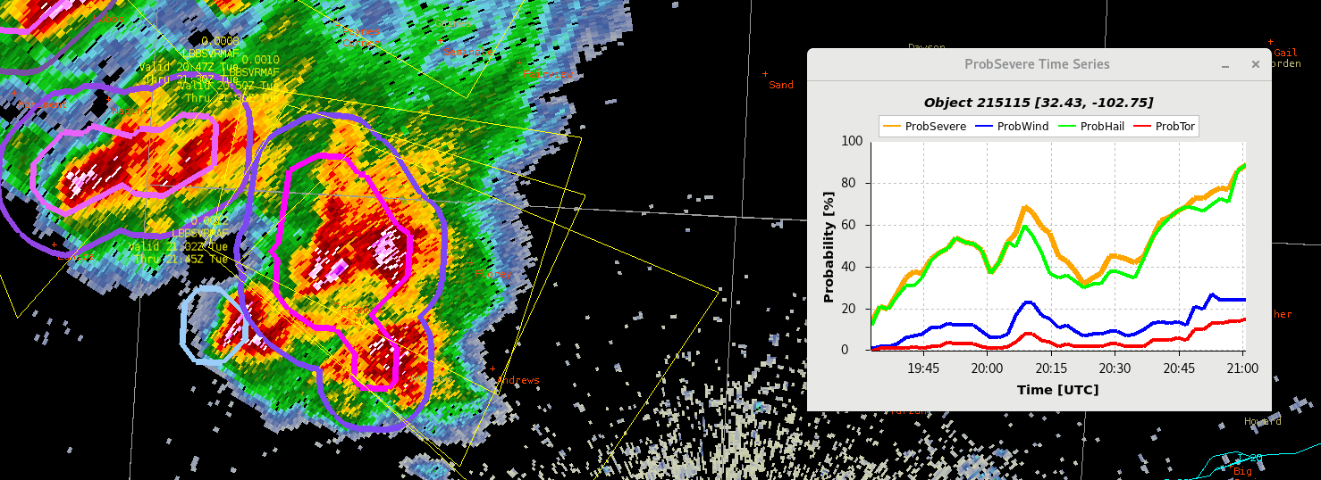
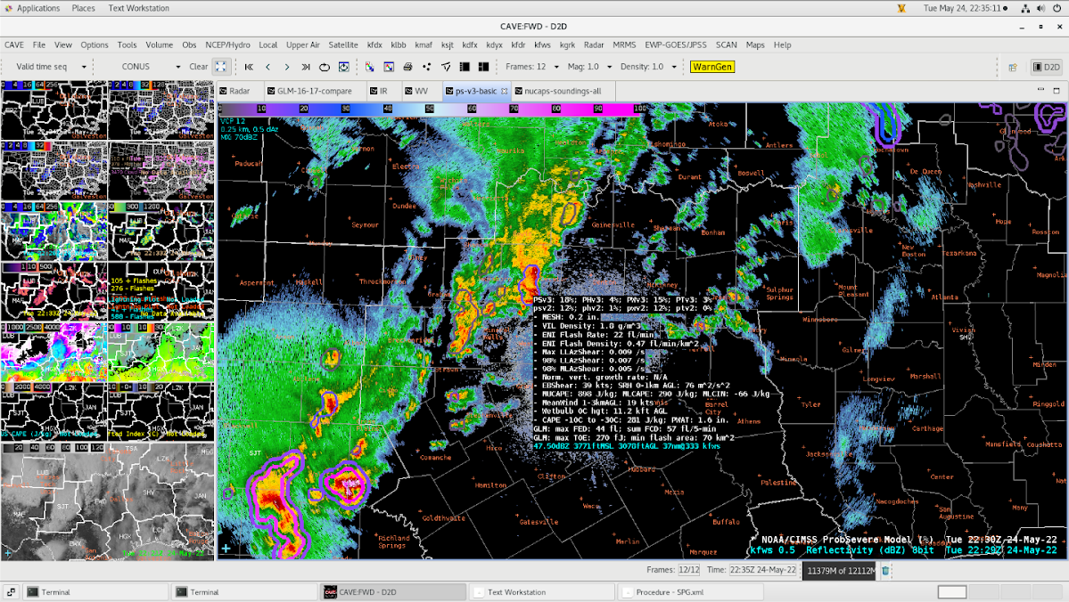
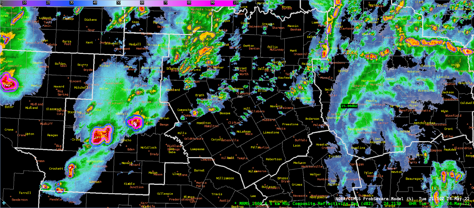
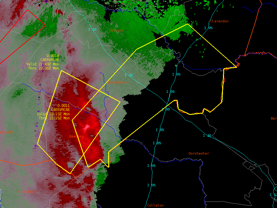
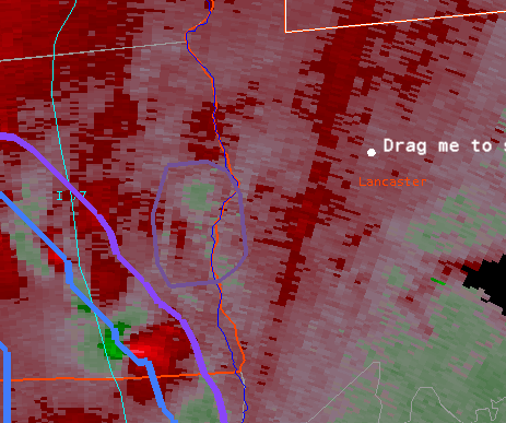
For the initiation of convective storms, I found that the ProbSevere performed the best over the other products available to me today. I have seen over the last couple of days that the best use of ProbSevere is the trend table. The steep increase in these total severe values support radar trends that suggest a warning is necessary. For the initial warning on severe storms, this was the best use.
The only negative to this product was the latency. While the latency was only on the order of 2-5 minutes, this was equivalent to appx. 2 radar scans that indicated to me ahead of time that this storm was strengthening. This can lead to some confusion especially if the storm is quickly pulsing and falling.

Additional upticks were noticed in subsequent SVR issuances throughout the afternoon that provided a nice heads-up in conjunction with the radar data. These were used in the context of the storm maintaining its strength after the storm was warned and again after the storm re-pulsed several minutes later.


It is also worth mentioning that the perceived threat of ProbSevere was also the shared opinion of the forecast (forecaster perceived threat for hail had the highest ProbS. probability). Once the storms reach the “cap” of their ProbSevere, it becomes of little use.
GLM
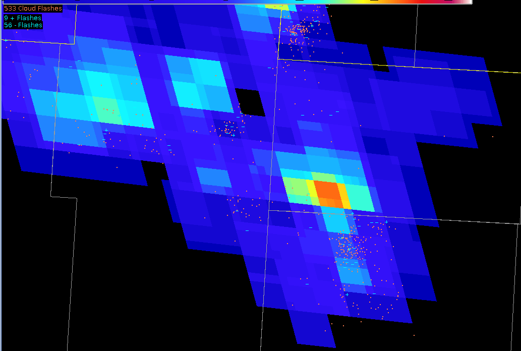
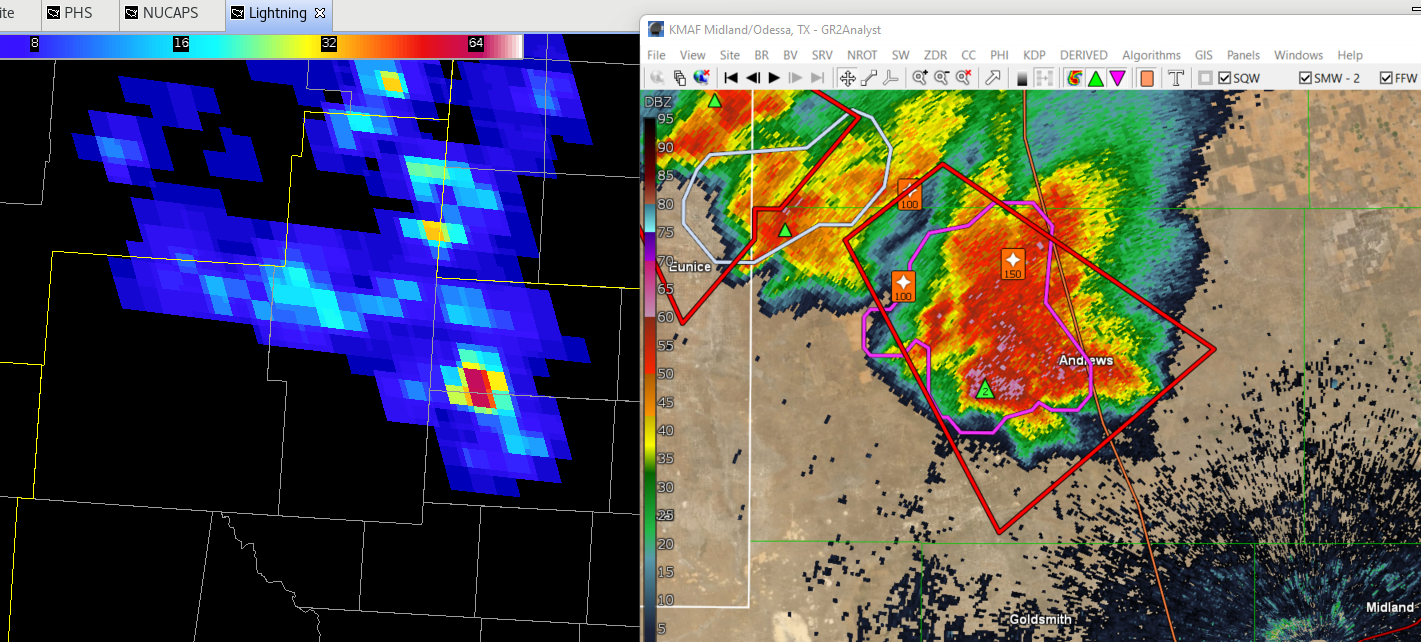
GLM was useful during convective initiation, but did best for storms that were already at the peak of the ProbSevere threshold. GLM showed additional pulses in a mature storm that had a 90% probability of being severe and added confidence to the warning forecaster that the storm had gained additional strength which manifested itself in larger hail for example.
It was however short-lived as the storm gained additional intensity but did not show the corresponding increase in GLM FED that one would expect. This was explained as a limitation due to the structure of a mature (and severe) thunderstorm.
Min Flash Area also reached its lower values on several storms which provided little to no additional data. Maybe this used in conjunction with total optical energy would be useful, but this yielded no significant results when investigating briefly.
PHS Model
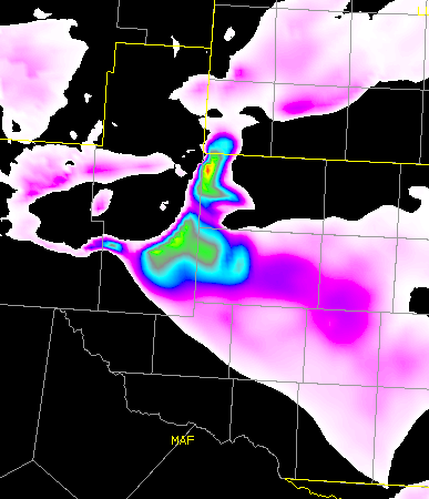
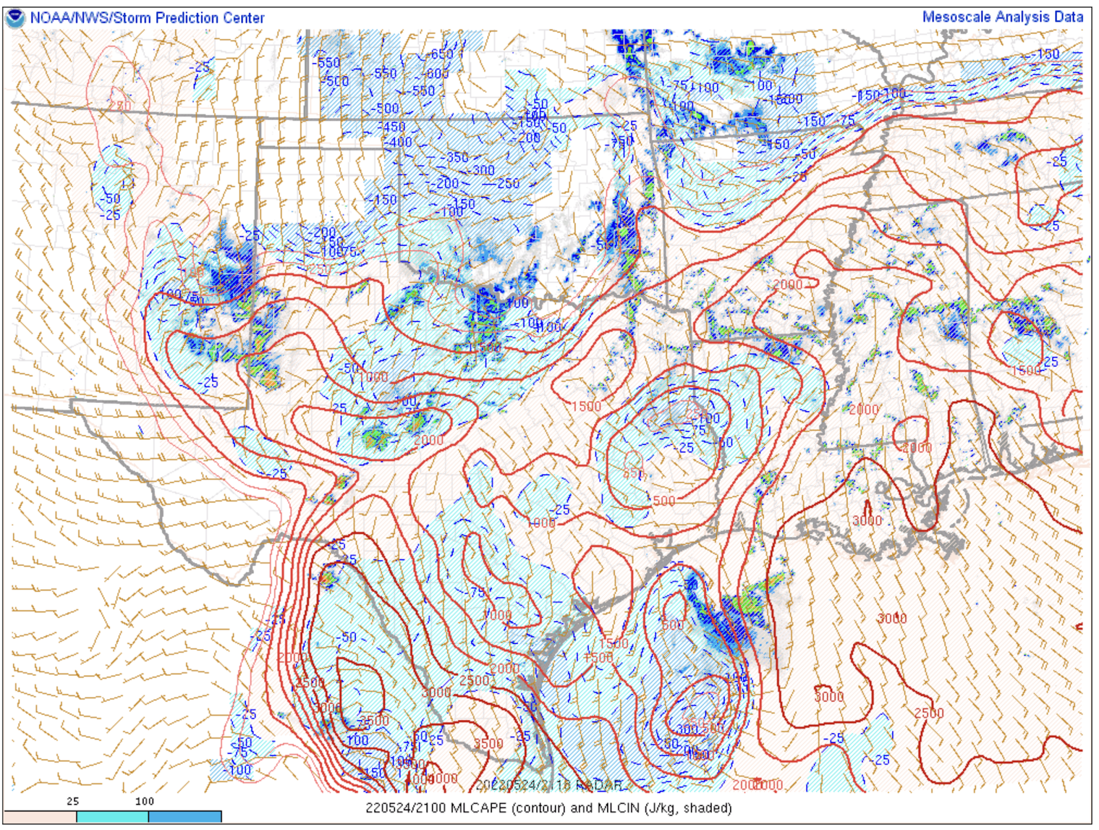
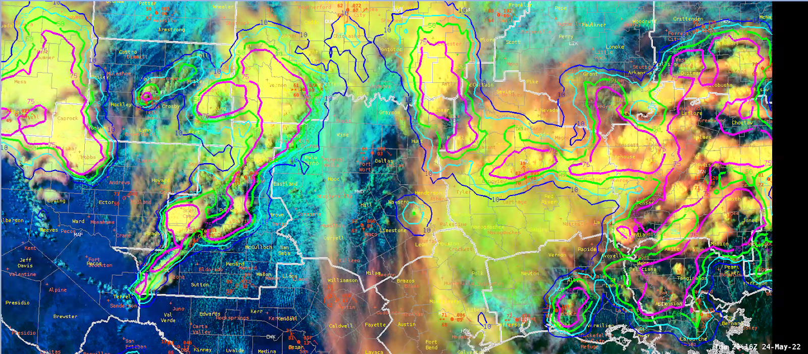
The PHS model was very useful today ahead of convective initiation, but more so in an advective situation.
Instability parameters were observed as ongoing severe storms moved SW toward the established instability gradient. ProbSevere outlined areas are moving SW in the image below across an area of relatively high CAPE and low LIs. This provided useful information about the existence of a boundary and the motion of the storms along with the pre-conditioned environment.
The model did have limitations as the storms became ingested into the later runs of the model and the storms showed developed cold pools. The environment depicted in this situation had become dominated by nearby cold pools of incorrectly placed convection which limited the model’s usefulness.
LightningCast
Not much use of the lightning cast today due to the lack of CI within our CWA, but we did get a chance to look at the advection of lightning. In general, this proved to be a little too slow. It seemed the contours were tight to the storm and storm motion was rather slow, but the lead time on lightning detection was around 30-40 minutes. With an advecting storm, I would have expected this to be rather accurate to the 60 minute threshold that it attempts to achieve, but 30-40 minutes is still VERY useful for DSS and now-casting purposes.
NUCAPS
NUCAPS had some interesting results today, primarily in the way it reported green, yellow, and red data points. Some of the gridded data was unavailable for points with green-retrieval and this was puzzling because it would have indicated a dry slot over the DFW region that was evident in the water vapor and visible satellite. However, the data grid boxes were missing or contaminated with bad data over a mostly clear area. Areas with similar cloud coverage performed as expected. The pop-up skew-t continues to be the best tool in this suite of products, provided the data points are green-retrieval.
Optical Flow Winds
Not much use on the optical flow winds today due to the fact that ongoing convection muddied the data. Overshooting tops were visible for a brief moment, but quickly engulfed in strong storms and expanding anvils. The divergence field is really hard to gather meaningful intel from and the existing platform outside of AWIPS limits its overall usage. A suggestion in our group today was that divergence could be useful if the noise is limited. Perhaps remove values above and below a certain threshold. Instead of widespread values, draw attention to the important outliers.
- Overcast Ambience