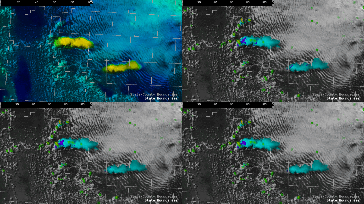
We did warning operations today across the Lubbock TX CWA. Storms were beginning to fire up as we started, but took a while to mature. Multiple convective attempts were needed before a primary updraft took root. Seen below, is the transition from a sputtering narrow convective column to a deep mature storm. OCTANE helped pin-point this motion showing warmer/faster colors and stronger divergence.
An old outflow boundary, from yesterday’s activity across New Mexico and Texas, served as focus for convection. Soundings showed steep lapse rates through the column south of the boundary with a moist boundary layer. North of the boundary, the boundary layer was stable as indicated by the billow clouds / undulating smooth stratus. Hodographs were long and straight, but we deduced that a tornado threat existed immediately along the boundary and perhaps a bit to the north where low-level helicity was more enhanced. We also surmised that the tornado threat would increase with time as the low-level jet ramped up and elongated the lowest portions of the hodograph.
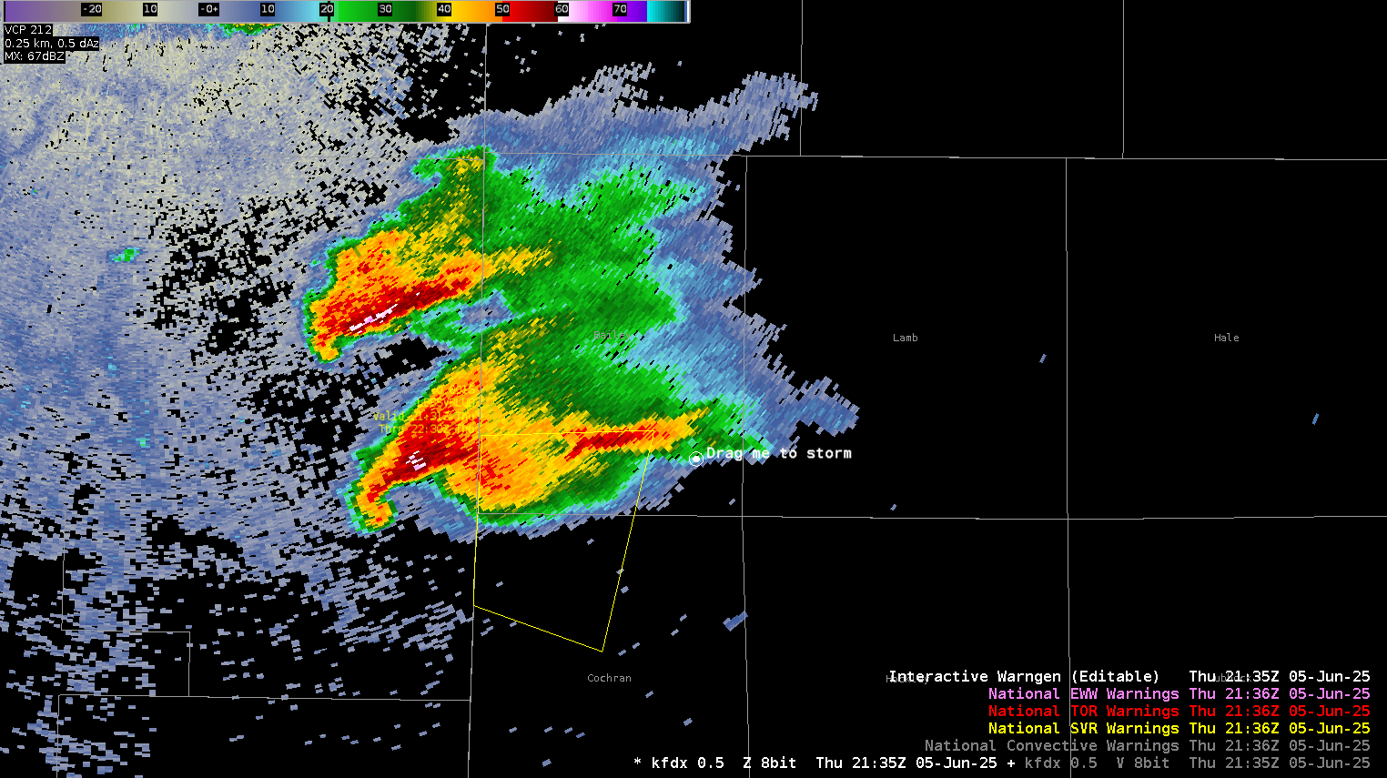
Storms were initially in ABQ’s CWA and we issued our first warning around 2130z with a duration of one hour. I heavily used storm top divergence within my warning strategy as OCTANE showed 100+ knots and radar showed 145 knots at times. Combined with a BWER to 35k ft (-20C level was 22k ft) and 50dbz to 45k ft…I went with 2” diameter hail and 70mph winds along with possible tornado. I did not go tornado warning simply because that part of the storm wasn’t close enough to our CWA yet.
It was interesting to note that the massive anvil from each of the two supercells merged causing GREMLIN to show only one primary core. The extreme DBZ values within gremlin added confidence to the severity of the cells within the anvil. Another interesting thing is that the northern cell died down shortly after this image was captured resulting in only one primary cell reminiscent of the above image.
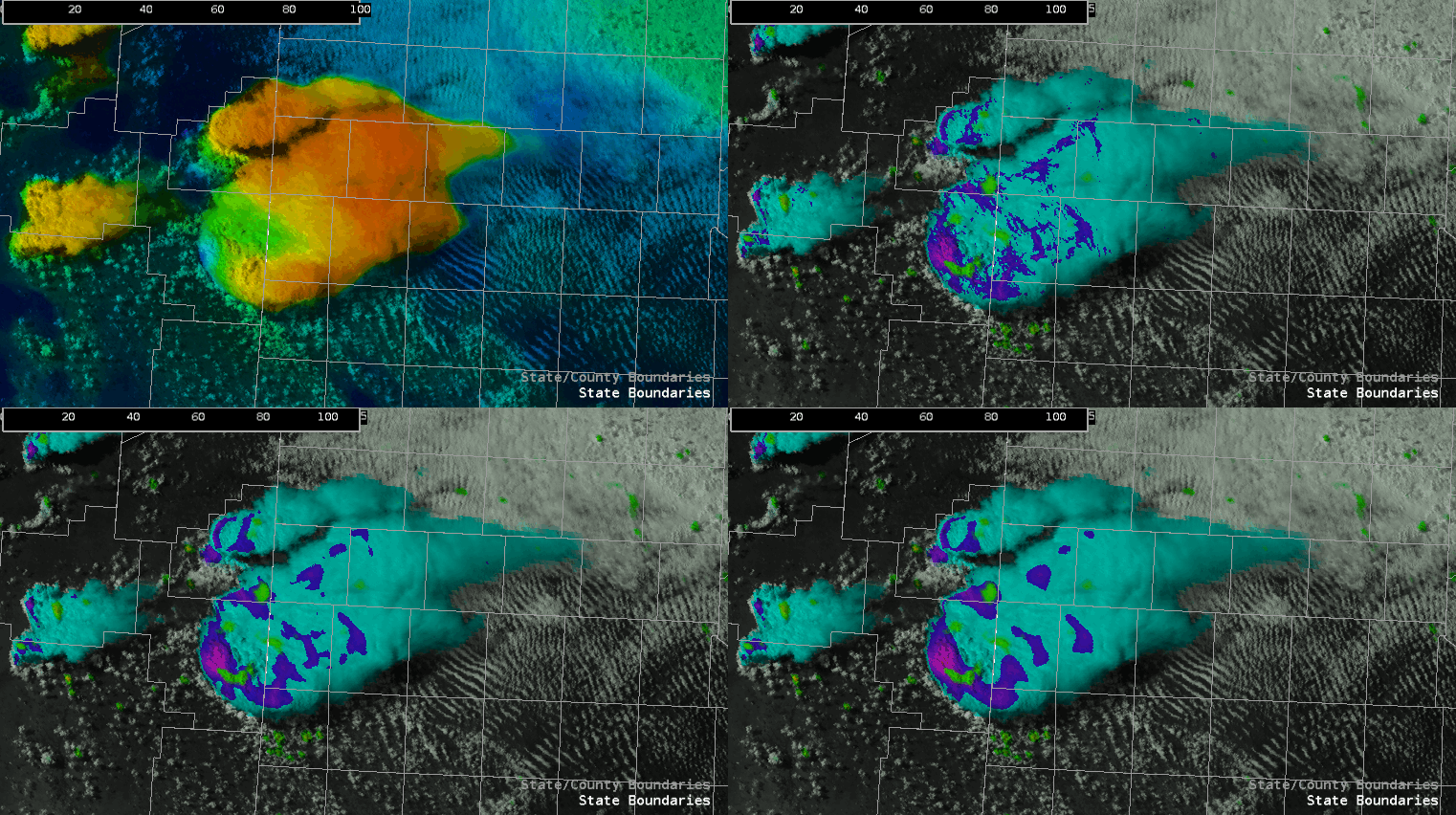
Towards the end of operations the now mature primary supercell showed strong divergence within OCTANE and a wake near and immediately downstream of the overshooting top, indicative of a very strong and likely severe storm.
We ended up issuing a tornado warning as the storm neared the state line, which verified as broadcast media reported a tornado just east of the Texas line. Our warning had about 17 minutes of lead time. Additionally, 1.75 to 2 inch hail reports were on the New Mexico side of the state line during the time of our SVR warning…with a 3 inch hail report coming in on the Texas side as the testbed came to an end.
Overall, OCTANE aided our warning decisions significantly…the addition of satellite-derived storm top divergence was a good confidence nudger and helped us get half an hour to an hour lead time on large hail and over 15 minutes on a tornado. LightningCast and OCTANE helped guide us toward which cell would eventually become dominant during the initiation phase.
- WxAnt
No comments:
Post a Comment